
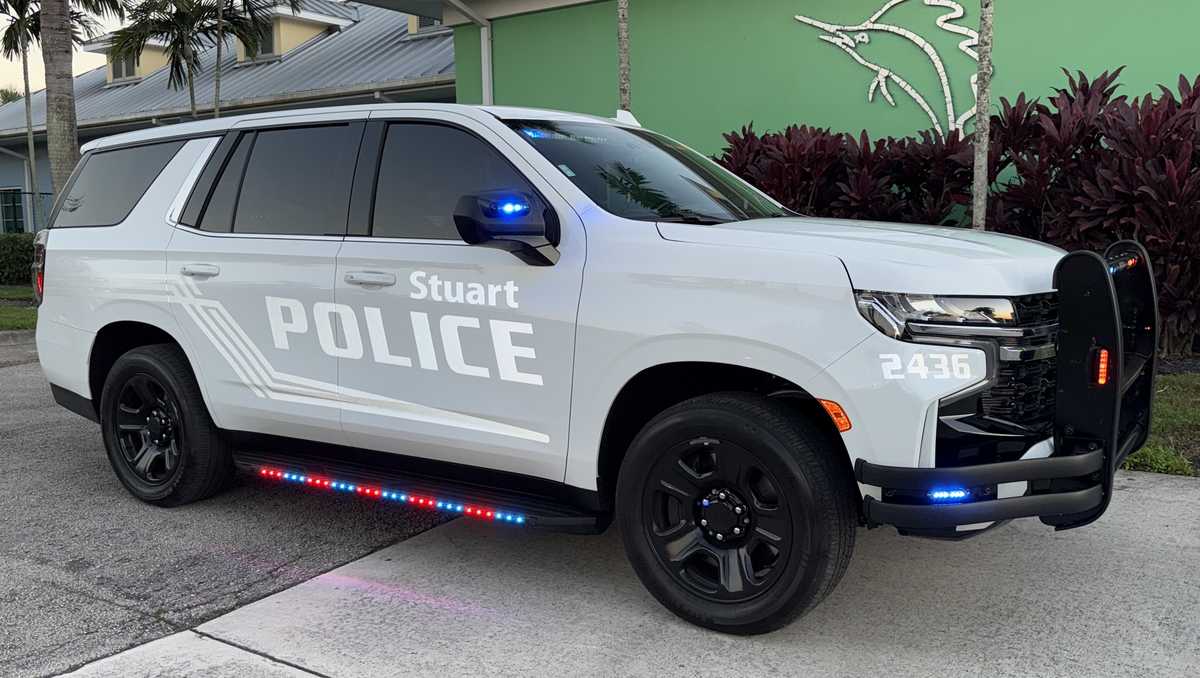
Suspect detained after fleeing in stolen vehicle near Stuart City Hall
BEEN REPORTED. GLENN. ALL RIGHT. THANKS, FELICIA. LET’S TAKE A LOOK AT WHAT’S GOING ON. OUR WEATHER HERE. FIRST, THE SPC, THE STORM PREDICTION CENTER OUT OF OKLAHOMA PUT OUR ENTIRE VIEWING AREA UNDER THE RISK FOR ISOLATED SEVERE STORMS FOR TODAY. AND THAT WAS CERTAINLY A VALID THING TO DO BECAUSE WE HAVE SEEN THAT POTENTIAL. EVEN YESTERDAY. WE WERE SEEING THE POTENTIAL TODAY IN THE COMPUTER MODELS FOR ISOLATED SEVERE STORMS TO DEVELOP. WE’VE HAD TWO SO FAR TODAY, ONE IN PALM BEACH COUNTY, CLOSE TO WELLINGTON EARLIER THIS AFTERNOON, AND NOW THIS ONE HERE, WHICH MOVED OUT FOR SOME ENERGY IN CENTRAL FLORIDA ALL THE WAY DOWN TO OUR VIEWING AREA AND REALLY STIRRED THINGS UP A BIT. IN FACT, YOU CAN SEE MORE OUTFLOW BOUNDARIES HERE. THESE LITTLE SKINNY LINES YOU SEE RIGHT HERE, THAT’S ENERGY BEING PUSHED OUT AND WIND BEING PUSHED OUT AHEAD OF SOME OF THESE STORMS. BUT THIS IS THE SEVERE THUNDERSTORM MOVING DOWN FROM INDIAN RIVER COUNTY INTO SAINT LUCIE COUNTY AND EASTERN PARTS OF OKEECHOBEE COUNTY. WINDS AT 60 MILE PER HOUR GUSTS, AND WE’RE LOOKING AT ONE INCH TO 1.5IN HAIL MOVING DOWN. LOOK AT THAT FROM NORTH TO SOUTH THERE. SO THIS HAS BEEN A GENERAL SOUTHERLY MOTION IS MOVING AT ABOUT 5 TO 10MPH. SO IT’S NOT MOVING TOO QUICKLY. WE’LL SEE IF IT DOESN’T FALL APART A LITTLE BIT MORE OVER THE NEXT 12 MINUTES OR SO. AS THIS SEVERE THUNDERSTORM WARNING CONTINUES, OR IF IT GETS EXTENDED A LITTLE FARTHER TO THE SOUTH, WE’VE ALSO GOT A LITTLE THUNDERSTORM HERE DEVELOPED AROUND OKEECHOBEE, AND THEN SOME MORE RAINFALL OFF OF HOBE SOUND, JUNO BEACH PALM BEACH GARDENS. THIS IS ALL LIGHT TO MODERATE RAINFALL DOWN TO LAKE WORTH BEACH HERE, AND NOT MUCH HAPPENING IN BOCA, ALTHOUGH WESTERN PARTS OF BOCA. SEEING SOME RAIN AND A LOT OF THUNDERSTORMS JUST OFF TO THE WEST OF PALM BEACH COUNTY. SOMETHING INTERESTING IS GOING TO HAPPEN OVER THE NEXT COUPLE OF DAYS HERE IN THE VERY BRIGHT GREEN. THAT’S WHERE WE’RE SEEING THE HIGHEST POTENTIAL FOR RAINFALL, THE HIGHEST MOISTURE CONTENT IN THE ATMOSPHERE. AND WHEN WE CONTINUE INTO TOMORROW, YOU’LL SEE THAT IT STAYS RIGHT OVER TOP OF US HERE, SPREAD PRETTY FAR OUT ALL THE WAY ACROSS OUR AREA, A LITTLE LESS SO DOWN TO THE SOUTH HERE. BUT THIS IS TOMORROW AFTERNOON AND EVENING WITH PRETTY GOOD CHANCES FOR RAIN 40%. BUT AS WE GET INTO FRIDAY AND SATURDAY AND SUNDAY, WINDS BEGIN TO SHIFT MORE EASTERLY AND THAT WILL START TO DRIVE THE HIGHER CHANCES FOR RAIN OVER TO THE WEST COAST OF FLORIDA STARTING ON FRIDAY, BUT ESPECIALLY SATURDAY AND SUNDAY, WE’LL HAVE ABOUT A 20% CHANCE FOR RAIN NEAR THE EAST COAST, BUT A MUCH HIGHER CHANCE FOR RAIN. FARTHER INLAND AND OVER TO THE WEST COAST OF FLORIDA. SO KIND OF THE REVERSE OF THE PATTERN THAT WE’RE SEEING RIGHT NOW. LET’S TALK A LITTLE BIT ABOUT THE HEAT. OBVIOUSLY, IN THE AREAS WHERE IT’S COOLER RIGHT NOW, WE SEE SOME HEAVY RAINFALL. WE’VE GOT TEMPERATURES THAT HAVE DROPPED DOWN TO THE 70S, EVEN INTO THE 80S, BUT WE’RE ALSO SEEING TEMPERATURES WHERE IT HASN’T RAINED THAT MUCH, REMAINING FEELING LIKE THE UPPER 90S AND LOW 100. AND THIS WILL CONTINUE TO BE THE TREND ALL THE WAY THROUGH THE WEEKEND, WITH HIGH TEMPERATURES IN THE 90S AND THE HEAT INDEX NEAR 100 DEGREES. SO HERE’S A QUICK LOOK AT THE SEVEN DAY FORECAST. 40% CHANCE FOR RAIN AS WE GET INTO TOMORROW. SHOWERS AND STORMS MOVING FROM SOUTH TO NORTH TOMORROW AS COMPARED TO TODAY. WE’RE MOVING NORTH TO SOUTH. WE’VE ALSO GOT A 20% CHANCE FOR RAIN FRIDAY THROUGH THE WEEKEND. THAT’S A PRETTY LOW CHANCE FOR RAIN. IT WILL BE ABOUT A 30% CHANCE FOR RAIN. IF YOU’RE AROUND LAKE OKEECHOBEE FROM FRIDAY THROUGH SUNDAY, AND THEN RAIN CHANCES START TO COME BACK UP AGAIN. MONDAY 30% WITH IMPACT WEATHER
Suspect detained after fleeing in stolen vehicle near Stuart City Hall

Updated: 6:55 PM EDT Jun 24, 2026
Stuart police responded to a disturbance at a residence Wednesday afternoon, where the suspect fled the scene in the victim’s vehicle. Officers located the stolen vehicle a short time later near City Hall in downtown Stuart and safely detained the suspect without further incident. The investigation remains ongoing, and the suspect is expected to be charged with battery, grand theft auto, and driving while license suspended. The scene in downtown Stuart has been cleared, and police said additional information will be released as it becomes available.Stay up-to-date: The latest headlines and weather from WPBF 25Get the latest weather updates with the WPBF 25 News app. You can download it here.
STUART, Fla. —
Stuart police responded to a disturbance at a residence Wednesday afternoon, where the suspect fled the scene in the victim’s vehicle.
Officers located the stolen vehicle a short time later near City Hall in downtown Stuart and safely detained the suspect without further incident.
The investigation remains ongoing, and the suspect is expected to be charged with battery, grand theft auto, and driving while license suspended.
The scene in downtown Stuart has been cleared, and police said additional information will be released as it becomes available.
Stay up-to-date: The latest headlines and weather from WPBF 25
Get the latest weather updates with the WPBF 25 News app. You can download it here.