
Hot, stormy pattern continues across Central Florida
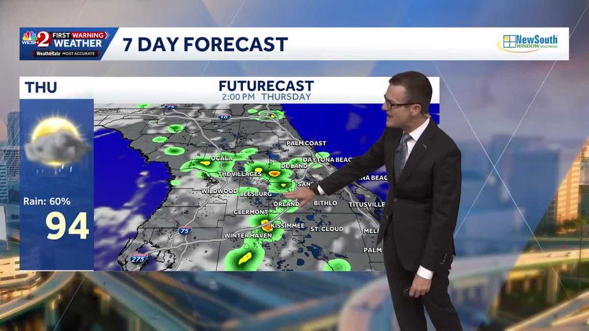
AT THE OFF RAMP THERE. ALL RIGHT. GOOD ON YOU, ALLEN. GOOD ON YOU. LISTEN, WHATEVER OUR PLANS ARE THIS WEEKEND, WE’RE GETTING BACK TO OUR NORMAL RAIN PATTERN TODAY. YESTERDAY, IT’S A HIGHER THAN AVERAGE SHOWER AND THUNDERSTORM SET UP AT ABOUT 60%. BUT LOOKING AHEAD TO SATURDAY. SUNDAY, QUIET IN THE MORNING. AND THEN THOSE STORMS GET FIRED UP NOW. IT’S STILL GOING TO STORM OVER THE WEEKEND JUST A LITTLE BIT MORE. WE’LL SAY UNDER CONTROL. BUT FOR TODAY IT’S A 60% COVERAGE OF RAIN, 94 DEGREES, OUR HIGH TEMPERATURE. AND THEN NOTICE WE KIND OF GET BACK TO NORMAL. I DO WANT TO POINT OUT THOUGH, LOOKING AHEAD TO NEXT WEEK, RAIN COVERAGE STARTS TO BUILD AS A STORM SYSTEM TRIES TO BUBBLE UP AROUND US. WE’LL TALK MORE ABOUT THAT COMING UP IN THE NEXT HALF HOUR. BUT LET’S GET INTO TODAY’S RAIN OPPORTUNITIES. ALL RIGHT. STARTING AROUND LUNCHTIME, I-75, A FEW AREAS OF RAIN, THEN INTO THE METRO. NOTICE 2 TO 4 P.M. THAT’S YOUR WINDOW FOR WIDESPREAD STORMY WEATHER. AND THEN BY ABOUT DINNERTIME OR SO, IT’S SETTLING IN OUT ALONG OUR I-95 CORRIDOR FOR TOMORROW. SAME IDEA, BUT THE COVERAGE IS A LITTLE MORE UNDER CONTROL. WIDESPREAD SHOWERS AND STORMS AROUND TOWN. SO LET’S LOOK AT OUR DAY TO DAY. SHALL WE? STARTING OFF NICE AND QUIET, GETTING THOSE TEMPERATURES CLIMBING 92 BY 1 P.M. 3 P.M. IT’S 95. THERE’S THAT 60% COVERAGE OF STORMS. AND THEN, OF COURSE, THE TEMPERATURES START TO DROP OFF A BIT AS WE GET THAT RAIN AROUND. UV INDEX TODAY IS AT AN 11, MEANING THAT YOU’VE GOT ABOUT TEN MINUTES TO BURN. IT’S GOING TO BE ONE OF THOSE DAYS HEADING TO THE BEACH. WATER TEMPERATURES, GREAT SURF, LOOKING FANTASTIC IN THE POOL. FORECAST PUTS US IN A GOOD RANGE JUST BECAUSE OF THOSE SHOWERS AND STORMS. THE EARLIER THE BETTER YOU’LL BE. LIVE. LOOK OUTSIDE ON OUR TOWER CAM. IT IS FINE IN THE TOURIST DISTRICT. NOTHING. ON OUR FIRST WARNING. LIVE DOPPLER RADAR. LOVE THAT IT GETS ACTIVE THOUGH LATER ON TODAY, 60% COVERAGE OF RAIN. MORE ACTIVE THAN NORMAL TODAY. RAIN CHANCES KIND OF GETTING MORE IN CHECK FOR FRIDAY, SATURDAY, SUNDAY AND THEN SOME RAIN
Thursday’s weather will be very similar to yesterday’s, with hot temperatures helping fuel afternoon and evening thunderstorms.Highs will reach the mid-90s, with about a 50% chance of showers and storms. A few storms could become stronger at times, producing heavy rain, frequent lightning and gusty winds.Tracking the TropicsThe tropics are expected to remain quiet through the next seven days. Looking ahead to next week, forecast models indicate a weak area of low pressure may develop near the Southeast coast. First Warning Weather Stay with WESH 2 online and on-air for the most accurate Central Florida weather forecast.RadarSevere Weather AlertsDownload the WESH 2 News app to get the most up-to-date weather alerts. The First Warning Weather team includes First Warning Chief Meteorologist Tony Mainolfi, Eric Burris, Marquise Meda, Cam Tran and Victoria Wisniewski.
ORLANDO, Fla. —
Thursday’s weather will be very similar to yesterday’s, with hot temperatures helping fuel afternoon and evening thunderstorms.
Highs will reach the mid-90s, with about a 50% chance of showers and storms.
A few storms could become stronger at times, producing heavy rain, frequent lightning and gusty winds.
Tracking the Tropics
The tropics are expected to remain quiet through the next seven days.
Looking ahead to next week, forecast models indicate a weak area of low pressure may develop near the Southeast coast.
First Warning Weather
Stay with WESH 2 online and on-air for the most accurate Central Florida weather forecast.
Download the WESH 2 News app to get the most up-to-date weather alerts.
The First Warning Weather team includes First Warning Chief Meteorologist Tony Mainolfi, Eric Burris, Marquise Meda, Cam Tran and Victoria Wisniewski.