
JACKSONVILLE, Fla. — Here’s what the First Alert Weather Team said you can expect for the forecast:
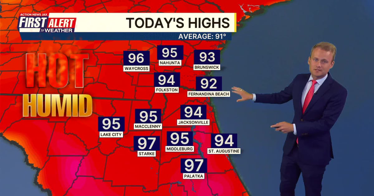
Saturday morning is warm and dry with temperatures in the middle 70s.Saturday will be hot with temperatures a little above average. Highs will warm into the middle 90s with feels like temperatures 100-105 in the afternoon.Isolated coverage of rain and storms is expected Saturday. Some neighborhoods will get an afternoon cooldown, but many won’t. Sunday will be similar with heat, humidity, and rain chances. Monday will feature higher coverage of storms across the area in the afternoon and evening.Temperatures will drop slightly Tuesday and Wednesday to near 90 degrees, still with a few storms.Heat continues through the July 4 weekend with highs in the 90s and a few storms likely each day.
WATCH THE FORECAST | DOWNLOAD THE APPS
TROPICS:
No active storms.Some indication that low pressure could develop offshore the southeast U.S. next week along an old frontal boundary. This will be worth watching, but nothing is there as of now.The next name is Bertha.
TODAY: Partly cloudy and hot with isolated afternoon storms. HIGH: 94 (Feels like 100-105)
TONIGHT: Isolated storm early, then partly cloudy and warm. LOW: 76
SUNDAY: Partly cloudy and hot with isolated afternoon storms. 76/96 (Feels like 102-107)
MONDAY: Partly cloudy and hot with scattered to numerous afternoon/evening storms. 77/95
TUESDAY: Partly cloudy with a few showers and storms. 74/89
WEDNESDAY: Partly cloudy with a few showers and storms. 73/89
THURSDAY: Partly cloudy, a few storms. 72/93
FRIDAY: Partly cloudy, isolated storm. 74/93
Follow Action News Jax Meteorologists on Twitter for updates:
Mike Buresh | Garrett Bedenbaugh | Corey Simma | Trevor Gibbs
ALLERGY TRACKER: See what the pollen counts look like in our area
LISTEN: Mike Buresh ‘All the Weather, All the Time’ Podcast
INTERACTIVE RADAR: Keep track of the rain as it moves through your neighborhood