
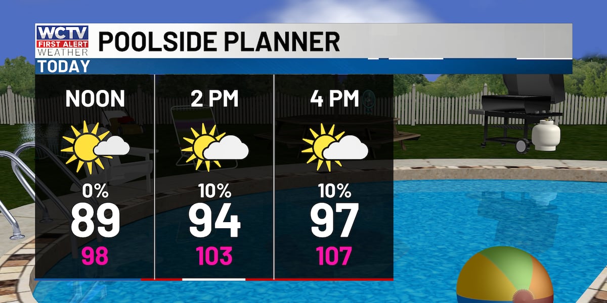
TALLAHASSEE, Fla. (WCTV) – Heat advisory is in effect for coastal Wakulla, coastal Franklin and southern Liberty County this afternoon as feels-like temperatures approach 108.
The heat alert is in place to highlight where the humidity will be highest this afternoon.
Approaching triple digits
High pressure is strengthening today and will keep the sea breeze pinned to the coast. This means partly to mostly sunny skies will lead to a hot afternoon for North Florida and South Georgia. Highs in the upper 90s.
Humidity will be highest in the morning, slightly decreasing throughout the day. So, the feels like temperature will reach 105 in many spots this afternoon, which is just shy of heat advisory criteria (108 or warmer).
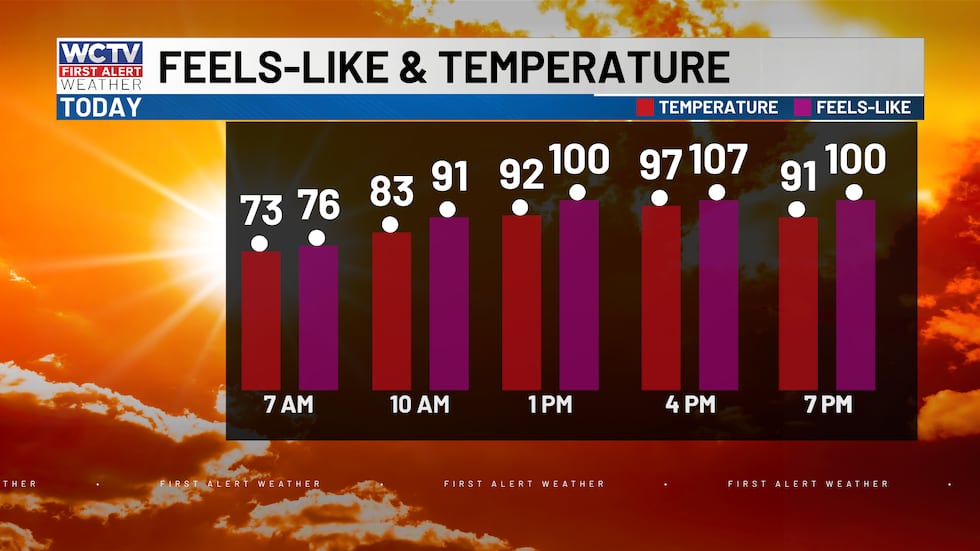 Highs will soar into the upper 90s this afternoon, but with humid air, it will feel like the low 100’s.(WCTV)
For those who work outdoors or have things to do around the house outdoors, be sure you are taking breaks outside and drinking plenty of water.
If your Sunday plans take you to the coast, hot and humid. With good beach and boating conditions today. Waves 1 foot or less from a W/NW wind 5 to 10 knots.
Feeling hotter on Monday
Temperatures climb another degree or two on Monday. The first half of your day will be rough. More humid and warmer in the upper 90s to near 100. Late afternoon and in the evening, showers develop, mainly for the eastern Big Bend. Most of us will remain rain-free and humid.
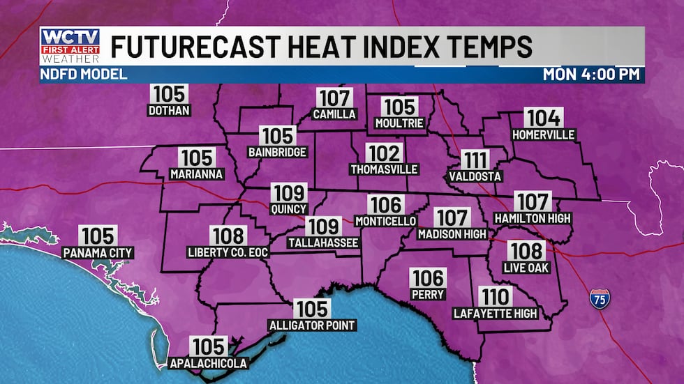 Even hotter on Monday afternoon with higher humidity and warmer temperatures. It will feel as hot as 106 to 110 for most spots in the afternoon.(WCTV)
Tomorrow is likely to meet heat advisory levels with feels like numbers over 107 to 109 in the afternoon.
Again, for those who work outdoors take care of yourself by staying hydrated and shaded throughout your workday.
Tuesday Showers
Scattered rain and storms are back on Tuesday as strong easterly winds and an upper-level disturbance work in tandem. A few morning showers are possible, then turning partly sunny, HOT and humid through early afternoon. Showers and storms develop and become likely in the afternoon and evening, which will bring heavy downpours making driving difficult and brief gusty winds that could bring down limbs and leaves.
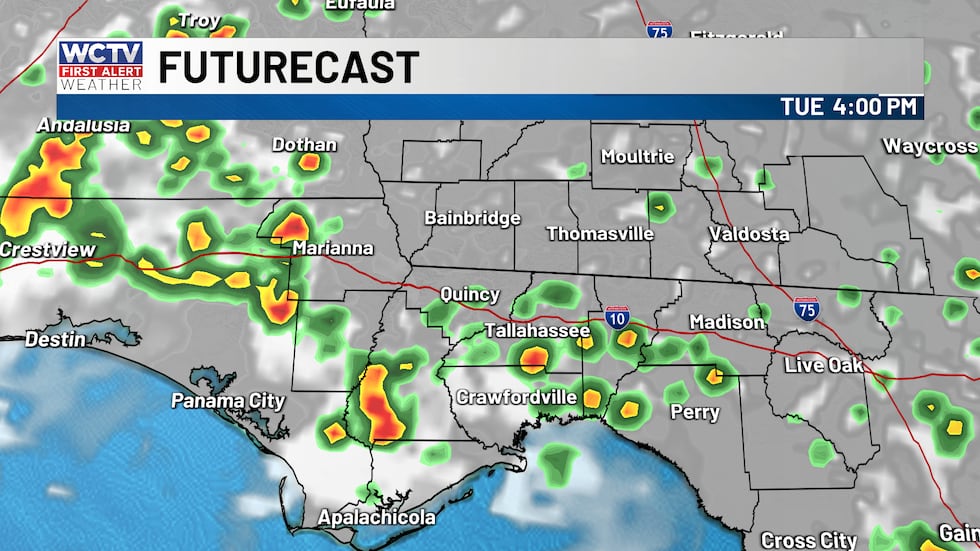 Showers and storms on Tuesday afternoon, especially in the Big Bend region.(WCTV)Trending drier and HOT
Leading up to America’s 250th birthday, high pressure holds on, keeping rain chances around 30% each afternoon. Highs above average in the mid 90s.
The high starts to break down on the 4th of July, meaning higher rain chances in the afternoon, should clear up by your evening firework plans.
Tracking the tropics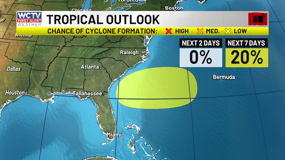 The NHC is monitoring the chance of tropical development early this week, with a 20% chance of developing in the next 2 days.(WCTV)
The National Hurricane Center is monitoring the Western Atlantic off the Mid-Atlantic coast for tropical development early this week. The warm Gulf Stream waters may help it briefly develop into something tropical as it drifts westward with time.
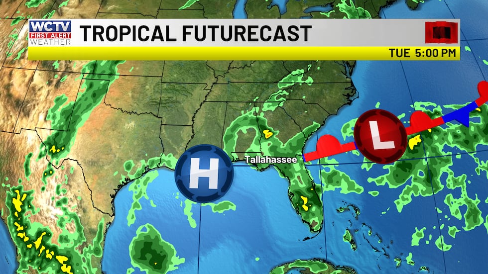 Watching the development of weak low pressure early next off the Mid-Atlantic coast.(WCTV)
The low’s track and development look a lot slower in today’s model runs, which is keeping it east of the Florida peninsula for now. I still think some upper-level energy tied to the weak offshore front helps our rain coverage increase on Tuesday.
Something to monitor, but nothing to worry about.
To stay updated on all the latest forecasts and weather, follow WCTV First Alert Weather on Facebook and X (Twitter).
Click here to see all the latest weather headlines and here to view the First Alert Radar. Receive push alerts and watch the latest forecast anytime on the free WCTV First Alert Weather app. Click here to download it now.
Interested in becoming a WCTV First Alert Weather Watcher? Click here to join the team!
Copyright 2026 WCTV. All rights reserved.