
Tracking impact weather with scattered showers and storms across South Florida
JUST A MOMENT. BUT FIRST YASMINE IS WATCHING THE ROADS IN SANDRA WITH THAT HOT FORECAST. YEAH, WE’RE HALFWAY THROUGH THE YEAR AND ALMOST HALFWAY THROUGH THE SUMMER. NOT REALLY QUITE THAT FAR YET, BUT WE HAVE A MODERATE HEAT RISK AGAIN TODAY. MAYBE NOT QUITE AS ELEVATED AS TOMORROW. IT’S A SUBTLE AND NUANCED DIFFERENCE. WE’RE STILL GOING TO REACH THE LOW 90S THIS AFTERNOON AND FEEL LIKE THE TRIPLE DIGITS WITH WIDESPREAD STORM ACTION. SO THAT’S ONE OF THE REASONS BASICALLY ABOUT A 40% COVERAGE. WE JUST HAVE A FEW SPRINKLES OUT THERE IN ATLANTIC WATERS RIGHT NOW. WE MIGHT SEE THE SEA BREEZES IGNITE SOMETHING ABOUT 11 UNTIL TWO AND THEN AGAIN LATER THIS AFTERNOON. BUT WE’LL SEE. MEANWHILE, WE’VE GOT THE 70S ON THE BOARD ON THE TREASURE COAST, 81 IN JUPITER, 81 IN BOYNTON AND BOCA. SO A LITTLE STEAMY FOR SURE. DOWN SOUTH AS WE TAKE A LOOK AT PORT SAINT LUCIE, IT DOES LOOK LIKE WE PULL OUT A SLIGHT CHANCE OF A COUPLE OF ISOLATED STORMS AT 10:00, BUT REALLY MORE SO LATER ON THIS AFTERNOON WITH ABOUT THAT 40% COVERAGE AND PRETTY MUCH BASED WEST OF THE TURNPIKE TOWARD THE LAKE, ACCORDING TO THE MODELS THAT I JUST CHECKED OUT. AS FAR AS THE PALM BEACHES GO, IT IS A SIMILAR TALE WEST OF THE TURNPIKE. WE’RE GOING TO SEE SOME SHOWER AND STORM ACTION ENSUING. WHAT ABOUT JULY 4TH? AS YOU’RE PLANNING YOUR FIREWORKS OR COOKOUTS OR WHAT HAVE YOU BY FIREWORKS TIME? I THINK WE’RE OUT OF THE STORM
WPBF 25 First Warning Meteorologist
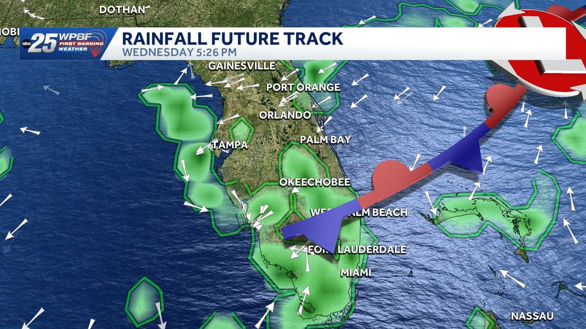
WPBF 25 First Warning meteorologists are tracking impact weather with the chance for scattered showers and isolated strong storms across South Florida.”A combination of tropical moisture from the Atlantic Ocean and a weak front slowly moving south through Florida, will quickly increase our chances for showers and storms today, but even more so on Wednesday and Thursday,” said Glenn Glazer. The slow movement of the showers and storms, due to very light winds, could lead to temporary localized flooding. The pattern will continue into the July 4 holiday weekend. Interactive radarSevere Weather Alerts Download the WPBF 25 News app for the most up-to-date weather alerts.
WPBF 25 First Warning meteorologists are tracking impact weather with the chance for scattered showers and isolated strong storms across South Florida.
“A combination of tropical moisture from the Atlantic Ocean and a weak front slowly moving south through Florida, will quickly increase our chances for showers and storms today, but even more so on Wednesday and Thursday,” said Glenn Glazer.
The slow movement of the showers and storms, due to very light winds, could lead to temporary localized flooding.
The pattern will continue into the July 4 holiday weekend.
Download the WPBF 25 News app for the most up-to-date weather alerts.