
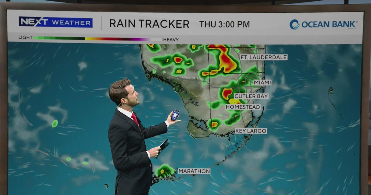
The CBS News Miami NEXT Weather team is tracking another round of scattered to widespread showers and thunderstorms for Thursday.
Rain chances will be more focused along the coast early Thursday morning before increasing later in the afternoon.

This graphic shows what the radar could look like in South Florida on Thursday afternoon.
CBS News Miami
The current forecast calls for isolated thunderstorms to start developing around 12 p.m. and growing scattered to widespread across Broward and Miami-Dade counties between 1 p.m. to 4 p.m.
Isolated heavy downpours could lead to minor flooding concerns.

This graphic shows the hourly forecast in South Florida on Thursday, July 2, 2026.
CBS News Miami
The rain should fizzle out by 6 p.m. to 7 p.m.
Despite the rain, steamy conditions continue across South Florida as “feels-like” temperatures still reach the lower triple-digits by midday.
We will be monitoring a moderate heat risk across our metro areas this afternoon.

This graphic shows the rain chances in South Florida over the next seven days.
CBS News Miami
Our wet weather pattern sticks around as we kick off the Fourth of July holiday weekend.
There is a 60% chance for showers and thunderstorms on both Friday and on the 4th of July.
Our most recent forecast calls for our highest rain chances on Independence Day for midday through the early afternoon.

This graphic shows the forecast in South Florida over the next seven days.
CBS News Miami
Rain is expected to decrease in time for firework displays in the evening.
Heat index values linger between 100 and 106 for the next 7 days, so make sure you and your family are staying hydrated and consider wearing light colors and loose-fitting clothing when spending time outdoors.