
Tracking rain, strong storms and heat advisory July Fourth across South Florida
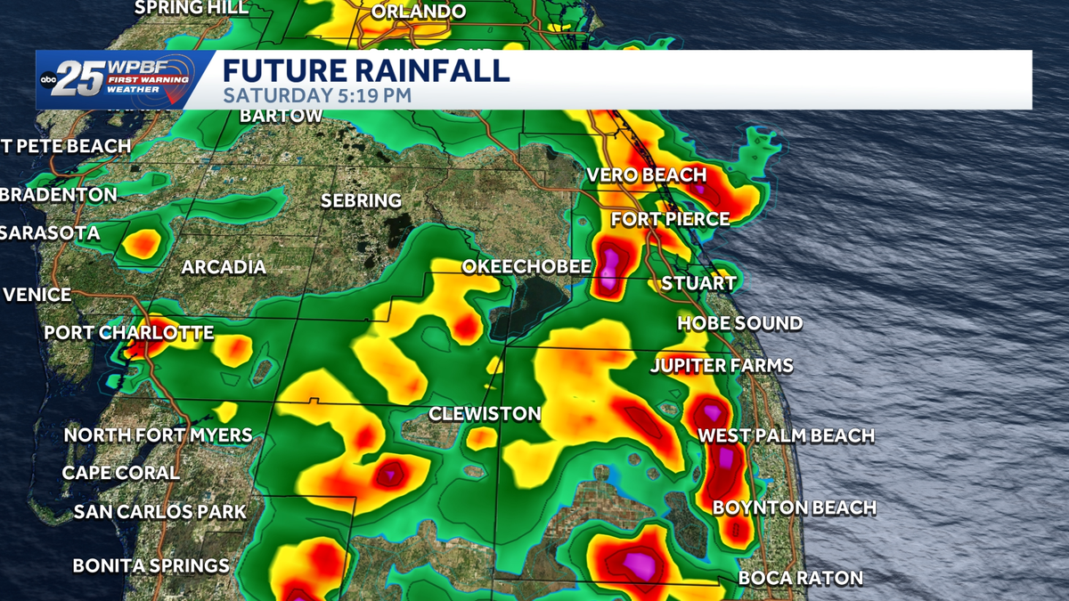
CHILDREN HAVE DROWNED. CHRIS. ALL RIGHT. THANKS, LEE. AS WE MAKE IT INTO THE WEEKEND, HERE IS THE FUTURE TRACK IN THE PLANNER AS WE GO IN TOWARDS YOUR 4TH OF JULY. SO WE START YOUR MORNING OFF DRY 11 A.M. TO ABOUT 1 P.M., AND THEN 2 P.M. TO 8 P.M. THAT IS THE TIMING FOR THE SHOWERS AND STORMS, AS THAT IMPACT WEATHER WILL BE ALIVE. AND THEN AFTER THAT, WE ARE QUIET. SO MOST OF THOSE FIREWORKS SHOWS GO OFF AT 9 P.M. SO AGAIN, WE’RE LOOKING AT AN 8 P.M. CUT OFF FOR THOSE SHOWERS AND STORMS. SO HOPEFULLY MOTHER NATURE PLAYS BALL WITH US AND GIVES US WHAT WE NEED FOR THE FIREWORKS. I THINK EVERYTHING IS GOING TO BE JUST FINE. SAME DEAL ACROSS THE TREASURE COAST. WAKE UP TO SUNSHINE IN THE MORNING AND THEN WE’LL START TO SEE THOSE STORMS REALLY FIRE UP THREE, FOUR, FIVE, SIX ALL THE WAY TO ABOUT 7:00. AND THEN WE’RE DONE WITH THE RAIN ABOUT 8 P.M. AS WELL. HIGH TEMPERATURES WILL SOAR IN THE LOWER 90S. NICE AND QUIET TONIGHT. THOSE SKIES CLEARED VERY QUICKLY EVEN THOUGH WE HAD SOME REALLY INTENSE RAINFALLS. LIKE INDIANTOWN GOT HIT BY A LIGHTNING STRIKE THAT TOOK OUT THE WATER SYSTEM THERE FOR A LITTLE BIT, PALM CITY AND TOWARDS PORTIONS OF STUART. SOME HEAVY RAINS, GOOD RAINFALLS AGAIN, JUST DOING WONDERS FOR THE DROUGHT. BUT NICE QUIET RIGHT NOW. MOSTLY CLEAR SKIES. 77 IN PORT SAINT LUCIE TO 79 IS WHAT WE’RE LOOKING AT RIGHT NOW IN DOWNTOWN WEST PALM BEACH. THE WINDS ARE CALM, SO OF COURSE IT’S GOING TO FEEL A LITTLE BIT ON THE MUGGY SIDE OUT THERE BECAUSE THE WINDS ARE NOT OUT THERE TO STIR THE ATMOSPHERE UP. SO IT’S GOING TO FEEL A LITTLE STICKY OUT THERE TONIGHT, ESPECIALLY AFTER THE SHOWERS WE SAW TODAY. ALL RIGHT. HERE’S A LOOK AT THE TIMING FOR THAT FUTURE TRACK. AGAIN SHOWERS START TO BLOSSOM AFTER 11:00 IN THE MORNING. GOT 1 OR 2 POPPING UP AROUND THE TREASURE COAST BY SATURDAY 11:00. AND THEN WE REALLY GET GOING. 2 P.M. ALL THE WAY TO ABOUT 8 P.M. HERE’S A LOOK AT 230. NOTICE A FEW MORE SCATTERED SHOWERS AND STORMS. ALL THE BIG STUFF WILL BE OUT TOWARDS SOUTHWEST FLORIDA AND THE WEST COAST OF FLORIDA TOMORROW. THEN AS WE GET THAT DAYTIME HEATING, HERE’S SOME HEAVY RAIN MOVING THROUGH FORT PIERCE, COASTAL TREASURE COAST AND EVEN ACROSS INLAND PALM BEACH COUNTY. THIS IS 530, CLOSE TO 6 P.M. AND THEN AS THE FUTURE TRACK ROLLS ON IN AND HERE WE BRING 8:00, EVERYTHING WRAPPING UP, WE GOT SOME LIGHT RAIN POTENTIAL. BUT ALL OF THIS IS JUST VERY IT’S BEEN A LITTLE DRAMATIC WITH THIS, BUT SOME LIGHT SHOWER ACTIVITY, MAYBE SOME DRIZZLE LEFT OVER, BUT YOU CAN SEE THE MAIN IDEA OF THE STORY IS THE BIG TIME THUNDERSTORMS AND HEAVY DOWNPOURS SHOULD BE DONE BY 8 P.M. BEFORE THOSE FIREWORKS SHOWS GO OFF AT 9 P.M. AND THEN GUESS WHAT? SAME PATTERN ON SUNDAY AFTERNOON. SHOWERS AND STORMS. RAIN CHANCES ABOUT 40 TO 50% COVERAGE. BOTH WEEKEND DAYS STILL HOT, STILL HUMID AS HIGHS WILL BE 90 TO 93 BOATING FORECAST IN THE MORNING. LOOKS GREAT. SEAS RUNNING ABOUT TWO FEET OR LESS. OBVIOUSLY THOSE SHOWERS AND STORMS WILL BE THE MAIN HAZARDS. HERE’S A LOOK AT YOUR FIRST WARNING. SEVEN-DAY. FORECAST IMPACT WEATHER HEAVY DOWNPOURS, THE THREAT OF SOME MINOR FLOODING, AND A STRONGER THUNDERSTORM INTO THE MIX. 2 P.M. TO 8 P.M. ON YOUR SATURDAY. ON YOUR JULY 4TH. KEEP THAT IN MIND. AND THEN AS WE HEAD THROUGH NEXT WEEK, LOWER RAIN CHANCES, ESPECIALLY NEXT WEEK, THAT DUST IS ON THE WAY.
Tracking rain, strong storms and heat advisory July Fourth across South Florida

Updated: 8:47 AM EDT Jul 4, 2026
WPBF 25 First Warning meteorologists are tracking impact weather, with rain and strong storms Saturday across South Florida. A heat advisory is in effect for metro Palm Beach County from 11 a.m. until 8 p.m. Feels like temperatures could range from 105 to 110 degrees. Impact weather outlook Saturday: Highs in the low-to-mid 90s Feels like temps well into the 100s Scattered storms starting near the coast around noon, then expanding around 4 p.m. Bulk of activity will be around 6-7 p.m. Isolated showers lingering around 9 p.m.Sunday: Highs in the low-to-mid 90s with feels like temps in the 100s Scattered afternoon rain and storms 40%Next few days: Scattered rain and storms continue into the start of the workweek. Highs remain in the low-to-mid 90s We could see 2-4 inches over the next seven daysTracking the tropicsStay with WPBF 25 on-air and online for updates.2026 Hurricane SeasonInteractive radarSevere Weather Alerts Download the WPBF 25 News app for the most up-to-date weather alerts.
WPBF 25 First Warning meteorologists are tracking impact weather, with rain, strong storms Saturday across South Florida.
A heat advisory is in effect for Metro Palm Beach County from 11 a.m. until 8 p.m.
Feels-like temperatures could range from 105-110 degrees.
Impact Weather Outlook
Saturday:
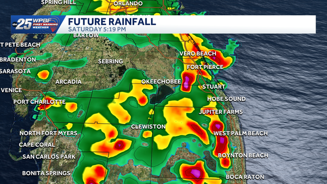
Highs in the low to mid 90s Feels like temps well into the 100s Scattered storms starting near the coast around 12pm then expanding around 4pm. Bulk of activity will be around 6-7pm. Isolated showers lingering around 9pm.
Sunday:
Highs in the low to mid 90s with feels like temps in the 100s Scattered afternoon rain and storms 40%
Next few days:
Scattered rain and storms continue into the start of the work week. Highs remain in the low to mid 90s We could see 2-4″ over the next 7 days
Tracking the Tropics
Stay with WPBF 25 on-air and online for updates.
Download the WPBF 25 News app for the most up-to-date weather alerts.