
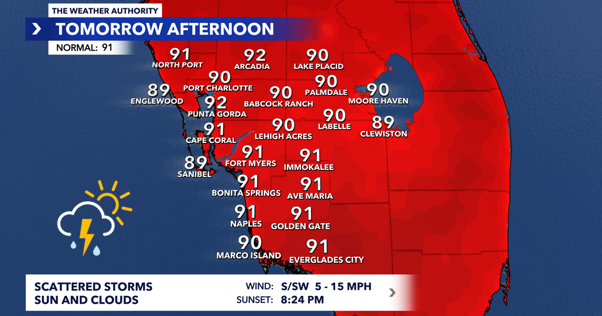
THE WEATHER AUTHORITY, (WINK) — After a stormy Fourth of July, Southwest Florida is settling back into a familiar summertime weather pattern for the first full week of July.
A southwest wind flow will continue through the weekend and into next week, bringing the chance for morning coastal showers and storms before activity shifts inland during the afternoon and evening hours.

Boaters start the day with storms
If you’re heading onto the water Sunday morning, keep an eye on the radar.
The southwest flow will help spark scattered showers and thunderstorms near the Gulf coast during the morning hours. While winds remain relatively light at 5 to 10 knots and seas stay around 1 to 2 feet, thunderstorms will be capable of producing dangerous lightning, gusty winds, and reduced visibility.
Water temperatures continue to run around 89 degrees.
Morning storms near the coast, afternoon storms inland
Coastal communities from Naples to Cape Coral could see scattered showers and thunderstorms during the morning before activity gradually shifts eastward through the day.
By late afternoon and evening, the greatest storm coverage is expected inland across Hendry, Glades, and eastern Collier counties, where sea breeze boundaries collide and help fuel stronger thunderstorms.
While not everyone will see rain, scattered storms will be capable of heavy downpours, frequent lightning, and localized flooding in poor drainage areas.
Heat and humidity continue to build
Outside of thunderstorms, temperatures will remain seasonably hot.
Morning lows will start in the lower to upper 70s inland and upper 70s to near 80 degrees along the coast. Afternoon highs will climb into the lower 90s area-wide.
When humidity is factored in, however, it will feel much hotter. Heat index values are expected to reach between 100 and 104 degrees on Sunday afternoon, with several days next week seeing feels-like temperatures approach or exceed 105 degrees.
The hottest stretch of the upcoming forecast appears to arrive during the middle and latter part of next week, when actual air temperatures climb into the mid-90s.
Tropics remain quiet
While daily thunderstorms will continue locally, there are no tropical concerns on the horizon.
The National Hurricane Center is not expecting tropical development anywhere across the Atlantic Basin, Caribbean Sea, or Gulf over the next seven days.
Looking ahead
Rain chances remain elevated Sunday and Monday near 60 percent before gradually decreasing later in the week. Daily afternoon storm chances will still persist, but coverage should become somewhat more isolated by Thursday.
Temperatures will trend upward as rain coverage decreases, with highs reaching the mid-90s by the second half of next week. Heat index values between 104 and 108 degrees will be possible, especially where afternoon sunshine dominates.