

TALLAHASSEE, Fla. (WCTV) – Hot and humid is the name of the game from this point forward. After a really great Fourth of July weather-wise, we hold on to the heat for any remaining holiday festivities, but there is a higher chance for some showers today.
Better chance for showers today
I am already seeing some rain near the coast thanks to an onshore wind this morning and VERY soupy Gulf waters. That is also keeping temperatures very mild in the mid to upper 70s across North Florida and South Georgia.
Rain coverage should remain low this morning, but there is a chance you will run into some drops for your morning walk along the Florida coast. Most of us will just be walking our dogs in the humid air.
Scattered showers and storms develop this afternoon. Everyone has a fair shot at seeing rain today. While there is an opportunity for rain this morning, the best chance of showers will be between 2 and 8 p.m.
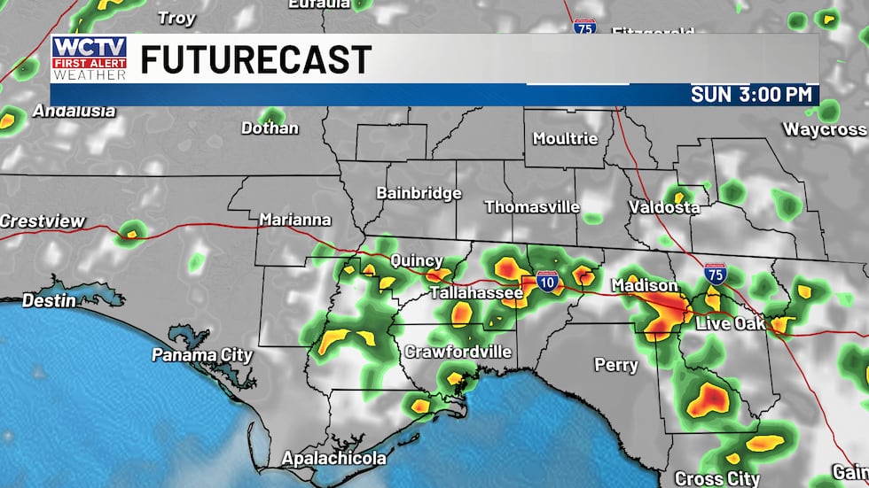 Showers and storms this afternoon could impact your outdoor plans.(WCTV)
Outside of any storms, it is going to be another steamy day where you will want to be by the springs, pool or Gulf waters to keep cool. High temperatures will once again reach the mid to upper 90s with a mix of sun and clouds.
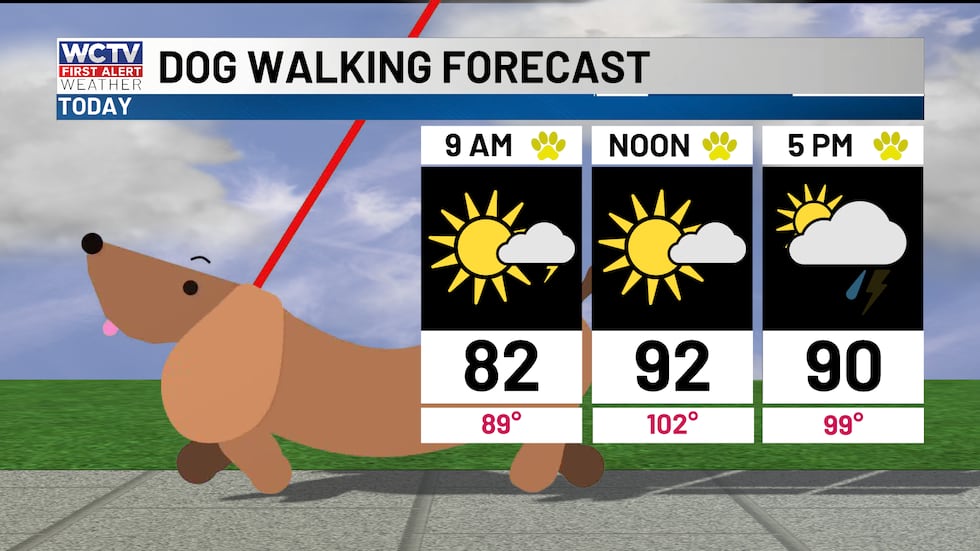 Hot and humid with scattered storms this afternoon.(WCTV)
For boaters, today is another great day to be on the water. Although, you may need to dodge some showers this morning, the sea breeze moves inland late morning and will clear you up for the afternoon. Waves a foot or less. Winds Southwest 5 to 10 knots.
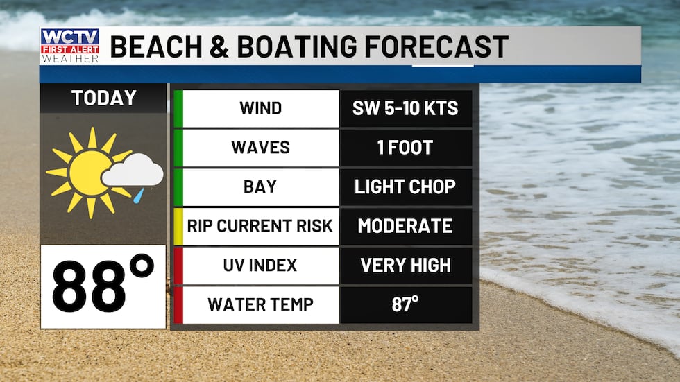 Great conditions on the water today.(WCTV)
The onshore wind will continue tonight, keeping out overnight temperatures mild in the mid to upper 70s again. This means the coastal shower chance remains tonight.
Monday morning showers
I expect to find showers tomorrow morning as we get ready for work, so just grab the rain gear. Otherwise, a warm start to the day. Scattered summertime rain will be possible from the early morning through the early afternoon on Monday. Wet weather should wrap up by dinner. This is not an all-day rain. Highs in the low to middle 90s and humid.
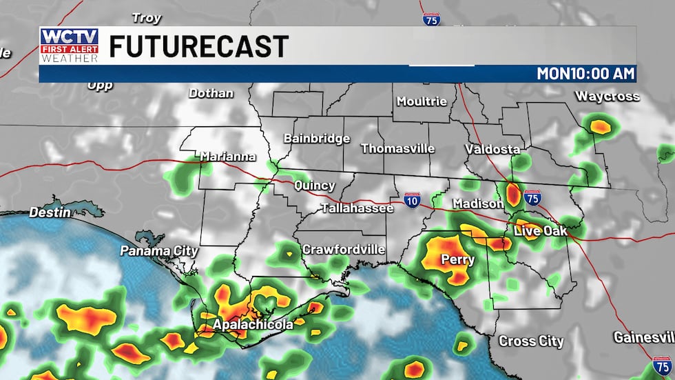 Additional showers and storms tomorrow, especially for the Big Bend.(WCTV)Typical summer week ahead
The weather pattern will not shift much throughout the week. A west/southwest wind will keep temperatures mild at night in the mid to upper 70s and keep highs in the low to mid-90s with a chance for showers each day. The coverage of rain looks higher early week and lower late week, but none of these days will be a wash.
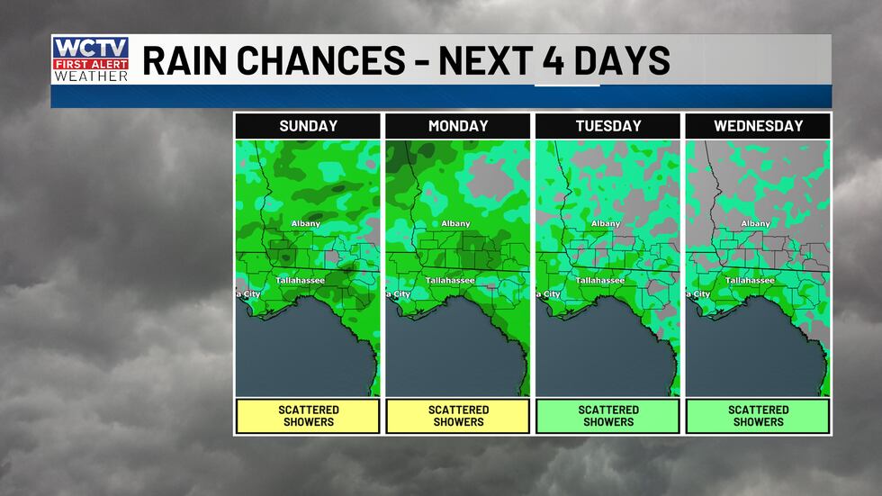 Higher rain coverage today and tomorrow, scattered storms continue through next week.(WCTV)
The main focus is going to be the heat. With the really humid air, feels like temperatures will be around 105 for much of the upcoming week, especially in the late morning and early afternoon.
To stay updated on all the latest forecasts and weather, follow WCTV First Alert Weather on Facebook and X (Twitter).
Click here to see all the latest weather headlines and here to view the First Alert Radar. Receive push alerts and watch the latest forecast anytime on the free WCTV First Alert Weather app. Click here to download it now.
Interested in becoming a WCTV First Alert Weather Watcher? Click here to join the team!
Copyright 2026 WCTV. All rights reserved.