
Feel-like temps in the 100s with severe thunderstorms moving across South Florida
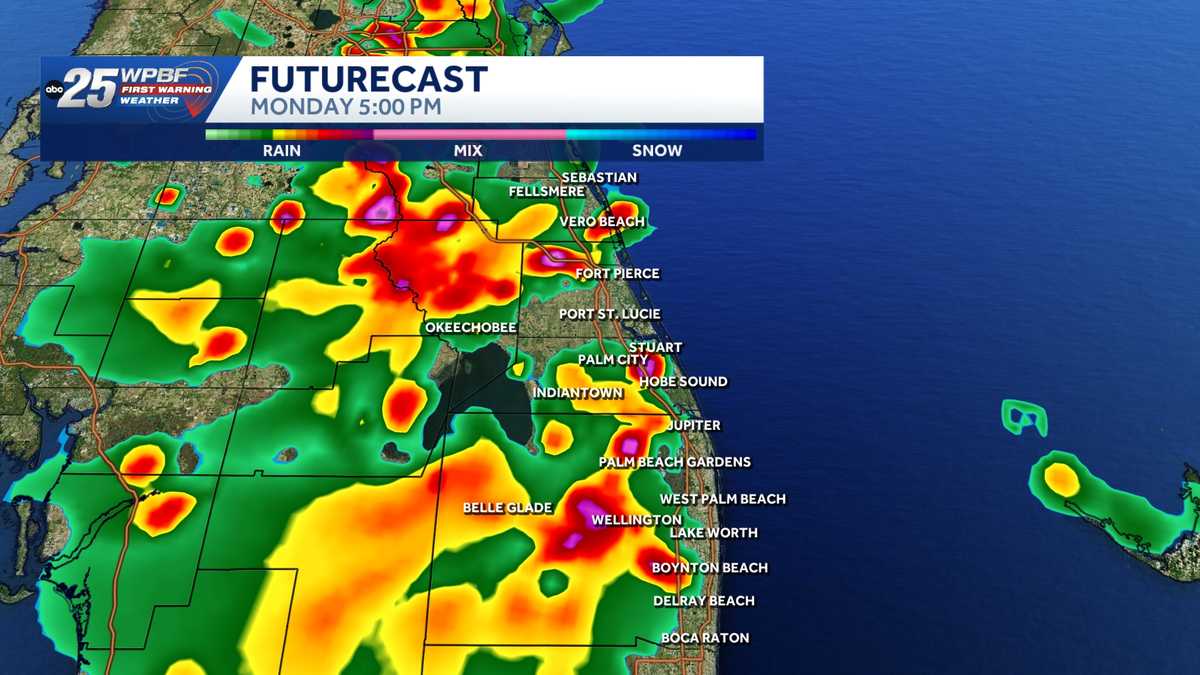
THE COAST RIGHT NOW AND INTO THE JUPITER AREA. LET’S TAKE A LOOK AT THE RADAR. WE’LL GET RIGHT DOWN TO IT HERE. AND AS WE TAKE A LOOK, YOU’LL SEE JUST IN THE PAST HALF HOUR OR SO, WE HAVE SEEN NUMEROUS SHOWERS AND THUNDERSTORMS POPPING UP ACROSS THE AREA ALL ACROSS SOUTH FLORIDA. BUT IN OUR AREA, MORE OF THE SCATTERED VARIETY. I DO THINK WE WILL GET TO A SITUATION HERE WHERE WE COULD SEE NUMEROUS SHOWERS AND ISOLATED STRONG STORMS THROUGH THE AFTERNOON. HERE’S A QUICK LOOK AT WHAT’S HAPPENING RIGHT NOW IN SOUTHERN PALM BEACH COUNTY. YOU’LL SEE A FEW SHOWERS AND STORMS STARTING TO DEVELOP AND MOVE SLOWLY UP TO THE NORTH. BUT WHERE WE’RE SEEING THE REALLY HEAVY RAINFALL, TWO SPOTS RIGHT NOW OUT AROUND THE EASTERN SIDE OF THE LAKE AND THEN OVER HERE, PALM BEACH GARDENS, RIVIERA BEACH DOWN TO WEST PALM UP TO JUNO BEACH. WE’RE SEEING THIS REALLY HEAVY DOWNPOURS OF RAIN, BUT ALSO QUITE A FEW LIGHTNING STRIKES COMING IN JUST IN THE PAST FEW MINUTES HERE. CENTURY VILLAGE CYPRESS LAKES LAKESIDE GREEN WITH THE HEAVY RAIN. MANGONIA PARK. YOU’VE GOT THE REALLY HEAVY RAINFALL COMING DOWN BACK OUT WEST HERE IN WESTERN PARTS AND EASTERN PARTS OF PALM BEACH GARDENS, DOWN TO LAKE PARK. AND THEN WE GO A LITTLE BIT FARTHER TO THE NORTH HERE IN THE ABACOA COMMUNITY IN JUPITER, OVER TOWARD JUNO ISLES AND JUNO RIDGE, WITH THE HEAVY RAINFALL DEVELOPING. NO LIGHTNING STRIKES THERE JUST YET, BUT I’M SURE YOU CAN HEAR THE THUNDER TEQUESTA WITH SOME RAINFALL. AND ALSO OUT TO THE WEST HERE WE’VE GOT A LITTLE RAINFALL JUST TO THE NORTH OF ROUTE HOBE SOUND. A LITTLE BIT OF RAIN THERE. LOOK AT CORTEZ ESTATES NOW. A THUNDERSTORM DEVELOPING JUST TO YOUR WEST. AND THIS IS A THUNDERSTORM IN DEVELOPMENT TO THE WEST OF LAKEWOOD PARK AND AROUND FLORIDA RIDGE. WE LOOK AT FUTURE RAINFALL. ALL COMPUTER MODELS HAVE SHOWERS AND STORMS DEVELOPING THIS AFTERNOON. SOME OF THOSE STORMS COULD BECOME STRONG RATHER QUICKLY, ALL OF THEM FADING OUT SLOWLY DURING THE EVENING HOURS. SO THAT’S PRETTY GOOD NEWS. TOMORROW, LOWER CHANCES FOR RAIN AND THEN THE RAIN CHANCES CONTINUE TO DECREASE. WHY? BECAUSE WE HAVE SAHARAN DUST THAT’S GOING TO BE ON THE WAY IN LATER THIS WEEK, AND IT’S GOING TO SHOVE THIS MOISTURE OUT OF THE WAY AND REPLACE IT WITH SOME DRIER AIR. AND SO OUR RAIN CHANCES GO DOWN BY MIDWEEK TO THE END OF THE WEEK, 60% CHANCE FOR SHOWERS AND STORMS TODAY IMPACT WEATHER. 40% CHANCE FOR TOMORROW. 30%. AS THAT SAHARAN DUST STARTS TO MOVE IN, AND THEN ONLY A 10 TO 20% CHAN
Feel-like temps in the 100s with severe thunderstorms moving across South Florida

Updated: 2:57 PM EDT Jul 6, 2026
WPBF 25 First Warning meteorologists are tracking impact weather due to the potential for some strong storms and the heat index hovering around 105 degrees in South Florida.What to expect “Hot and humid today with scattered showers and a few strong thunderstorms this afternoon and early evening. Most rainfall will move inland by 5 p.m. to 7 p.m.,” Glenn Glazer said. Rain chances begin to decrease Tuesday as drier air moves in, with Saharan dust mid-to-late week making it hotter and drier.Monday: Highs in the low to mid 90s Heat index in the upper 90s and 100s Scattered rain and storms in the afternoonTuesday: Highs in the low to mid 90s/ heat indices in triple digits Scattered rain and stormsNext few days: Saharan dust moves in, so a tad drier Hot with highs getting into the mid-to-upper 90sTracking the TropicsStay with WPBF 25 on-air and online for updates.Interactive radarSevere Weather Alerts Severe thunderstorm warning in effect for central Palm Beach County until 3:15 p.m.Download the WPBF 25 News app for the most up-to-date weather alerts.
WPBF 25 First Warning meteorologists are tracking impact weather due to the potential for some strong storms and the heat index hovering around 105 degrees in South Florida.
What to expect
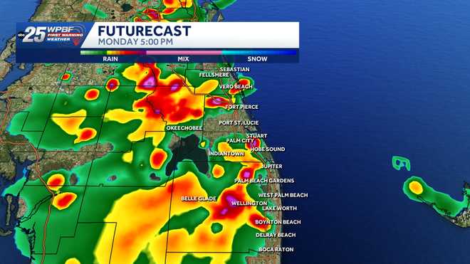
“Hot and humid today with scattered showers and a few strong thunderstorms this afternoon and early evening. Most rainfall will move inland by 5 p.m. to 7 p.m.,” Glenn Glazer said.
Rain chances begin to decrease Tuesday as drier air moves in, with Saharan dust mid-to-late week making it hotter and drier.
Monday:
Highs in the low to mid 90s Heat index in the upper 90s and 100s Scattered rain and storms in the afternoon
Tuesday:
Highs in the low to mid 90s/ heat indices in triple digits Scattered rain and storms
Next few days:
Saharan dust moves in, so a tad drier Hot with highs getting into the mid-to-upper 90sTracking the Tropics
Stay with WPBF 25 on-air and online for updates.
Severe thunderstorm warning in effect for central Palm Beach County until 3:15 p.m.
Download the WPBF 25 News app for the most up-to-date weather alerts.