
Hot and Humid with Storms for South Florida
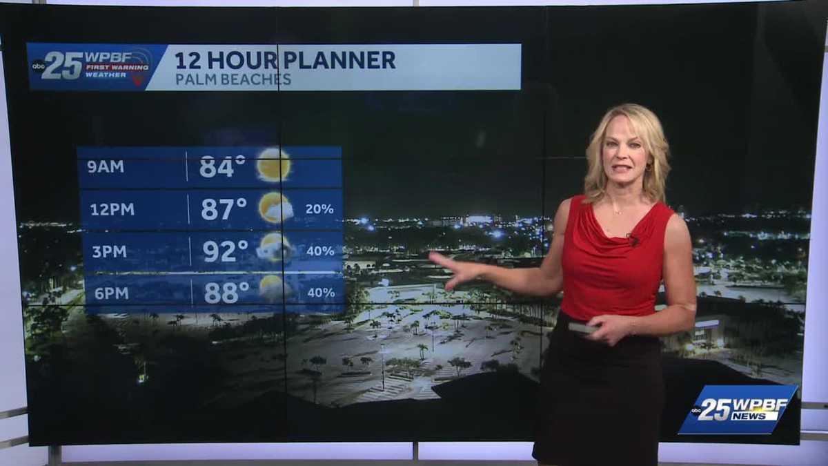
THANKS SO MUCH FOR WAKING UP WITH US ON THIS TUESDAY. YASMINE IS BACK FROM SOME WELL-DESERVED TIME OFF. WE’LL HAVE A LOOK AT THE ROADS FOR YOU IN JUST A MOMENT HERE. SANDRA, WITH YOUR FORECAST. ALL RIGHT. WE’LL TAKE A LOOK. WE’RE GOING TO FAST FORWARD TO THIS EVENING. AND YES WE’RE GOING TO POPULATE WITH SOME SCATTERED SHOWERS AND STORMS GOING TO BE ON THE STRONGER SIDE. A FEW OF THEM. SO A HEADS UP ON THAT. IN THE MEANTIME WE’RE JUST GOING TO BE HOT AND HUMID NOW. TOMORROW MORE SAHARAN DUST WHICH WILL KEEP AWAY THE STORM ACTION AS MUCH. SO THAT’S GOOD NEWS. A COUPLE OF HOT POCKETS HERE OF A MAJOR HEAT RISK AND A COUPLE OF AREAS. BUT WE’RE NOT REALLY GOING TO SUSTAIN IT FOR TOO LONG BECAUSE OF THE INCOMING STORMS. BUT WE WILL STILL FEEL LIKE THE TRIPLE DIGITS OUT THERE. AND WE’LL HIT A HOT HIGH HERE INTO THE 90S JUST SOUTH OF BOCA, DOWN INTO BROWARD. MIAMI-DADE. THERE IS HEAT ADVISORY STATUS IN PLAY. WE’RE JUST SHY OF THAT. IF WE GO TO HEAT ADVISORY STATUS, WE’LL CALL IMPACT. MEANWHILE, THE MID TO UPPER 70S INTO THE LOW 80S TO BEGIN DIDN’T REALLY COOL DOWN THAT MUCH LAST NIGHT. AND WE’LL SEE THE STORMS FIRING. THIS IS PORT SAINT LUCIE TREASURE COAST AREA 90 BY NOON, 92 TO 94 LATER THIS AFTERNOON, RUNNING ABOVE THE AVERAGE FOR THIS POINT OF JULY IS ACTUALLY 90. BUT WE’RE STILL SURPASSING THAT. SO 92 TO 94 WITH WIDESPREAD STORMS ACROSS THE PALM BEACHES AS WELL, FROM THREE UNTIL ABOUT 8 P.M. TONIGHT. I’VE GOT MUCH MORE ON THIS INCOMING PLU
WPBF 25 First Warning Meteorologist
South Florida will be hot with afternoon storms today. The average high for this date is 90 degrees, but the area will jump into the 94 degree range later today. Heat indices will surge into the triple digits. There’s a 40% coverage of storms expected in the afternoon and evening hours. Saharan dust moves into the area tomorrow.
South Florida will be hot with afternoon storms today. The average high for this date is 90 degrees, but the area will jump into the 94 degree range later today. Heat indices will surge into the triple digits. There’s a 40% coverage of storms expected in the afternoon and evening hours. Saharan dust moves into the area tomorrow.