
Heat index could reach 110 with a few showers across South Florida
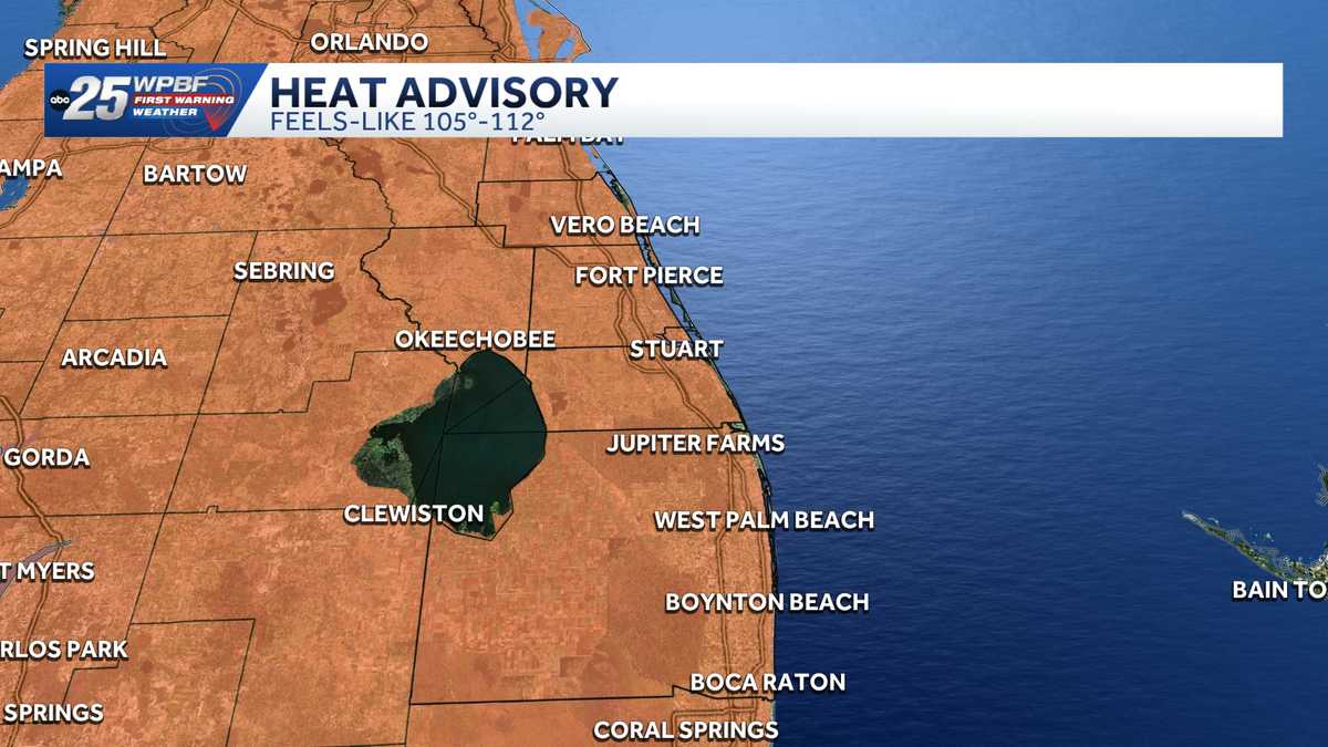
A.M. IMPACT WEATHER. FOURTH CONSECUTIVE DAY OF A HEAT ADVISORY STATUS FOR US THAT IMPACTS HERE AT 11 A.M. THROUGH THE EVENING HOURS, IT’S GOING TO FEEL LIKE 105 TO 112 THIS AFTERNOON. MOST SPOTS WILL PEAK AT 110, BUT WE COULD SEE A FEW POCKETS HERE. YOU SEE, WITH THE EXTREME HEAT RISK HIGHEST ON THE SPECTRUM, WHERE WE DO TOP OUT AT ABOUT 112 TO THE COMBINATION OF THE HEAT AND THE HUMIDITY, MAKING IT FEEL LIKE TO YOUR SKIN. IT IS A MORE THAN DISCOMFORT SITUATION. IT IS A DANGEROUS SITUATION BECAUSE OF THE RISK OF HEAT EXHAUSTION AND HEAT STROKE. SO ELECTROLYTE UP, MAKE SURE YOU HAVE YOUR LIQUIDS AND STAY COOL AS MUCH AS POSSIBLE RIGHT NOW. AS A CASE IN POINT, ALREADY FEELS IN OKEECHOBEE, LIKE 106102 THE HEAT INDEX READING IN JUPITER. 102 IN WEST PALM LAKE WORTH BEACH, AND 102 IN BOCA. SO ALREADY PUSHING THE ENVELOPE. ALSO, WE’RE ENTRENCHED WITH SAHARAN DUST THAT’S MIXED INTO THE ATMOSPHERE, SO IT’S KIND OF A DRY SITUATION WITH THE DUST AROUND. WE’RE NOT GOING TO SEE THE LATE DAY SHOWER AND STORM POTENTIAL THAT SOMETIMES WILL COOL US DOWN AT LEAST A COUPLE OF DEGREES IN THE AFTERNOON. GOING FORWARD, WE’RE GOING TO SEE THE IMPACT SCENARIO THROUGHOUT 92 ABOVE THE AVERAGE HIGH, WHICH IS 90 FOR THIS TIME OF THE YEAR, EXCEEDING THAT, PROBABLY HITTING 94 AT SOME POINT THIS AFTERNOON. AND SO THAT’S GOING TO CONTINUE FOR TODAY. THE DUST WILL HANG AROUND AS WELL. AND THEN THE HOTTEST HIGH THAT WE’RE CALLING FOR IS ACTUALLY HERE ON SUNDAY AND SUNDAY. WE MAY, IN FACT, GIVE THE RECORD A RUN FOR THE MONEY. THE RECORD HIGH FOR SUNDAY IS 97. WE’RE CALLING FOR 95. SO THE RECORD WAS SET BACK IN 1981. IT’S VULNERABLE. IT’S NOT OUT OF THE REALM OF POSSIBILITY. AS YOU KNOW, THE EXCESSIVE HEAT CONTINUES. 94 AS YOU CAN SEE NEXT WEEK INTO MONDAY, TUESDAY, WEDNESDAY, THURSDAY. A LITTLE BETTER RAIN CHANCES. THAT’S ONE DIFFERENCE THAT WE’LL SEE COMING IN IN THE AFTERNOON. SO MORE OF A WET SEASON TREND WITH THE SEA BREEZES INSTIGATING SOME MORE SHOWERS WITH A LIGHTER DUST LAYER TUESDAY THROUGH THURSDAY. BUT IT’S STILL OUT THERE. SOUTHEAST WINDS AT 10 TO 15 KNOTS. WATER TEMPERATURES 87 DEGREES. SO YOU’RE THINKING, OH, I HAVE THIS N
Heat index could reach 110 with a few showers across South Florida

Updated: 10:29 AM EDT Jul 10, 2026
WPBF 25 First Warning meteorologists are tracking extreme heat and triple-digit heat index values across South Florida.A heat advisory is in effect for Palm Beach County from 11 a.m. until 7 p.m. Okeechobee, Indian River, Martin and St. Lucie counties are under a heat advisory from 11 a.m. until 8 p.m. Feels like temperatures could reach 110 degrees. What to expectFriday: High near 94 degrees in West Palm Beach, close to the record of 96 Only a 20% chance of rainSaharan dust remains in the areaSaturday: Hot and humid with highs in the mid-to-upper 90s Few showers 30% Saharan dustNext few days: Rain chances remain low due to Saharan dust Hot with highs in the mid-90s for most Near-record heat is possibleTracking the TropicsStay with WPBF 25 on air and online for updates.Interactive radarSevere Weather Alerts Download the WPBF 25 News app for the most up-to-date weather alerts.
WPBF 25 First Warning meteorologists are tracking extreme heat and triple-digit heat index values across South Florida.
A heat advisory is in effect for Palm Beach County from 11 a.m. until 7 p.m. Okeechobee, Indian River, Martin and St. Lucie counties are under a heat advisory from 11 a.m. until 8 p.m.
Feels like temperatures could reach 110 degrees.
What to expect
Friday:
High near 94 degrees in West Palm Beach, close to the record of 96 Only a 20% chance of rainSaharan dust remains in the area
Saturday:
Hot and humid with highs in the mid-to-upper 90s Few showers 30% Saharan dust
Next few days:
Rain chances remain low due to Saharan dust Hot with highs in the mid-90s for most Near-record heat is possibleTracking the Tropics
Stay with WPBF 25 on air and online for updates.
Download the WPBF 25 News app for the most up-to-date weather alerts.