
The National Weather Service said it received a report of a landspout shortly after 4 p.m. Friday July 11 in the 1200 block of SW 27th Street of Cape Coral, with reports of winds of nearly 60 mph, but there hadn’t been a confirmation of a tornado.
A landspout, similar to waterspouts, is a non-supercell tornado with a narrow, rope-like condensation funnel that forms while the thunderstorm cloud is still growing and there is no rotating updraft — the spinning motion originates near the ground, according to the National Oceanic & Atmospheric Administration.
“It’s sometimes difficult to determine whether or not a tornado actually occurred,” said Tony Hurt, a weather service Meteorologist in Ruskin, the office that covers the Cape Coral-Fort Myers area and had investigated similar reports in May.
How many residents are without power in Southwest Florida on July 11?
Lee and Collier counties, which also had a rough, stormy afternoon, still had more than 900 customers without power at about 11 a.m. Saturday, July 11, down from the more than 5,600 at 6 p.m. Friday, according to FindEnergy.com. Royal Woods community resident Amy Newton, who lives off Island Park Road in south Lee, told the News-Press that she was informed not to expect restoration of power until about noon Saturday.
More violent weather was possible later Saturday, with a 40% chance of showers and thunderstorms, mainly after 1 p.m.

Dangerous heat in Southwest Florida was a major concern for July 11 and 12, 2026. From public records research.
What is another major Southwest Florida concern for Saturday, July 11?
Another major Saturday concern: The weather service, which had a heat advisory in effect until 7 p.m., was expecting highs in the mid to upper 90s with heat index values likely peaking in the 105-110 degree range this afternoon.
The service was advising that heat will continue to be a concern this weekend. If you have outdoor plans, be sure to stay hydrated and take plenty of breaks in the shade or air conditioning, according to the service.
The weather service said Fort Myers hit a record high of 97 prior to the storms of the eventful afternoon, surpassing the previous 1987 mark of 96.

Dangerous heat in Southwest Florida was a major concern for July 11 and 12, 2026. From public records research.
Where were there reports of possible tornadoes in Southwest Florida?
Prior to Friday’s Cape spout sighting, a severe thunderstorm warning was issued for Lee County by the weather service at 3:41 p.m., warning of winds as strong as 60 mph and the possibility of hail. Then at 4:29 p.m., it noted a severe thunderstorm was over Cape Coral, moving northwest at 25 mph.
It was the second afternoon in a row that Southwest Florida residents experienced strong thunderstorms and lightning. With rainfall amounts of up to 3 inches in spots, there was also an unconfirmed tornado in Naples off Vanderbilt Beach Road near I-75 around 3:30 p.m. Friday, according to the weather service.
How high did winds reach in Naples during Friday, July 10 major storm?
The Naples Daily News weather tracking tool noted winds of up to 63 mph at about that time, and the weather service confirmed winds of 60-70 mph.
“I wondered about a tornado,” Naples resident Holly Bailey told the Daily News. “I live right off Vanderbilt. It was crazy out.”

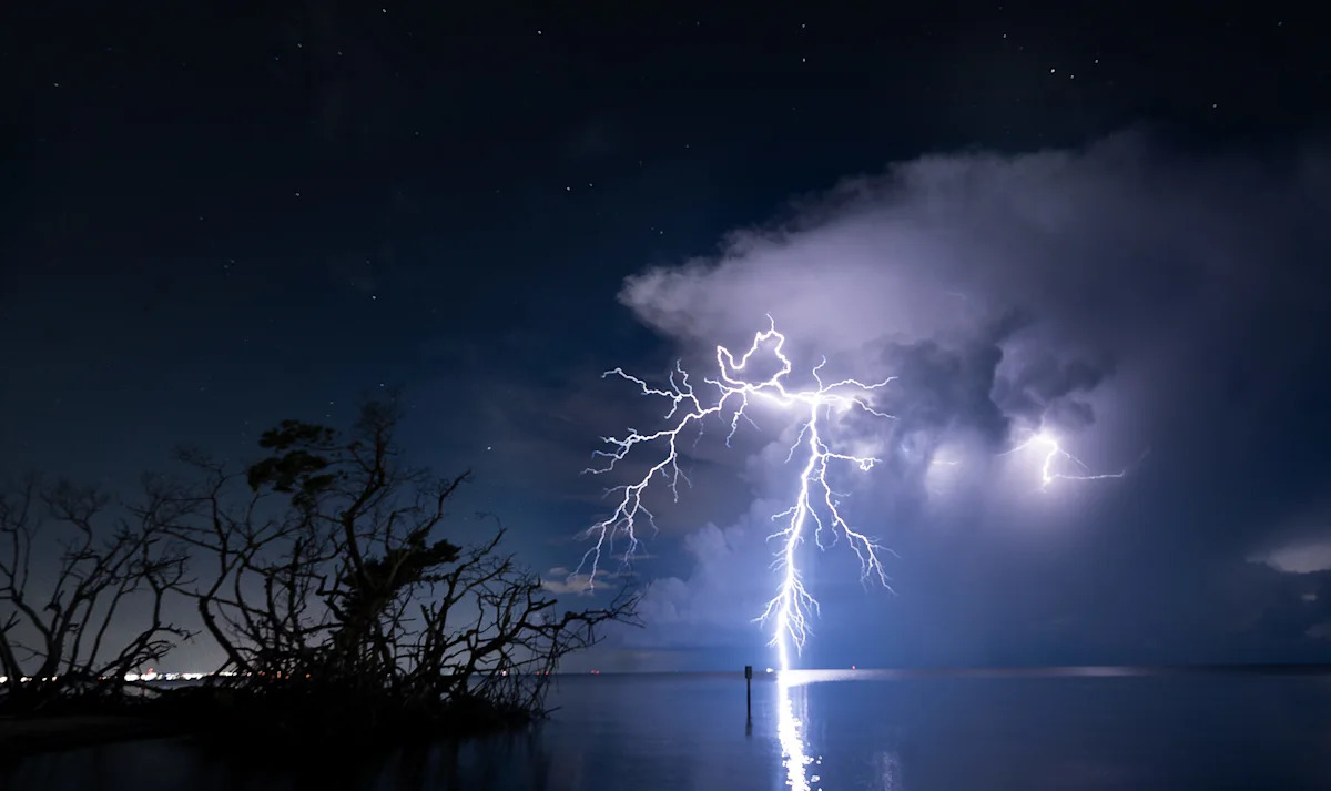
An evening lightning storm lights up the skes near the Sanibel Causeway on Saturday, Aug. 16, 2025. Photographed from a distance.
What did residents report during Southwest Florida storm of July 11?
Residents via various platforms reported some hail and trees damaged or down, and the Weather Service had received a report of possible minor damage to one roof.
“I was literally on Vanderbilt turning into the Vineyards and said, “I think I am driving through a dang tornado,” said Naples resident Tay Meeks Hopkins. “It was absolutely crazy. I immediately pulled over and waited — the weather was already bad but it became significantly worse for about 10 seconds. A complete white-wash, couldn’t even see out my front window at all.”
Other motorists reported simlilar experiences in that area.
“I felt an extra gust or two when I was driving,” said Naples resident Bobby Judah.
Added Naples resident Ann Marie Witmer: “The lightning was frightening.”

A storm rolls over Southwest Florida as seen from Bunche Beach in south Fort Myers on Monday, June 29, 2026.
What is a severe thunderstorm warning?
A Severe Thunderstorm Warningis issued when a storm is occurring or about to occur with winds of 58 mph or higher or hail 1 inch in diameter or larger, the National Weather Service says. These storms can also bring heavy rain and, in some cases, flooding or flash flooding.
Weather: SW Florida storms bring high winds, power outages and possible tornado
Tips for staying safe during thunderstorms
Once inside a shelter, stay away from windows and avoid using electrical equipment or plumbing.
Keep a battery-powered weather radio nearby in case of power loss.
Secure loose objects outside, as they can become dangerous during high winds.
Bring pets inside, and if time allows, make sure fences are secure to prevent pets from escaping or running away.
Also, remember lightning can travel several miles from a storm, so hearing thunder means you’re within striking distance. The common advice from experts is “When thunder roars, go indoors.”
In the Know: Fort Myers Beach projects include new resort, pier, bridge and more
How to stay safe around lightning
If indoors:
Stay off corded phones, computers and other electrical equipment that puts you in direct contact with electricity, according to the NWS.
Avoid plumbing, including sinks, baths, faucets and even toilets, if you can.
Stay away from windows and doors, and stay off porches.
Do not lie on concrere floors or lay against concrete walls.
If in a vehicle:
Ensure all windows are fully closed.
Refrain from touching radios, ignition systems, or any metal parts connected to the vehicle’s exterior.
Stay inside the vehicle until at least 30 minutes after the last sound of thunder.

Have an opinion on this topic? Write a letter to the editor and send to letters@naplesnews.com or mailbag@news-press.com. Keep to 250 words or fewer and include contact info. Have more to say? Send guest column of no more than 600 words. Created with Microsoft software.
What to do if a vehicle is struck by lightning
Stay inside. Your car acts as a Faraday cage, directing the electricity around you and protecting you.
Keep hands on your lap and away from metal surfaces .
Do not touch the radio, dashboard, or any electrical components.
Wait at least 30 minutes after the last thunder before exiting.
Writing In the Know for the USA TODAY Network, Columnist Phil Fernandez (pfernandez@gannett.com) grew up in Southwest Florida and has led Pulitzer Prize-winning efforts. Sign up for our free Breaking Ground growth and development newsletter. Subscribe to our News-Press and Naples Daily News apps.
This article originally appeared on Naples Daily News: Big storms leave Florida residents wondering if tornadoes touched down