
Happy Wednesday, South Florida!
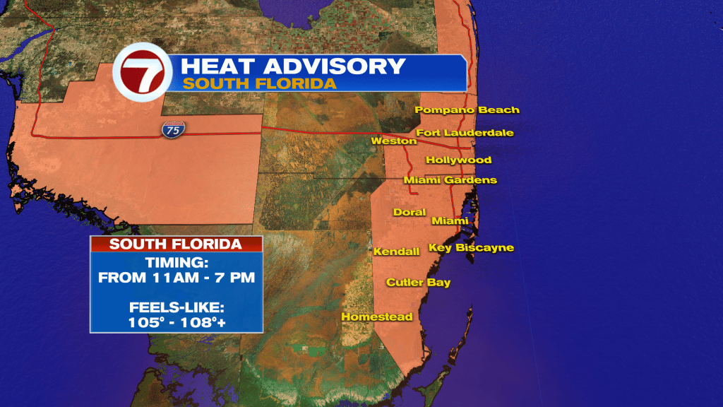
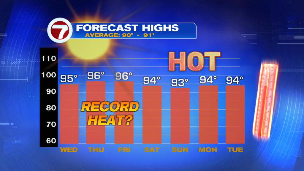
A heat advisory has been issued for Miami-Dade and Broward counties this afternoon. High temperatures will soar into the mid-90s and it will feel as hot as 110 degrees when you factor in the humidity. It’s very important that you stay hydrated and take frequent breaks from the heat this afternoon.
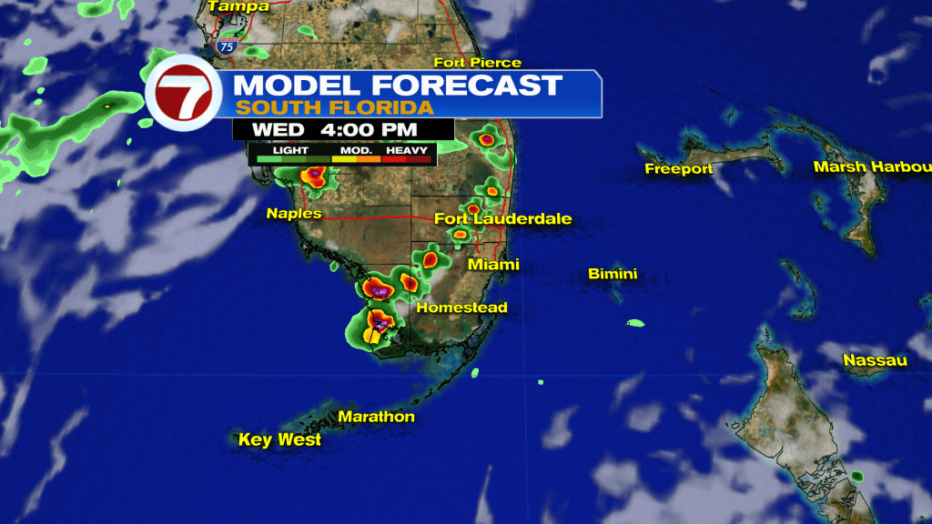
The only hope for today is the chance of a few storms inland this afternoon. Storms are unlikely closer to the coast today unfortunately.
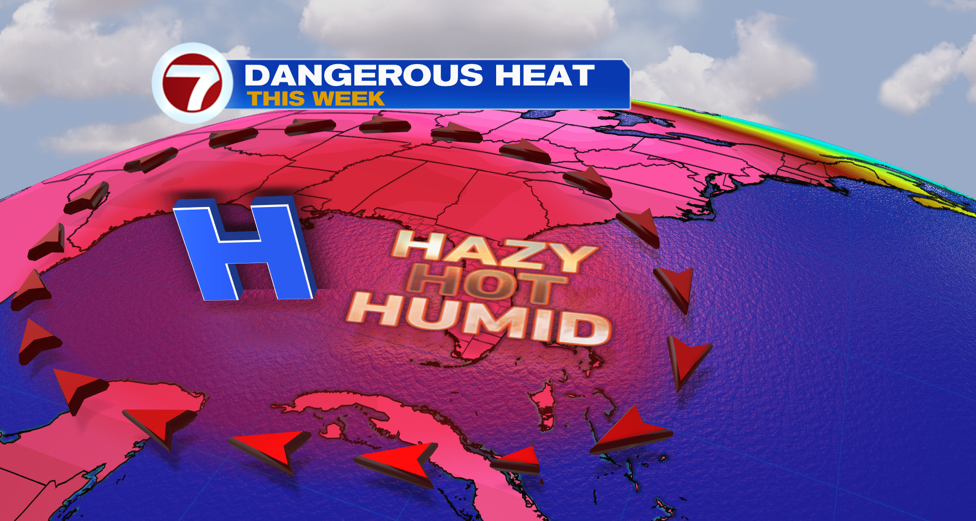
The heat will remain a huge story all week as a hot area of high pressure dominates the region.
In fact, the heat will only worsen towards the end of this week — with record high temperatures possible on Thursday and Friday.
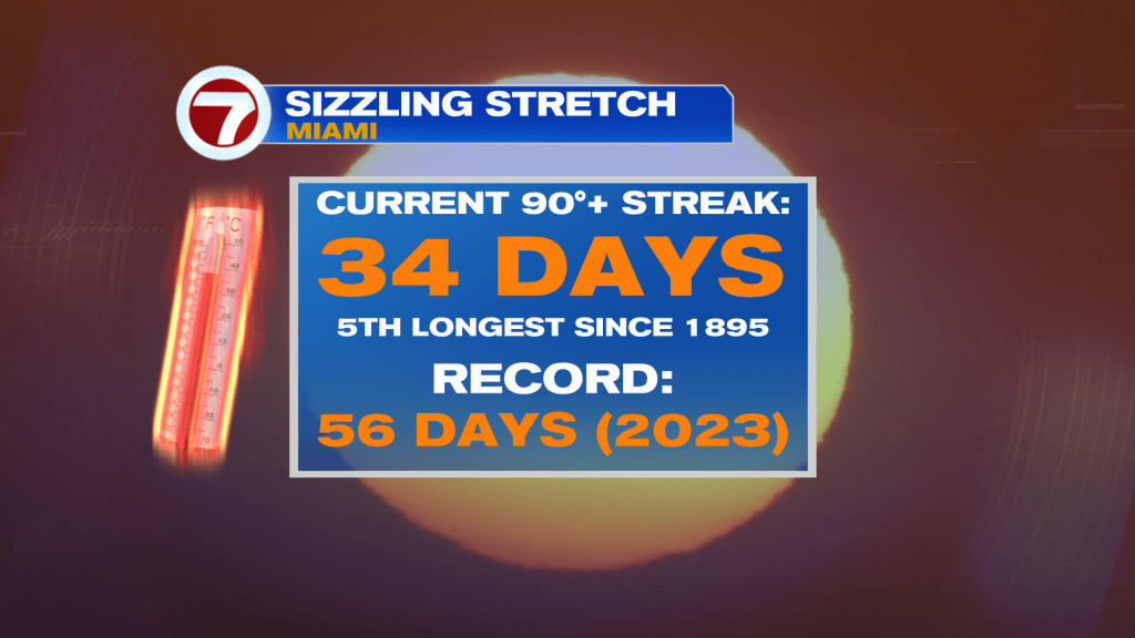
This is bad news because Miami has been on a very long hot streak. We have hit 90 degrees 34 days in a row — the 5th longest streak on record since 1895. The current forecast will put us at 41 days in a row, which would tie us with the third longest stretch since 2011. The record is 56 days in a row in 2023. Hopefully we don’t get there.
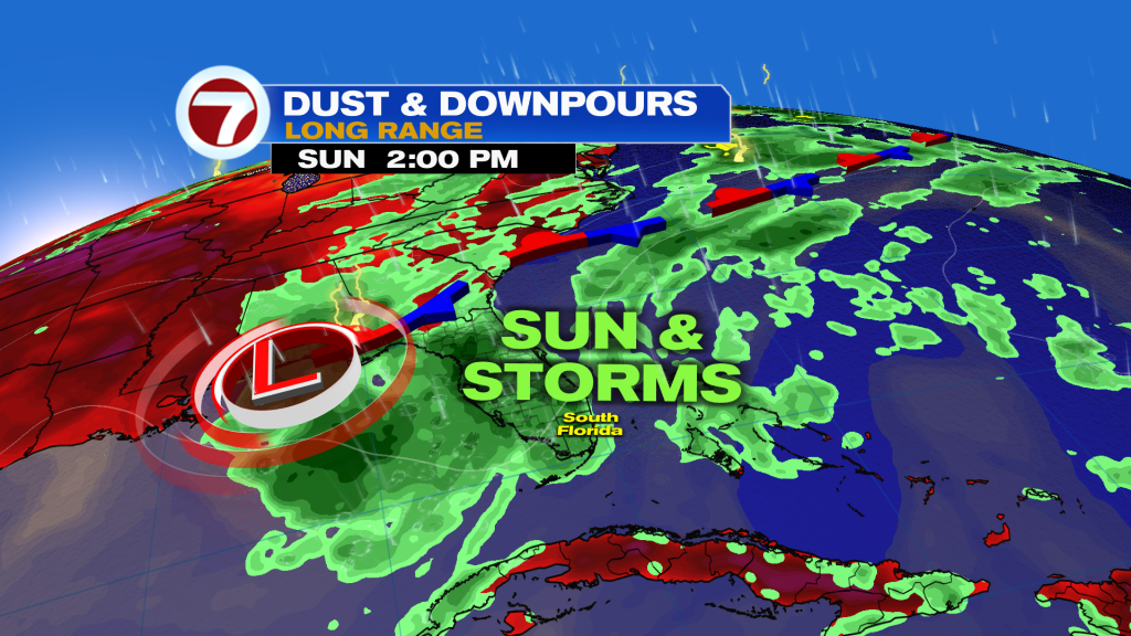
The good news is this very hot pattern will begin to break down this weekend as high pressure begins to break down. This will allow for more tropical moisture to return to Florida, which will allow for higher rain chances to cool us off a little bit.
 TROPICAL UPDATE
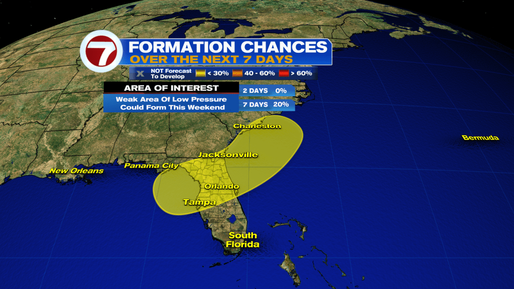
The National Hurricane Center is now mentioning the possibility of weak tropical development in the NE Gulf or just off the SE Coast this weekend. Heavy rain is the main threat for Florida, Georgia, and the Carolinas. Next name is Bertha.
Join our Newsletter for the latest news right to your inbox