
Tracking The Tropics: New area to watch for potential development near Florida
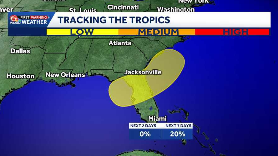
An area of interest has been identified in the northeastern Gulf for potentially development within the next 7 days.
Wake up on this hump day, Raven. What are we expecting today? Well, we are expecting to feel hot again. So last couple of days we’re into the 80s, actually the low 80s for the highs yesterday. Today we’re into the low 90s, so about *** 10 degree difference out there for you. Also less chances for rain. So today is that transition day where temperatures going back to average for us. So some of you, especially on the North Shore, could still feel just *** little bit below average where we usually are. For this time of the year, but warmer than yesterday. Here’s what’s going on in the bigger picture for us. So as of right now we do have *** lot of cloud coverage just to the north of us. This is that kind of system that’s been swirling storms or keeping storms constant for our area, especially yesterday. So today, starting off this morning, we’re actually on the dry side, so no need to worry about the rain gear for the morning. Now for the afternoon you very well may need it. We’re looking back at the hit or miss storms that will pop up as we do get some daytime heating. So, uh, just be prepared for that. Not everybody’s going to see it. I do have about *** 20 to 30% chance, 20 to 30% of us will see some rain. Other than that though, most of us are likely going to stay on the dry side, so you could, especially if you’re out over water, but be sure to watch out for lightning for today as well. Your temperatures right now, as you head out the door, *** little bit warmer than yesterday, not *** huge difference, but I’d say about 3+ degrees warmer than yesterday. So we’re starting to see the differences happening. And here’s *** look at our highs right at about 90 to 92 degrees for us and. Yeah, that is *** big difference from the past couple of days. We are starting off mostly cloudy. I do think we’re gonna see some clearing as we get later into the day as well. Here’s the other thing we are looking at again, so I’ve been showing this since yesterday, but, uh, this really shows it’s gonna happen as we get to the weekend. So the rain chance is going down, but look at your temperatures into the mid 90s, feeling like the triple digits. Very well could be talking about some heat advisories coming up shortly, uh, so we’ll see what happens, especially as we do get closer to the weekend over the next 7. is nothing expected over the tropics, so that is some good news for us. However, though, we could be talking about an increased chance of rain, especially right around the panhandle, the Big Bend of Florida as we’re heading into the end of the weekend into the beginning of next week. Now, will that form into anything as of right now, National Hurricane Center, uh, not expecting to see any development over the next 7 days. So as of right now could just be some rain if we’re heading out towards that way. So July tropical occurrences where we typically, typically do see them. All the areas highlighted in yellow, that’s gonna be the possible category. So basically homegrown storms is what we usually do get for July. So again, we’re getting deeper into the season, but good news is that we don’t have anything to worry about over the next 7 days. The next 7 days right here at home, you can see how the temperatures will gradually start to increase, looking at the mid 90s by your Saturday. If you do have some weekend plans for you, the only thing you really do need to be worried about is the heat because yeah, we’re gonna be feeling like the triple digits 105 and above.
Tracking The Tropics: New area to watch for potential development near Florida
An area of interest has been identified in the northeastern Gulf for potentially development within the next 7 days.

Updated: 7:40 AM CDT Jul 15, 2026
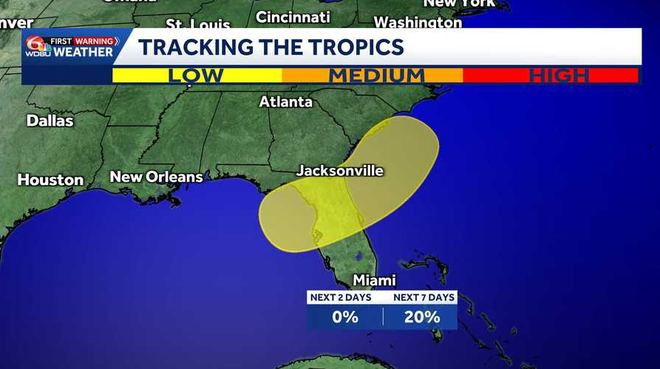
NORTHEASTERN GULF:Over the weekend, an area of low pressure is expected to form over the northeastern Gulf. Slow development is possible as the system continues to move northeastward from either the northeastern Gulf or the southeastern U.S. coast. WHAT WE KNOW:Development over the next 2 days: Low, 0%.Development over the next 3-7 days: Low, 20%.IMPACTS TO LOUISIANA:It’s still very early, but depending on direction of development, we could see an increase in rain chancesDevelopment could occur on the eastern side of Florida or the western side
NORTHEASTERN GULF:
Over the weekend, an area of low pressure is expected to form over the northeastern Gulf. Slow development is possible as the system continues to move northeastward from either the northeastern Gulf or the southeastern U.S. coast.
WHAT WE KNOW:
Development over the next 2 days: Low, 0%.Development over the next 3-7 days: Low, 20%.
IMPACTS TO LOUISIANA:
It’s still very early, but depending on direction of development, we could see an increase in rain chancesDevelopment could occur on the eastern side of Florida or the western side