
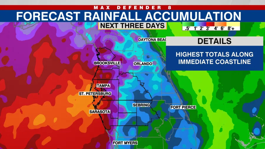
TAMPA, Fla. (WFLA) — An area of low pressure is forecast to develop in the eastern Gulf, leading into the weekend, and maintain elevated rain chances for Tampa Bay beginning Friday.
 Friday
The greatest chance of scattered downpours and storms will exist in the midday and early afternoon, as hit-or-miss storms drift to the north and west throughout the second half of the day. There is a low-end level 1/4 risk for flash flooding for a large portion of Tampa Bay on Friday due to heavy rainfall.
Conditions should be drier Friday evening around dinnertime and sunset, with just a lingering stray shower or two.
Saturday
Saturday morning may feature some spotty showers and storms, but chances for scattered storms will likely increase for the afternoon and evening. Most rain will generally drift north and west throughout the day.
Sunday
Sunday looks to be the soggier day of the weekend with scattered-to-widespread coverage of rain and storms. Early morning rain and storms will be possible, with rain coverage increasing throughout the day.
Rain will largely hug coastal areas, along and west of I-75, and continue to generally track north and west.
 Rainfall potential
Areas along the Gulf coast will see the greatest rainfall totals overall throughout the weekend. The Weather Prediction Center estimates rain totals between 1″ to upwards of 4″ closest to the coast.
Copyright 2026 Nexstar Media, Inc. All rights reserved. This material may not be published, broadcast, rewritten, or redistributed.
For the latest news, weather, sports, and streaming video, head to WFLA.