
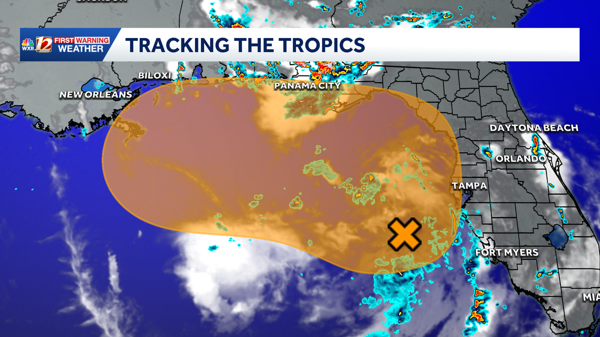
Gulf low becomes Invest 91-L promising for tropical activity | A tropical depression may form
The wave in the eastern Atlantic fizzled on Friday, but the Gulf low still has an increasing chance of becoming tropical.
Tried and the foothills. We’re also watching what is now Tropical wave Invest 91L. This is out in the Gulf, and this system is off the coast of Florida, but wrapping in some showers and thunderstorms closer to the peninsula right now. It’s moving slowly to the northwest at about 5 miles an hour, and wind speeds so far only 25 miles an hour, so it has *** ways to go before it becomes tropical in nature, but there is about *** 50% chance now that the National Hurricane Hurricane Center meteorologists believe that this is going to form. It’s looking more likely it could cause some problems for folks too out in the Gulf throughout the week. We’ll be watching to see if we can pick up any of that tropical moisture much later on heading into next weekend. For now, we’ll show you that we’ve got two impacted days in *** row, 90s to 80s on Monday, but still feeling steamy, and then *** little less humid by Thursday at 83 degrees, *** good looking 7 day forecast.
Gulf low becomes Invest 91-L promising for tropical activity | A tropical depression may form
The wave in the eastern Atlantic fizzled on Friday, but the Gulf low still has an increasing chance of becoming tropical.

Updated: 12:32 AM EDT Jul 19, 2026
The tropical Atlantic basin is, as we would expect, mostly quiet during the ongoing climate pattern known as El Niño or ENSO. There is one area that still has the attention of meteorologists at the National Hurricane Center (NHC). The low is now an area of interest labeled Invest 91-L in the Gulf off the Florida coast this week. Potential Tropical Development in the GulfThe low over the Gulf near the Florida Peninsula will bring rain and thunderstorms to Florida regardless of its tropical characteristics. Surface pressures had remained too high for a surface circulation to form, but the upper low may change this. NHC meteorologists indicate there’s still time during the next seven days for the disturbed area to become tropical. It looks unlikely that the low will move into the Atlantic along the North Carolina coast. However, the area of disturbed weather’s northerly track may bring rain over a large area of the Southeast Coast into next week. Stay tuned as we watch and wait as the low takes shape in the Gulf.Find more on severe weather threats this weekend in our article here.More weather coverage: Weather Alerts | Latest weather forecast | Post pictures to the uLocal North Carolina Facebook Group | Traffic information | Report closings and delays | SkyCams | Download the WXII12 News mobile app
WINSTON-SALEM, N.C. —
The tropical Atlantic basin is, as we would expect, mostly quiet during the ongoing climate pattern known as El Niño or ENSO. There is one area that still has the attention of meteorologists at the National Hurricane Center (NHC). The low is now an area of interest labeled Invest 91-L in the Gulf off the Florida coast this week.
Potential Tropical Development in the Gulf
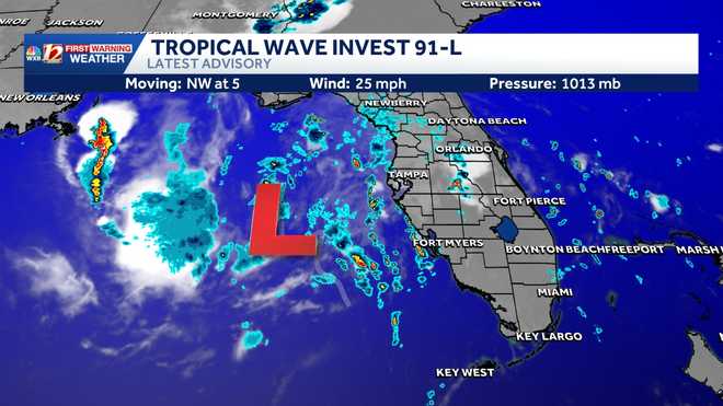
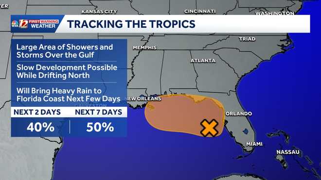
The low over the Gulf near the Florida Peninsula will bring rain and thunderstorms to Florida regardless of its tropical characteristics. Surface pressures had remained too high for a surface circulation to form, but the upper low may change this. NHC meteorologists indicate there’s still time during the next seven days for the disturbed area to become tropical. It looks unlikely that the low will move into the Atlantic along the North Carolina coast. However, the area of disturbed weather’s northerly track may bring rain over a large area of the Southeast Coast into next week. Stay tuned as we watch and wait as the low takes shape in the Gulf.
Find more on severe weather threats this weekend in our article here.
More weather coverage: Weather Alerts | Latest weather forecast | Post pictures to the uLocal North Carolina Facebook Group | Traffic information | Report closings and delays | SkyCams | Download the WXII12 News mobile app