
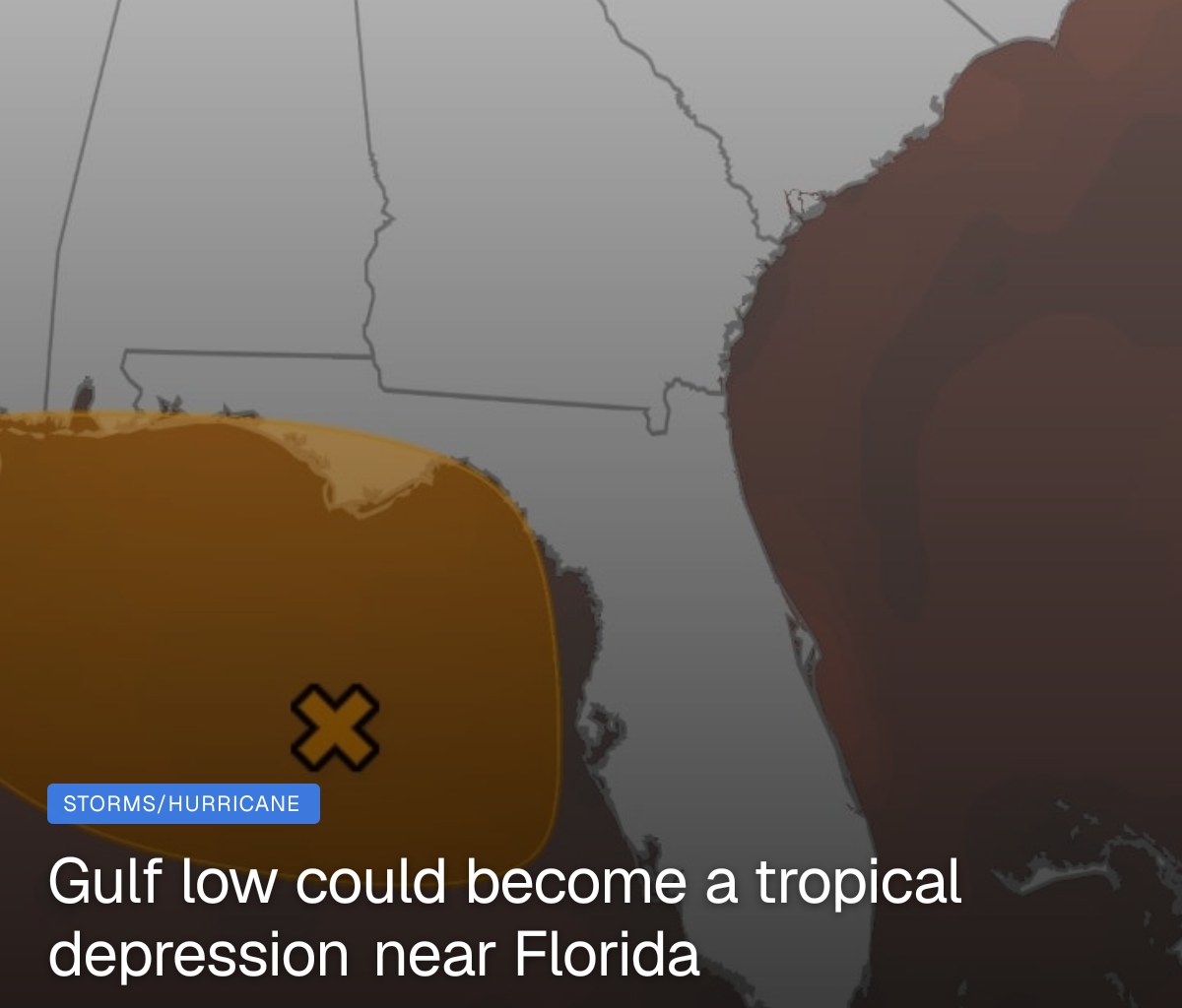
Tropical development is possible in the Gulf or near the Southeast U.S. coast this weekend into early next week, though locally heavy rain may be a threat, regardless, from Florida to the Carolinas.
(MORE: El Niño factoring into hurricane season outlook)
What may happen
An area of low pressure is forming in the eastern Gulf near Florida and has been enhancing thunderstorm activity over the Florida peninsula.

Weather in your inbox
By signing up you agree to the Terms & Privacy Policy. Unsubscribe at any time.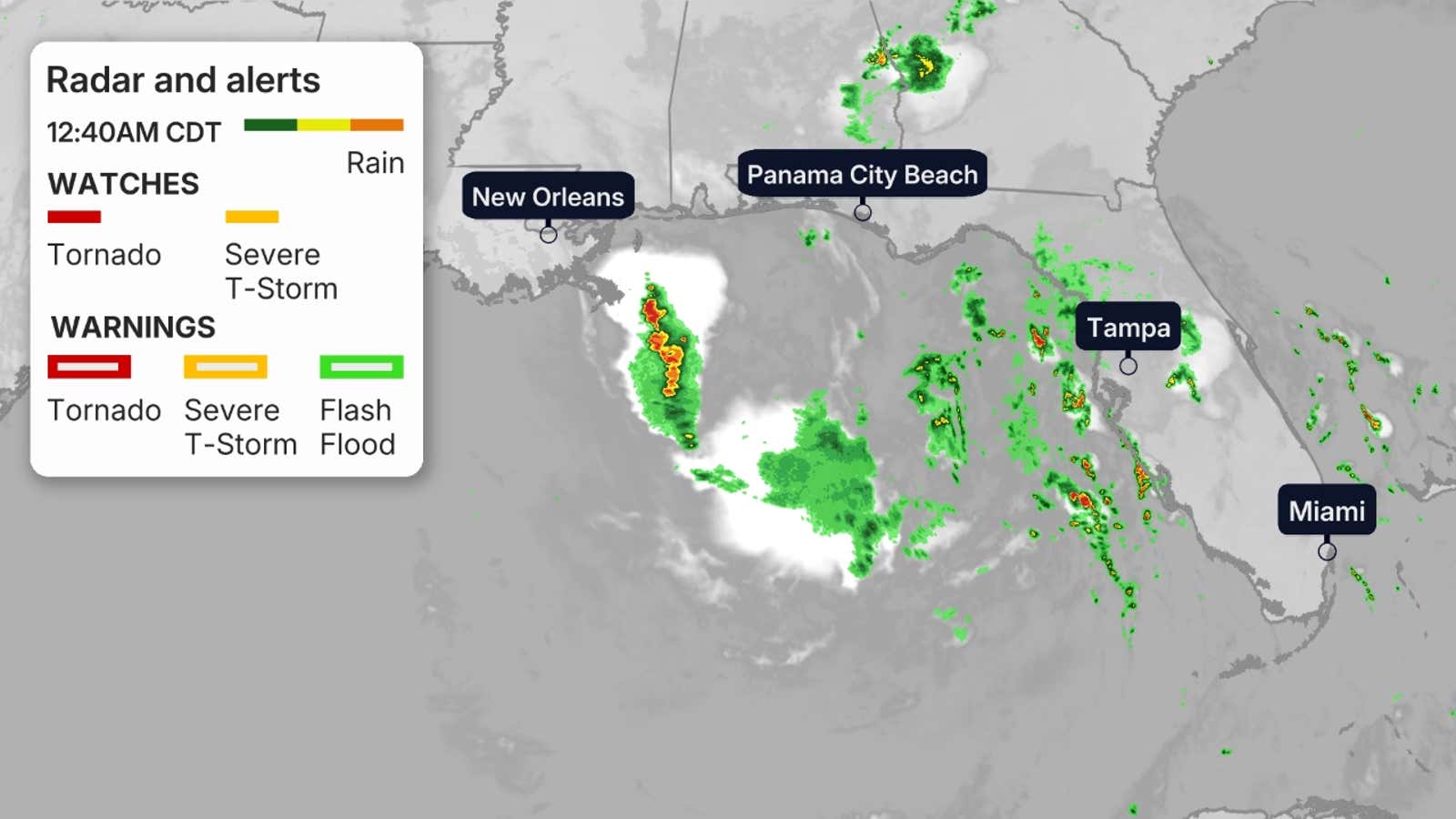
Computer models now suggest that this swirling system will become better developed throughout the weekend. If it can sustain thunderstorms and stay offshore, a tropical depression or even Tropical Storm Bertha could form by early next week.
The hurricane hunters could investigate the system on Sunday.
Regardless of what the system is called, it could spread rain and enhance winds to the Florida, Alabama, Mississippi and Louisiana coasts and add a chop to the Gulf waters.
Water in the northeast Gulf and off the Southeast coast is warmer than average, with water temperatures as high as the upper 80s available to fuel any thunderstorms.
There are a few scenarios with this low after this weekend:
It may slide inland relatively quickly over some part of Florida or the Southeast. It could sit for a while over the northeast Gulf.It could drift westward in the northern Gulf.
For now, there’s not too much to be concerned about if you’re near the Gulf or Southeast coast.
However, we’re in hurricane season and things can change quickly. Check back with us at weather.com for updates to this forecast.
It’s always a good time to make sure you’re prepared for hurricane season, well before any storms threaten.
(MORE: How to stay safe in hurricane season)
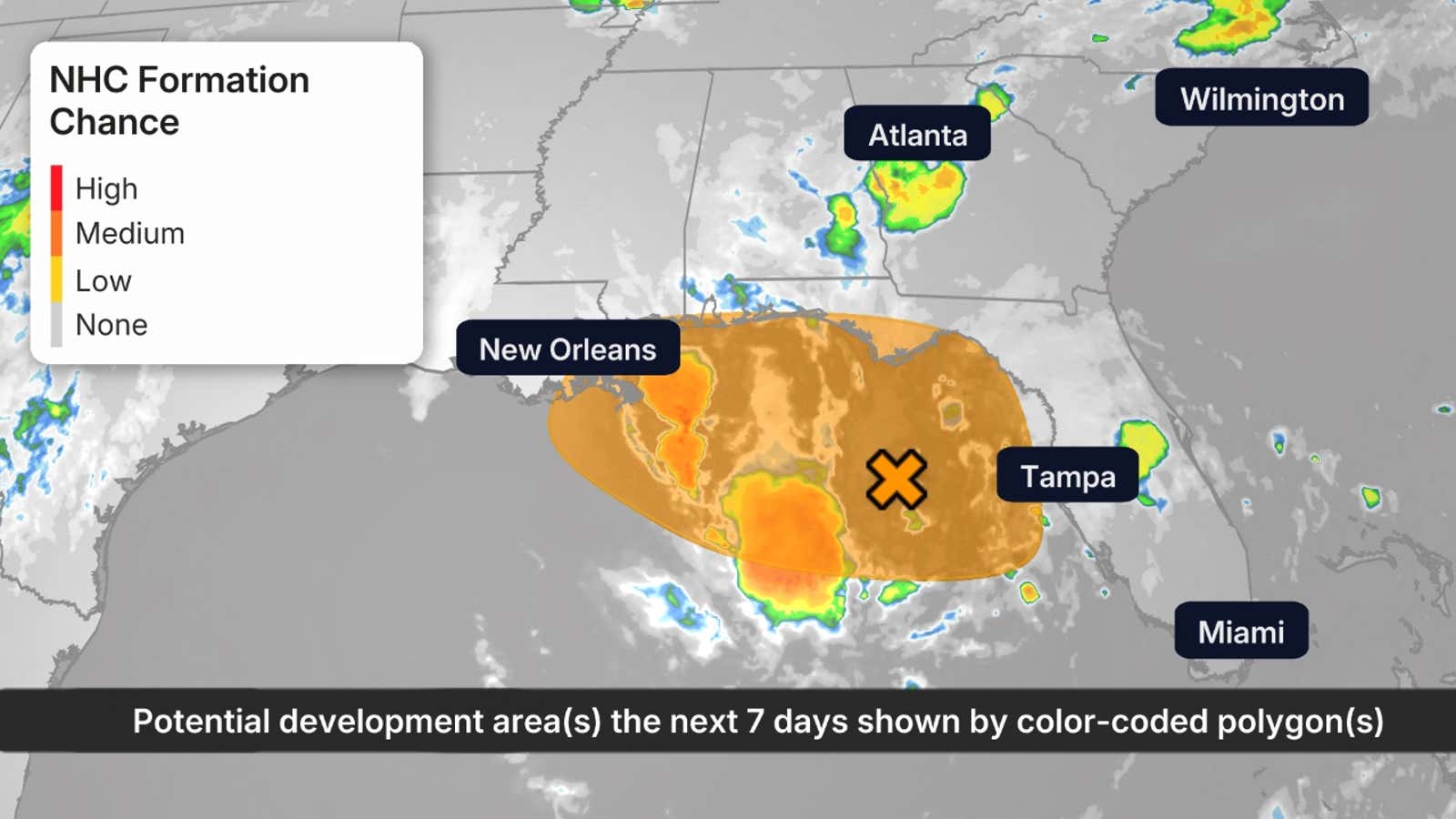
The possible area(s) of tropical development according to the latest National Hurricane Center outlook are shown by polygons, color-coded by the chance of development over the next seven days. An “X” indicates the location of a current disturbance.
Soaking rain possible
You don’t need a tropical depression or storm to wring out heavy rain in summer.
Regardless of tropical development, there is a threat of locally heavy rain this weekend into early next week from parts of Florida and the northern Gulf Coast into the Carolinas. Up to 5 inches could fall from west-central Florida to the Big Bend.
For now, these locally soaking downpours are most likely in northern and central Florida, above and beyond the typical daily afternoon scattered storms.
While many of these areas are currently in drought and can use rain, these heavier downpours could lead to local flash flooding, especially in urban areas.
(MORE: How to stay safe in a flash flood)
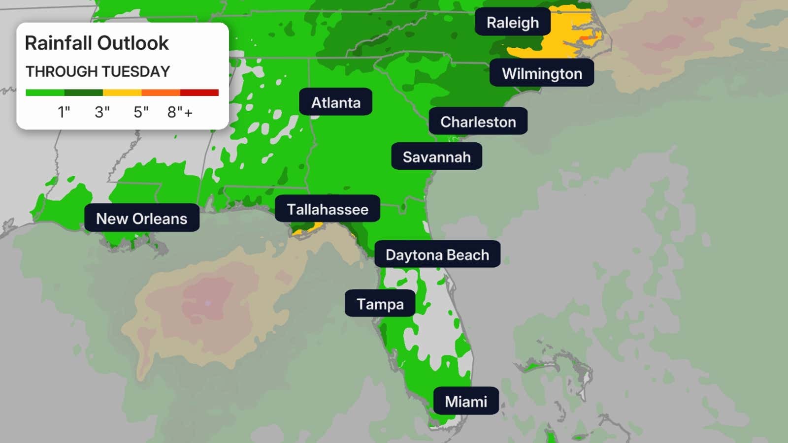
This is a broad outlook of where the heaviest rain may fall. Higher amounts may occur where bands of rain stall over a period of a few hours.
Jonathan Erdman is a senior meteorologist at weather.com and has been covering national and international weather since 1996. Extreme and bizarre weather are his favorite topics. Reach out to him on Bluesky, X (formerly Twitter) and Facebook.