
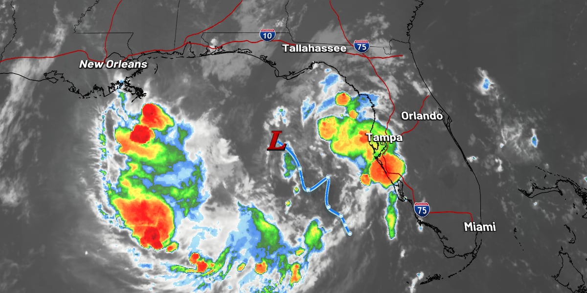
TALLAHASSEE, Fla. (WCTV) – Invest 91L is a disturbance in the Gulf that has tropical-like characteristics. The term Invest is used by the National Hurricane Center when the agency is investigating an area of thunderstorms prior to tropical development.
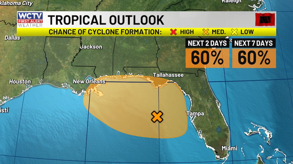 The National Hurricane Center has a 60% chance of tropical formation over the next 2 days.(WCTV)
The NHC is going planning on flying into the assumed center of circulation on Sunday afternoon to gather more weather data which will improve modeling and determine if it is a tropical depression or tropical storm (winds of 39 to 73 mph).
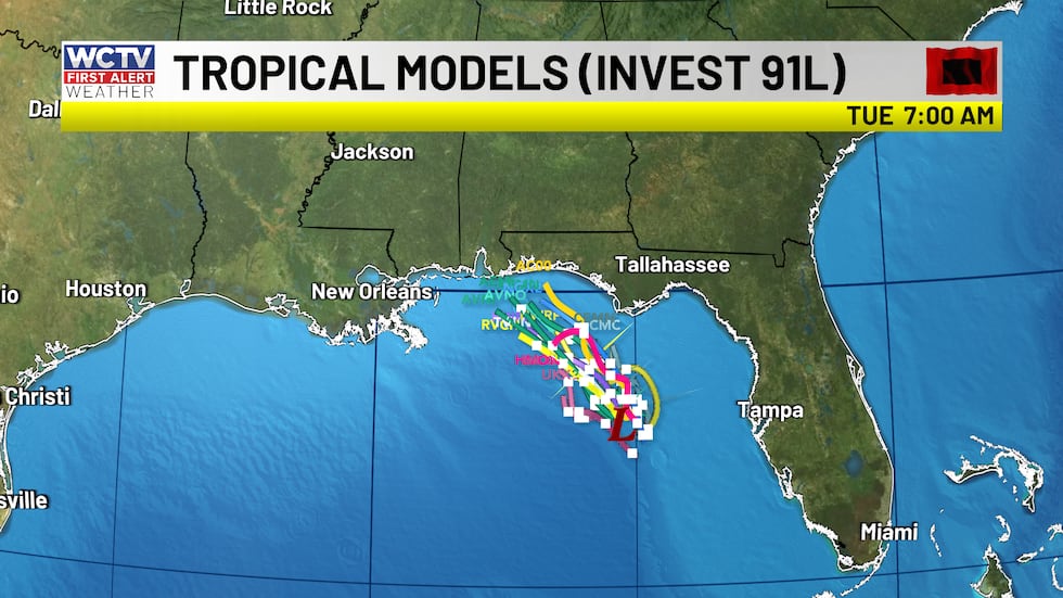 Slowly drifting northwest over the next three days. No local landfall but could regionally make a landfall to our west.(WCTV)How does Invest 91L impact Sunday’s weather?
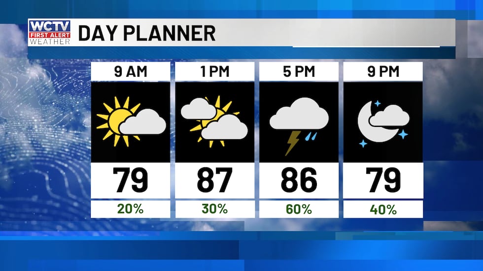 Scattered showers and storms, especially this afternoon.(WCTV)
Periodic rain bands will circulate around the Gulf low. Whether it is named or not, the system will bring beneficial rain and thunderstorms to the Big Bend and South Georgia. However, since this is not a landfalling system, we will only get periodic rainbands and not a nice steady rain. So, some folks will miss out on rain all together this weekend.
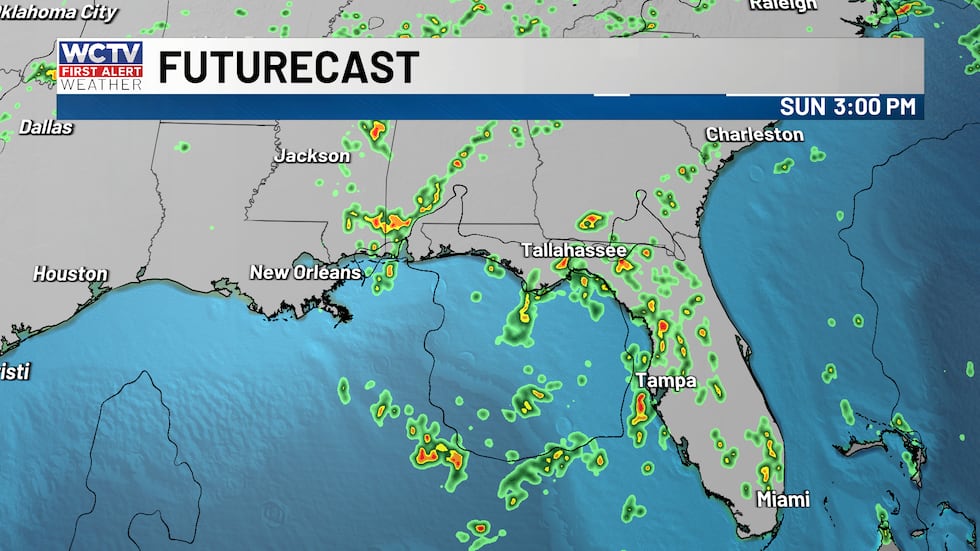 Scattered thunderstorms from disorganized rainbands this afternoon.(WCTV)
Hot and humid with partly sunny in between showers. Afternoon highs in the low 90s.
Impacts peak on Monday
Invest 91L will likely be a tropical depression or tropical storm by Monday, which means more organized rain bands spiraling out from the storm’s center. Rain coverage will be at its highest with periodic showers throughout the day. This will NOT bring an all-day rain to anyone as the storm’s center will still be 100 miles or so offshore, so no landfall is expected locally, just rain bands from this.
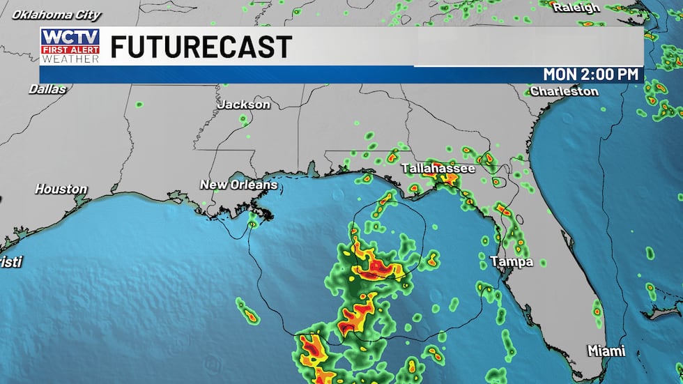 Highest coverage of showers and storms will be on Monday as Invest 91L organizes into a tropical depression or tropical storm.(WCTV)
Partly to mostly cloudy in between rainbands will keep temperatures a few degrees cooler in the upper 80s, but very humid.
Storm threats
The biggest risk with rain bands and thunderstorms will be gusty winds between 40 and 60 mph. These strong gusts could take down branches, limbs or weak trees, which could lead to outages.
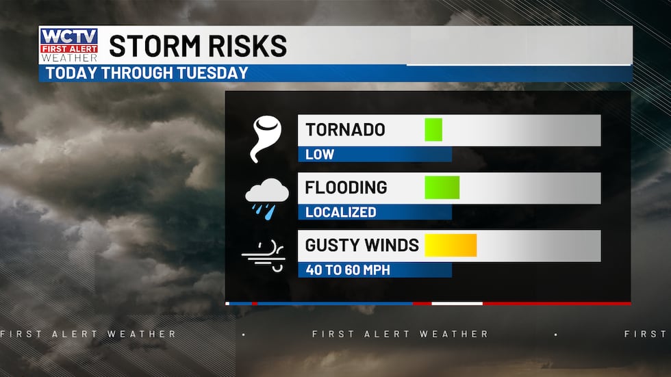 A risk for strong winds heavy rainfall and a brief tornado through Tuesday.(WCTV)
A brief tornado is possible, especially with tomorrow’s rain bands. The tornado risk is not high, but anytime a tropical cyclone gets more organized a low-end tornado risk is often present.
I am not expecting widespread severe weather but be sure you have weather alerts turned on your mobile device.
Rain totals between 2 and 5 inches this weekend, some higher amounts underneath persistent thunderstorms. While others struggle to get anything measurable.
Beach and boating hazards
Boating conditions slowly deteriorate throughout the day and into your Monday.
Winds will gradually pick up as Invest 91L gains strength in the open Gulf waters. Winds are 10 to 15 knots this morning and will increase to 20 knots this afternoon. Waves are tolerable between 2 to 4 feet and starting to get a little bumpy. Choppy bay waters.
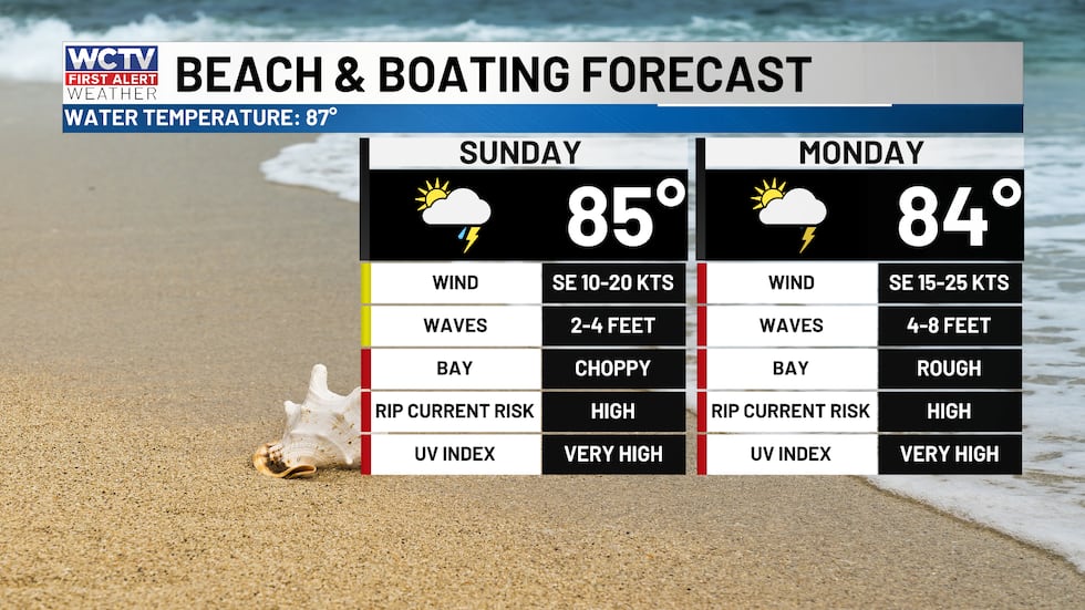 Not great boating or beach conditions over the next two days as Invest 91L passes by(WCTV)
I would avoid the boat and beach tomorrow with periodic storms and higher wave action. Waves 4 to 8 feet and rough bays. Southeast winds 15 to 25 knots. Rip current risk is high both days.
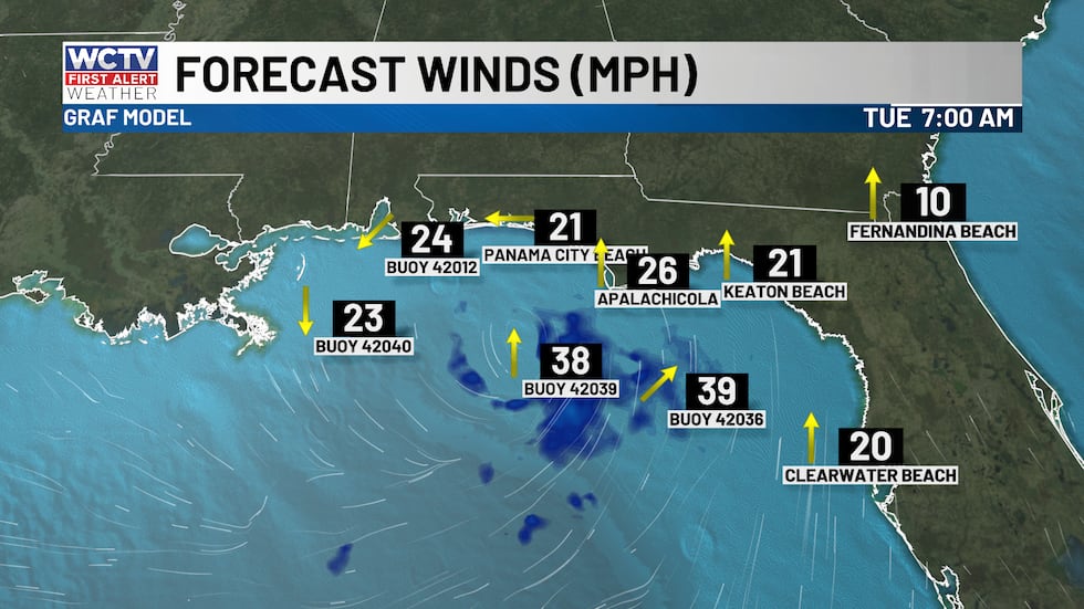 Tropical storm force winds are likely to stay south of us but should get breezy Monday and Tuesday along the coast.(WCTV)Keeping afternoon showers around
The low will continue to slowly drift west Tuesday and Wednesday slowly lowering rain chances associated with that, but the humid airmass is not going anywhere, keeping scattered afternoon showers in the forecast through the end of the week. Highs will remain in the low to mid 90s. Morning lows warm and humid in the mid 70s.
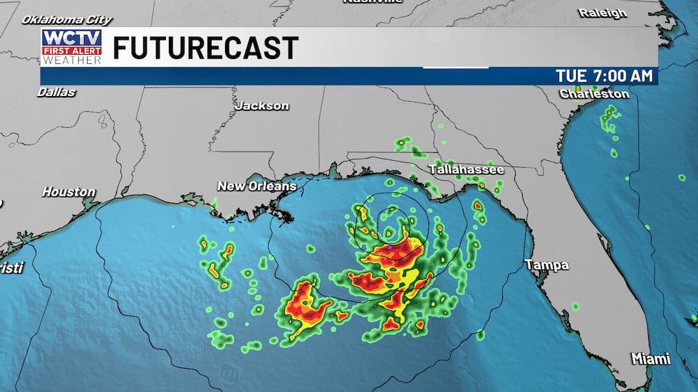 91L passes by our south bringing outer bands to the area on Tuesday as it drifts west.(WCTV)
To stay updated on all the latest forecasts and weather, follow WCTV First Alert Weather on Facebook and X (Twitter).
Click here to see all the latest weather headlines and here to view the First Alert Radar. Receive push alerts and watch the latest forecast anytime on the free WCTV First Alert Weather app. Click here to download it now.
Interested in becoming a WCTV First Alert Weather Watcher? Click here to join the team!
Copyright 2026 WCTV. All rights reserved.