
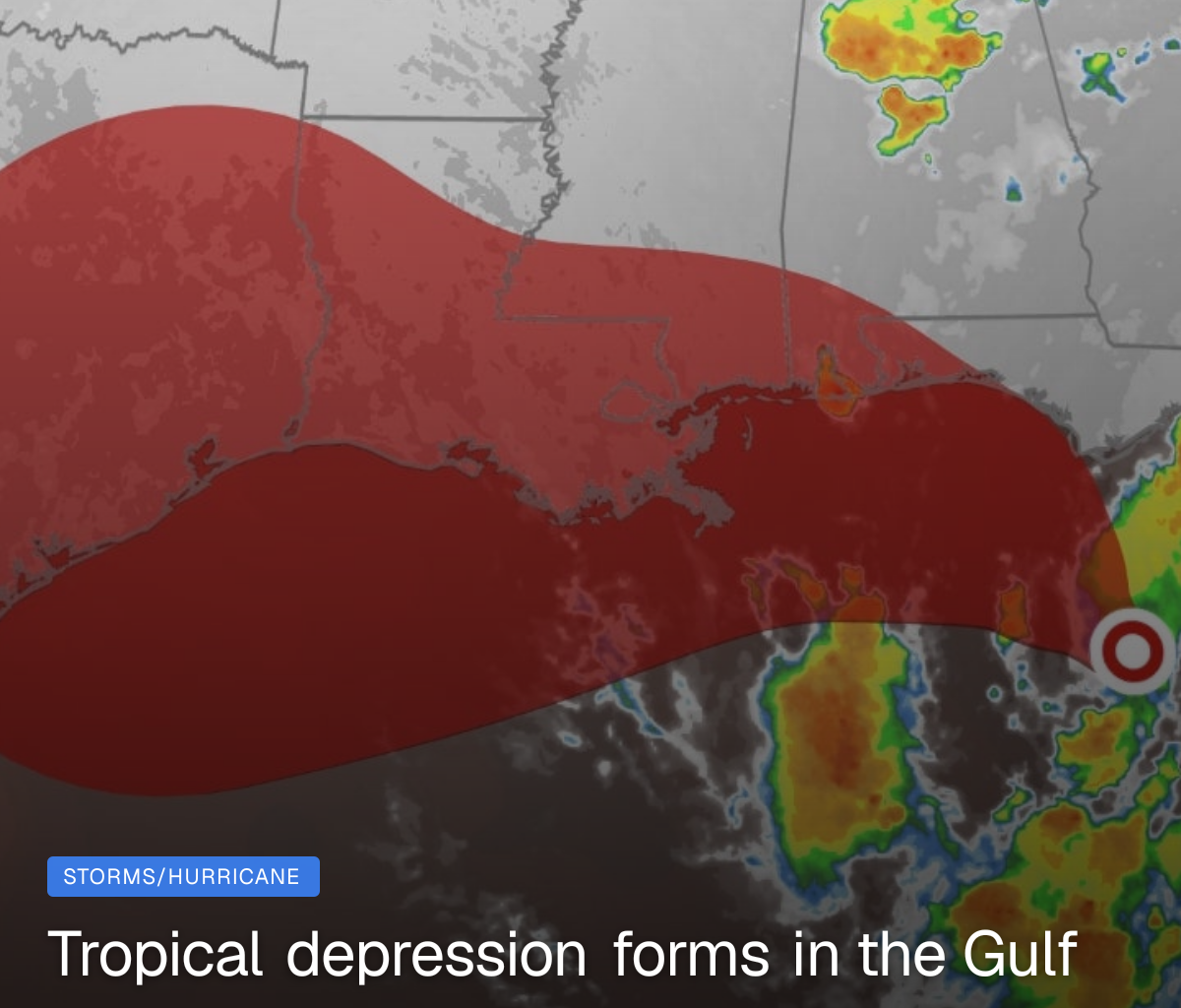
Tropical Depression Two has formed off the coast of the Florida Panhandle and is expected to bring heavy rain around the Gulf rim as it strengthens. It will likely become Tropical Storm Bertha by tonight or Monday.
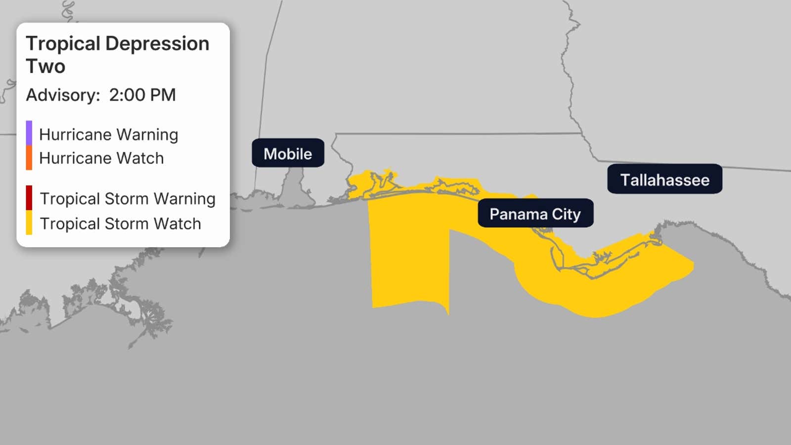
A tropical storm watch has been issued for Florida from the Ochlockonee River in the eastern Florida Panhandle to the Alabama border. Winds of 40 mph or greater are possible over the next 48 hours.
(MORE: Tropical Depression Two maps tracker)

Weather in your inbox
By signing up you agree to the Terms & Privacy Policy. Unsubscribe at any time.Tropical forecast
A tropical depression has formed in the eastern Gulf, according to the National Hurricane Center.
Water in the northeast Gulf and off the Southeast coast is warmer than average, with water temperatures as high as the upper 80s available to fuel any thunderstorms and tropical development. There remains some dry air entrenched in the system, so development is expected to be slow into early week.
The system is expected to become Tropical Storm Bertha later today or on Monday. That will occur when winds increase to 40 mph.
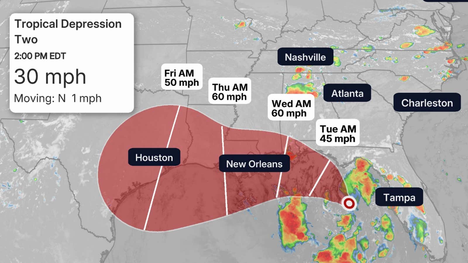
It will move toward the northwest through early week, then track along the northern Gulf Coast through the rest of the week, likely as a tropical storm.
If the storm can stay offshore, it is expected to strengthen into a moderate tropical storm.
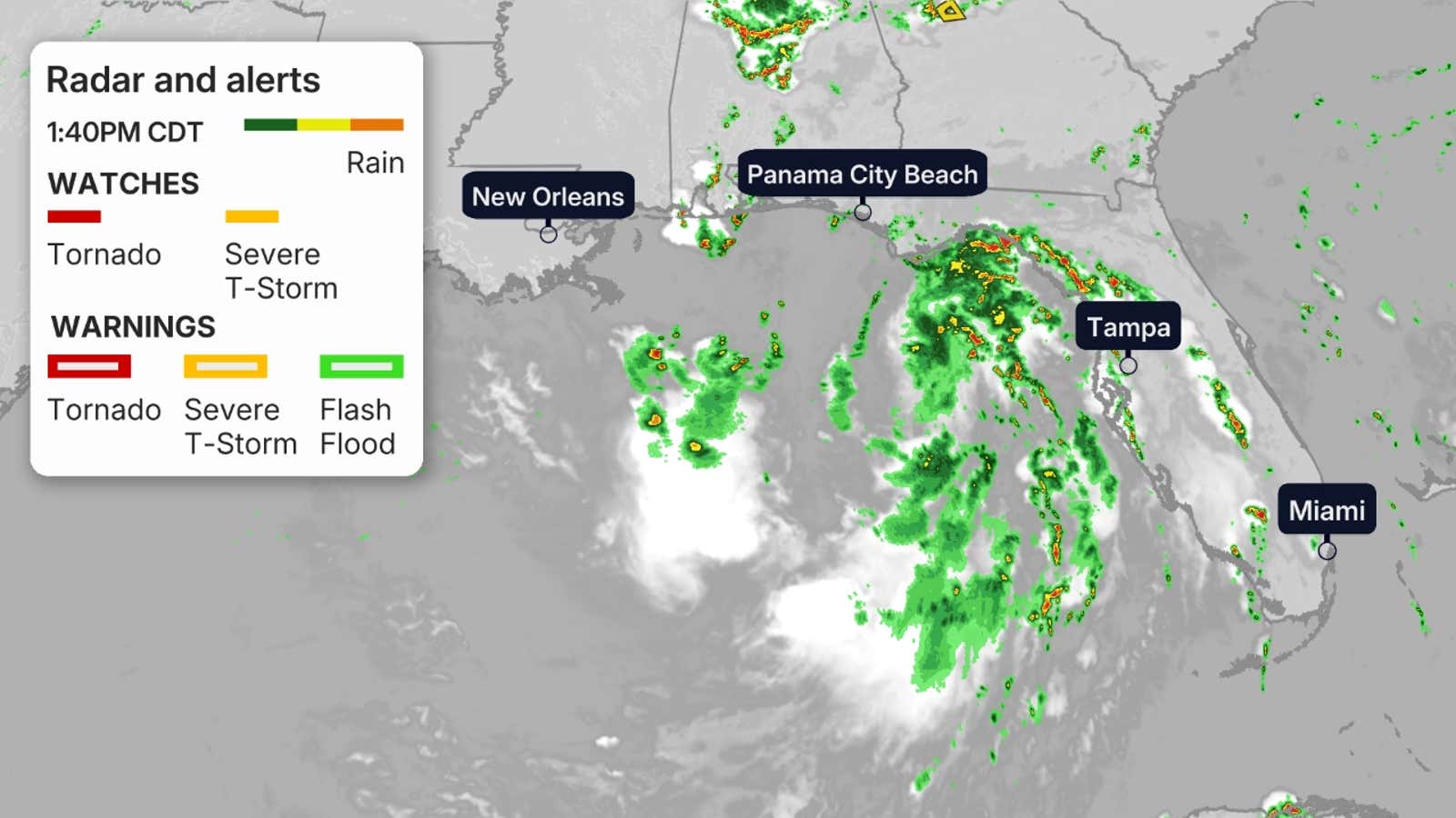
The hurricane hunters are investigating the system on Sunday afternoon.
Bands of rain and gusty winds are swirling around the system, occasionally coming ashore in Florida.
Now is always a good time to make sure you’re prepared for hurricane season, well before any storms threaten.
(MORE: El Niño factoring into hurricane season outlook)
Soaking rain possible
There is a threat of locally heavy rain into early this week from parts of Florida and the northern Gulf Coast into the Carolinas. Isolated areas could see up to 5 inches of rain from west-central Florida to the Big Bend.
For now, these locally soaking downpours are most likely in northern and central Florida, and will be above and beyond the typical daily afternoon scattered storms.
While many of these areas are currently in drought and can use rain, these heavier downpours could lead to local flash flooding, especially in urban areas.
(MORE: How to stay safe in hurricane season)
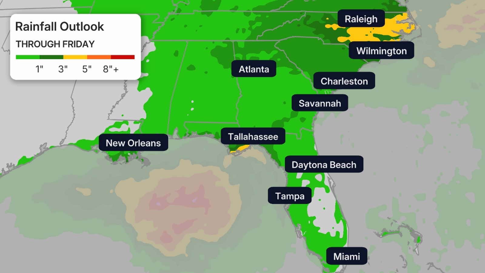
This is a broad outlook of where the heaviest rain may fall. Higher amounts may occur where bands of rain stall over a period of a few hours.
Other threats
In addition to rain and gusty winds, the threat of rip currents will be cranked up from the Florida West Coast to the Louisiana coast into early week. A storm surge of 1-3 is possible in the Florida Big Bend region.
It is also best advised to delay any boat travel in the Gulf this week. Seas could become choppy until this storm leaves the Gulf or dissipates.
A few tropical tornadoes or waterspouts are not out of the question.
Jonathan Erdman is a senior meteorologist at weather.com and has been covering national and international weather since 1996. Extreme and bizarre weather are his favorite topics. Reach out to him on Bluesky, X (formerly Twitter) and Facebook.