
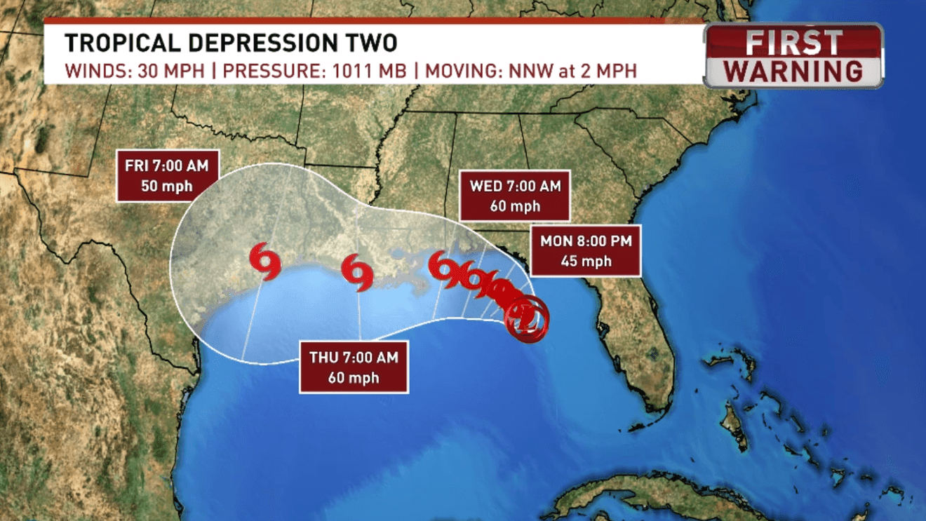
Tropical Depression Two has officially formed over the eastern Gulf and will be the main weather story for the next several days across northwest Florida and southwest Alabama.
The National Hurricane Center expects the system to slowly strengthen, with it likely becoming a tropical storm within the next 24 to 48 hours. If it reaches tropical storm strength, it will receive the name Bertha.
A Tropical Storm Watch is now in effect for the western Florida Panhandle coastline and adjacent Gulf waters, including Pensacola Beach. A watch means tropical storm conditions are possible within the next 48 hours, so now is the time to review your plans and stay up to date with the latest forecast.
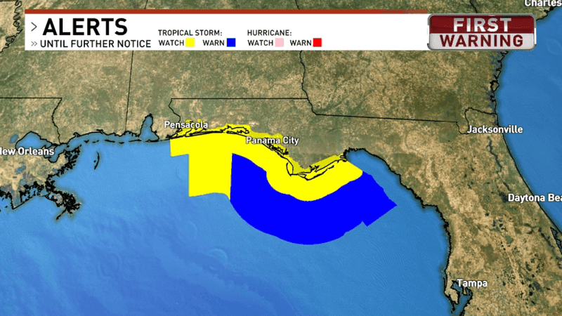
The Florida Panhandle is under a Tropical Storm Watch, indicated by the yellow color on the map.
At this point, we’re not expecting a major hurricane event locally. Instead, the biggest concerns will be rough beach conditions, periods of heavy rain, and gusty winds, especially near the coast.
The current forecast keeps the center of Tropical Depression Two moving slowly northwest through the northeastern Gulf before making its closest approach to our area around the middle of the week. There is still some uncertainty in the exact track, and even small shifts could change where the heaviest rain and strongest winds occur.
One thing we are becoming increasingly confident about is dangerous beach conditions. A high risk of life-threatening rip currents is expected to develop along the northwest Florida beaches beginning Tuesday, along with increasing surf. Swimming in the Gulf is strongly discouraged during high rip current risk days, even for experienced swimmers.
Boaters should also prepare for deteriorating conditions. Seas will become rough, winds will increase, and hazardous conditions are expected across the Gulf waters through the middle of the week.
On land, expect scattered to numerous showers and thunderstorms each day as tropical moisture spreads inland. Some of these rain bands will produce torrential downpours capable of dropping several inches of rain in a short amount of time. While not everyone will see flooding, localized flash flooding will be possible, particularly in low-lying or poor drainage areas.
The strongest winds are also expected to stay closer to the coast, where tropical rain bands could produce occasional tropical storm-force wind gusts. Farther inland across southwest Alabama and interior northwest Florida, impacts are expected to be lower, with mainly periods of heavy rain and thunderstorms.
Forecast confidence in the exact details remains lower than usual because the storm is still organizing. The Hurricane Hunters are flying into the system today to gather additional data, which should help improve forecast confidence over the next day.
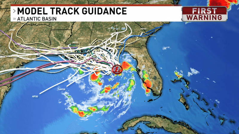
This map indicates uncertainty in where the tropical weather maker will end up. Each line is a different computer model. Not all of these model tracks are considered equally reliable, and many won’t verify. They’re useful for showing the uncertainty, but the official forecast from the National Hurricane Center weighs the models based on their past performance.
The WEAR Weather Team will continue to monitor Tropical Depression Two around the clock and provide updates as the forecast becomes clearer. Now is a good time to stay weather-aware and check back frequently, especially if you have plans along the Gulf Coast or on the water this week.