
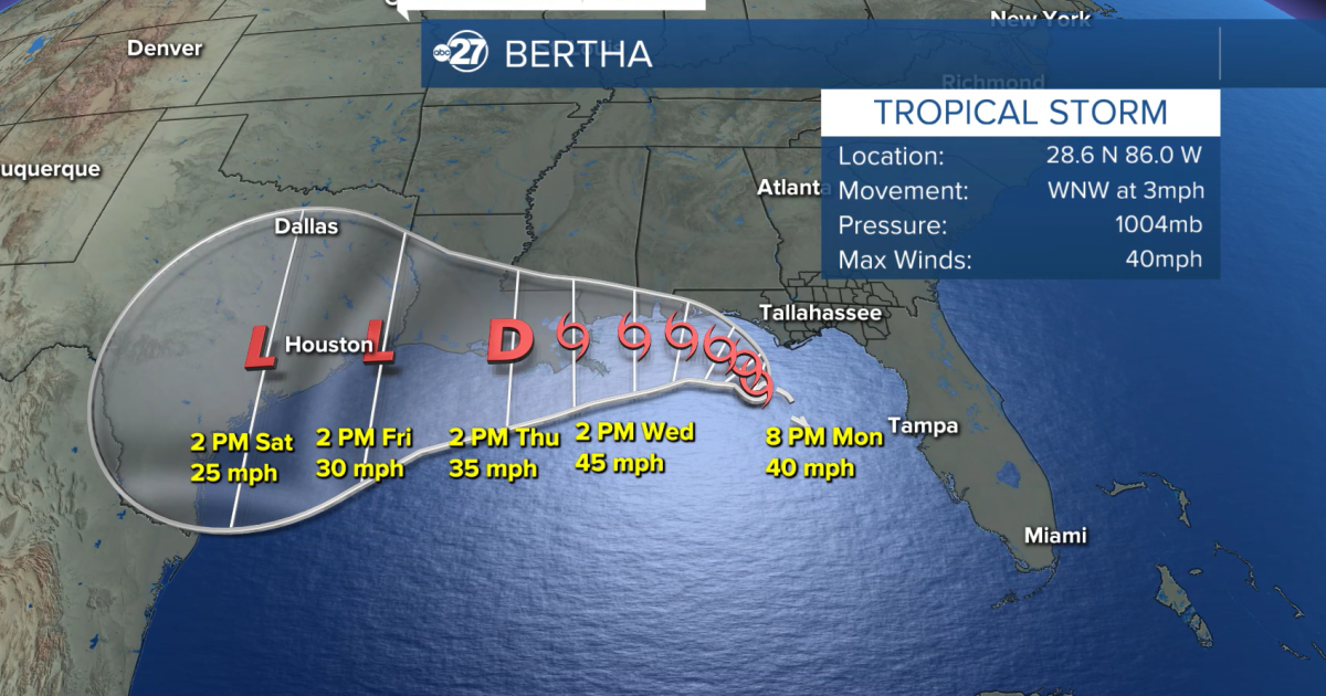
TALLAHASSEE, Fla. (WTXL) — Tropical Storm Bertha developed from the raggedly formed mass of clouds and rain swirling in the northeastern Gulf of America / Gulf of Mexico Monday evening as its core stays southwest of the Big Bend region.
The tropical storm has peak winds of 40 mph and is moving west-northwest at 3 mph.
A tropical storm watch remains in place for areas from the mouth of the Ochlockonee River westward. This includes the Forgotten Coast region of the western Big Bend. This means occasional wind gusts of 40 mph are possible within the watch zone in the next 48 hours.
Tropical Storm warnings are in effect for waters of Apalachee Bay beyond 20 nautical miles from the coast.
As the system is set to remain over the waters of the Gulf in the days ahead, the expectation is for the storm to move west to northwest, essentially parallelling the Big Bend and Panhandle coastlines. This would keep the center of the system offshore.
Bands of rain, showers, and thunderstorms can be experienced along the coastal areas and just inland from there through Tuesday. Rainfall can be heavy at times, with a low risk for flash flooding and excessive rainfall particularly along the coast, where isolated rain totals have already exceeded two inches.
Isolated thunderstorms have the chance to become briefly severe, mainly along the immediate coast and offshore.
Water levels along the central and western Big Bend coast may be as high as three feet above normal levels Tuesday, an increase caused by the onshore wind flow.
While local winds can gust upwards of 25 mph, broader adverse effects from sustained wind are not anticipated locally.
Want to see more local news? Visit the WTXL ABC 27 Website.
Stay in touch with us anywhere, anytime.