
Tropical Storm Bertha forms in the Gulf; Tropical Storm warnings issued
Tropical Storm Bertha forms in the Gulf, making it the second named storm of the 2026 hurricane season.
 FORT MYERS, Fla. —
Tropical Storm Bertha formed in the northeastern Gulf Monday night, making it the second named system of the 2026 Atlantic Hurricane Season.
The storm will bring heavy rain and tropical storm-force winds to the Florida panhandle, Alabama and Mississippi. The storm poses no direct threat to Southwest Florida.
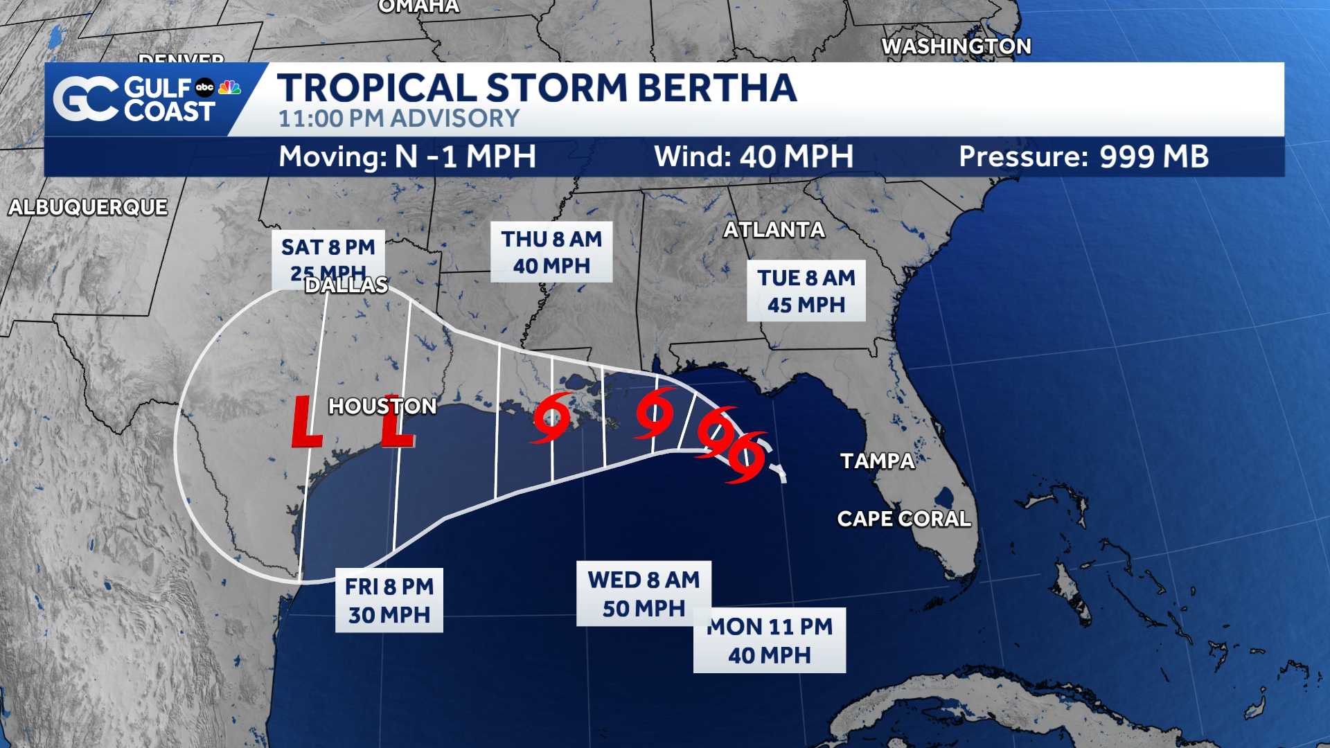
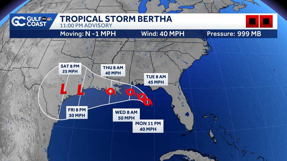
As of 11 p.m. Monday, Bertha is producing sustained winds of 40 mph. The storm is 100 miles south of Panama City and nearly stationary.
Despite warm sea surface temperatures, strengthening is expected to be gradual as the storm battles northerly wind shear and mid-level dry air. There is good consensus across the latest spaghetti models that Bertha will increase in forward speed and track west in the coming days. At this time, Bertha is not expected to become a hurricane.
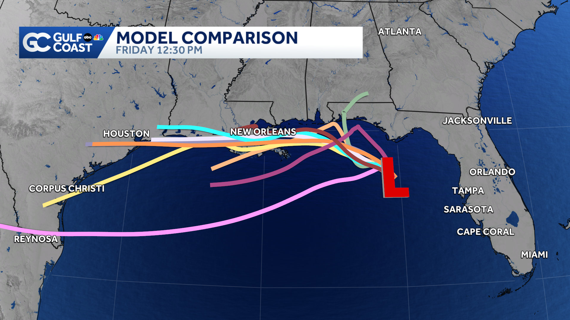
Bertha is expected to dissipate by the weekend due to land interaction.
Watches and Warnings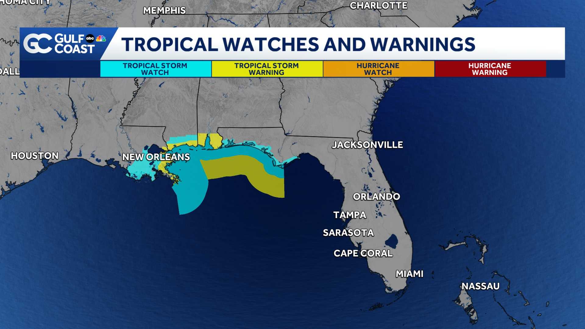
A Tropical Storm Watch is in effect for parts of the panhandle of Florida from the Ochlockee River to the Alabama coast.
The biggest threats from this storm will be tropical storm-force winds, heavy rain and the potential for flooding. The storm is expected to bring 2-4 inches of rain, with isolated pockets up to 6 inches along the Florida panhandle to the Texas coast.
Storm surge could be between 1 and 3 feet for portions of the panhandle and Alabama.
Impact on Southwest Florida
While the storm poses no direct threat to Southwest Florida, indirect impacts will linger through Tuesday. As Bertha pulls away, off and on again downpours will filter through the Gulf Coast Monday. As the system turns west on Tuesday, our rain chances will begin to decrease. Rainfall totals across Southwest Florida are expected to be under one inch over the next five days.
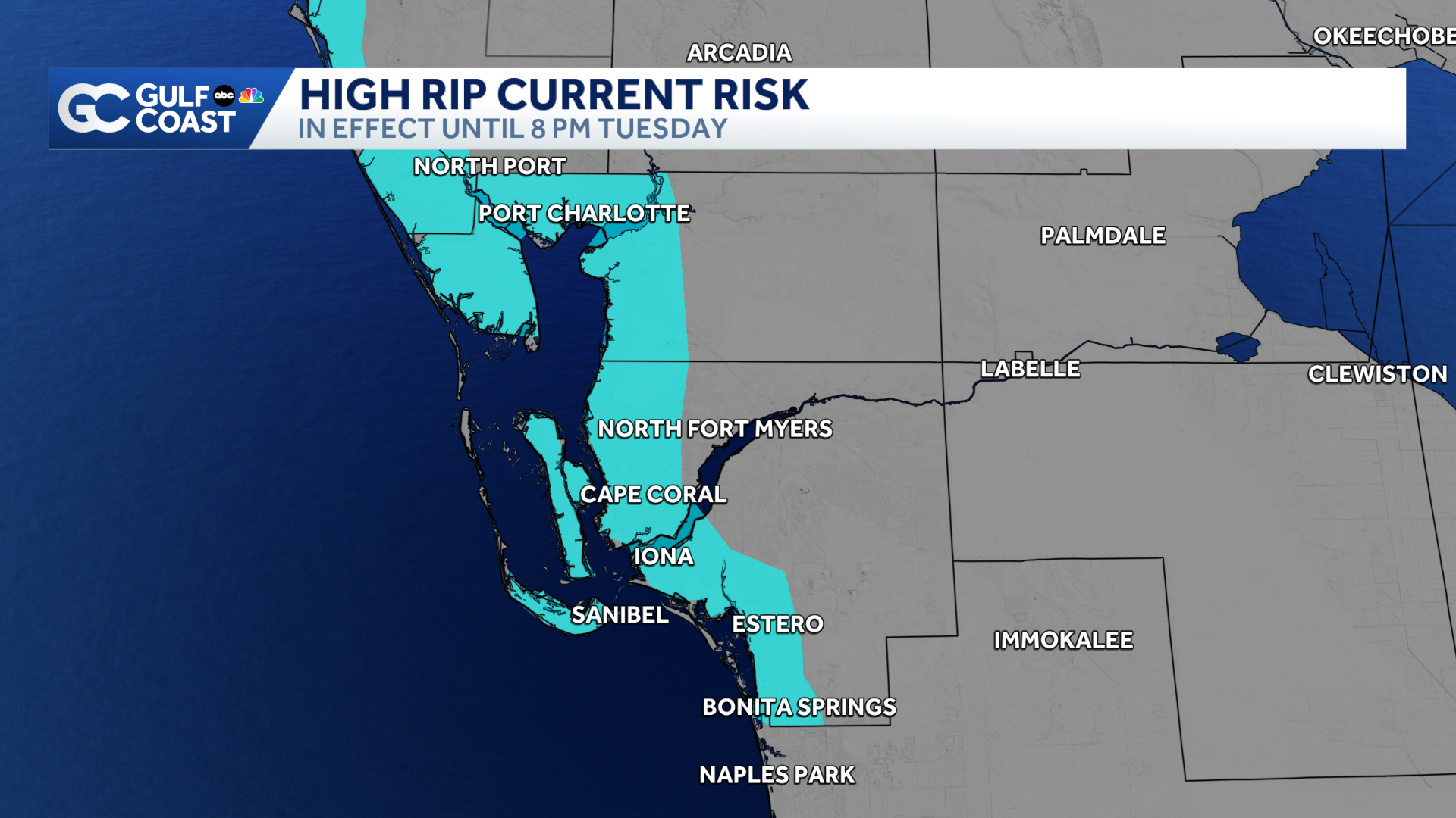
Lee and Charlotte counties will also see an increased threat for rip currents through Tuesday evening. Remember, rip currents can sweep even the best swimmers away from shore.
 Tropical Milestones
We usually see our second named storm form in the Atlantic by July 17. Typically, the first hurricane of the season doesn’t form until Aug. 11.
We are forecasted to see a below-average hurricane season this year. This is primarily due to El Niño, which tends to suppress tropical activity in the Atlantic. The peak of hurricane season is Sept. 10.
However you watch or scroll, we’re committed to delivering your Gulf Coast Weather Most Accurate Forecast, one you can rely on every day, wherever you are.
Live Interactive Radar: Track conditions in real time with the Gulf Coast Live Radar.
Watch Gulf Coast Weather: Find the latest weather forecast videos, streaming live or on demand, on TV and online.
Stream on the Go: Download the free Gulf Coast News app to watch on your phone or tablet.
Your Gulf Coast Weather Team
Follow on Social: Follow, like, and subscribe to Gulf Coast News on social media to share your tips and be part of the conversation with Southwest Florida’s most experienced, trusted weather team: Facebook | Instagram | YouTube | TikTok | Threads | Bluesky | Nextdoor | X
DOWNLOAD the free Gulf Coast News app for your latest breaking news and weather alerts. And check out the Very Local Gulf Coast app to stream news, entertainment, and original programming on your TV.