
Bertha and a drier Florida forecast
Bertha moves west, Less South Florida rain
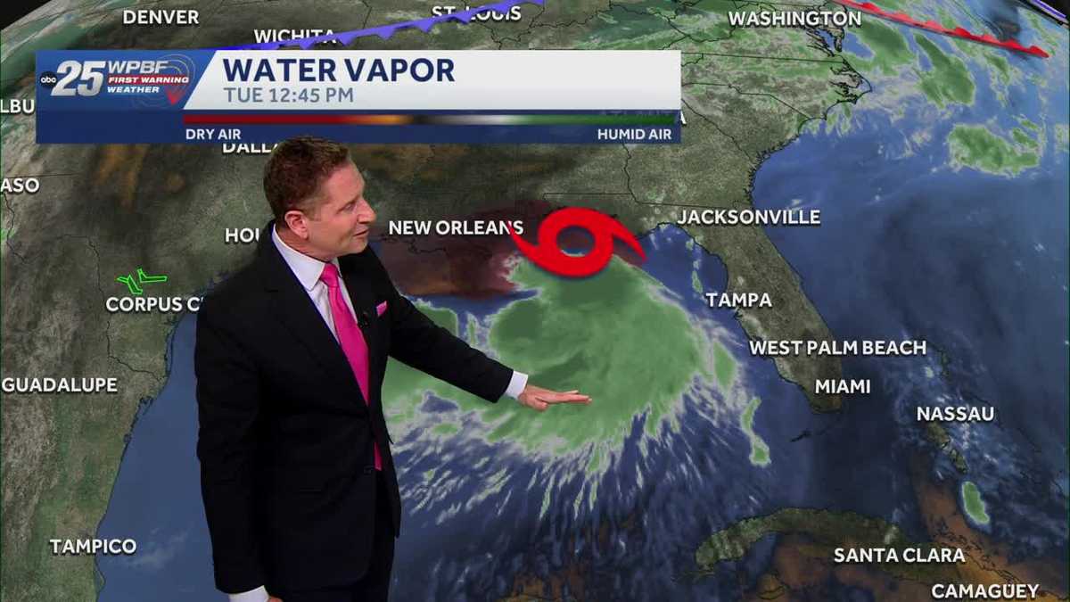
All right, let’s take *** look at what’s happening this afternoon. Good afternoon, everyone. We’re looking at Bertha first as it continues to make its way over towards the coast of Mississippi and Louisiana. It is *** very strong tropical storm. Not *** super organized tropical storm, but *** strong tropical storm nonetheless, with *** lot of the rainfall and moisture being pushed down to the south away from the center of the storm due to some wind shear, some winds acting opposite of it, trying to get itself together more. So those winds coming in out of the northeast are pushing all that moisture down to the south. Here’s *** quick look at the future tropical winds and in the yellow tropical storm force winds, and you’ll see Bertha stays pretty strong throughout the day today and even into. Early tomorrow morning, still tropical storm force winds, but Bertha begins to run into some trouble as it gets along the coast in Mississippi and Louisiana with that wind shear really taking over. You see those tropical storm force winds disappearing and the remnants of Bertha moving over toward Texas potentially as we get to Thursday and Friday. Let’s compare *** couple of computer models, the two that most people are familiar with the American model and the European model. The American model in blue and European model in green, both in good agreement here that this is where Bertha is located now, and they stay pretty close together in forecasting Bertha up until we get to about Wednesday night and then we start to see some separation in the two with the American model shifting *** little more down to the south and the European model staying over land in Louisiana. But by the time we get to Thursday afternoon and evening, both models don’t have the storm anymore here, basically falling apart as it. Continues to work its way over to the west, becoming *** remnant area of low pressure. With that said, the National Hurricane Center 11 a.m. update still has *** cone that goes all the way out into Friday and into Saturday, but you’ll notice that that tropical storm icon disappears after Thursday morning with just an area remnant low or maybe *** tropical depression continuing to work its way over to the west. So it’s possible that Bertha could fall apart over the next 24 to 36 hours. However, still tropical storm warnings in effect from the Florida Panhandle all the way to the Louisiana coast. Here’s *** look at what’s happening here at home. We’ve got *** lot of blue skies around as drier air continues to move in. Rain chances remain very low today, about 20% or less, especially along the coast where we’re seeing *** lot of that drier air move in, and there is some moisture still around enough. That we could see some inland showers and storms this afternoon. There’s *** couple of showers offshore there. There’s *** couple of showers there, and what we’re seeing in the future track is maybe *** coastal shower, *** coastal thunderstorm or near the coast, but most of the activity happening inland this afternoon. That goes for tomorrow and Thursday as well. We’re looking at low chances for rain with that drier air in you. Notice lower humidity. It still feels pretty hot outside. Temperatures low to mid 90s as we get into tomorrow and Thursday and even Friday. But on Friday and into the weekend, that moisture begins to return, and we end up with more average rain chances for this time of year, around 40 to 50% as we get into the weekend and the beginning of next week. That’s *** look at your weather. We’ll be right back.
WPBF 25 First Warning Meteorologist
This afternoon here in South Florida, high temperatures will reach the low to mid 90s with the Heat Index in the low 100s under mostly to partly sunny skies. Winds will stay a little breezy out of the south/southeast. Rain chances are much lower today as drier air moves in.. But there is still a chance for isolated showers and thunderstorms mostly for our inland communities.Tonight, mostly clear skies and low temperatures in the 70s along the Treasure Coast and in Okeechobee County, and upper 70s and low 80s in Palm Beach County. Winds will be light out of the southeast.
This afternoon here in South Florida, high temperatures will reach the low to mid 90s with the Heat Index in the low 100s under mostly to partly sunny skies. Winds will stay a little breezy out of the south/southeast. Rain chances are much lower today as drier air moves in.. But there is still a chance for isolated showers and thunderstorms mostly for our inland communities.
Tonight, mostly clear skies and low temperatures in the 70s along the Treasure Coast and in Okeechobee County, and upper 70s and low 80s in Palm Beach County. Winds will be light out of the southeast.