

SARASOTA, Fla. (WWSB) – Florida’s version of fall isn’t about sweaters and chilly mornings. It’s about subtle shifts. A little less humidity. A bit more breeze.
Those moments when the air doesn’t feel like it’s trying to hug you too tightly. That’s exactly what we’re feeling across Sarasota and Manatee County this week.
High pressure in charge
A strong area of high pressure sitting over the Southeast is the main player this week. It’s bringing sunny skies, mild mornings, and dry air. That same setup is tightening the pressure gradient, which means increasing northeast winds over the next few days, especially along the coast and out over the Gulf.
Breezy stretch for late week
Thursday through Saturday will be breezy, with gusts near 20 knots offshore at times. It won’t ruin beach plans, but it will make for choppier waters.
Marine forecast
Northeast to east winds will increase to 15 to 20 knots Thursday through Saturday, with seas building to 2 to 4 feet nearshore and up to 5 feet offshore. Conditions will gradually ease early next week.
Boaters should be cautious this week, especially during the late week and weekend period.
Weak front late weekend
A weak front slides across the area Sunday into Monday. It won’t bring a cool down, but it could spark a few isolated showers, mainly inland.
Temperatures will stay warm with highs in the upper 80s, but you’ll notice a bump in humidity starting late Sunday and lingering through much of next week.
That means those crisp, comfy mornings will give way to warmer, stickier nights and a more typical Florida feel by midweek.
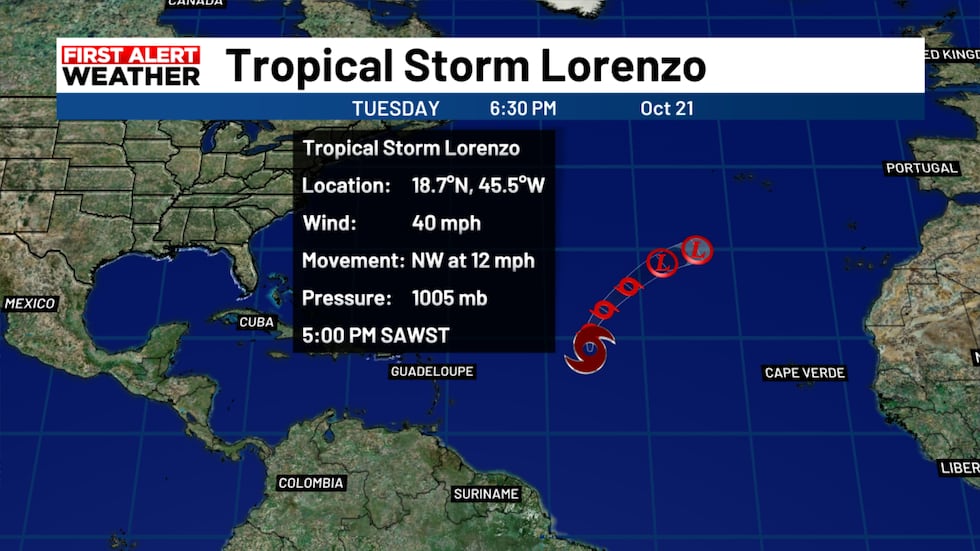 Tropical Storm Lorenzo to weaken as it moves away from land into the Atlantic.(WWSB)
Tropics update
Tropical Storm Lorenzo continues to spin over the central Atlantic with maximum sustained winds near 45 mph. Lorenzo will track northeast and weaken in the coming days.
It poses no threat to Florida or the U.S. The rest of the basin is quiet, but late October can still bring a surprise or two, so we’ll keep watching.
Skywatching tonight
It’s another beautiful night to look up. The Moon will once again cozy up to Jupiter in the eastern sky after sunset. Skies are mostly clear, so visibility should be great.
And for night owls, the Orionid meteor shower is ramping up this week, offering a few shooting stars for those willing to stay up late.
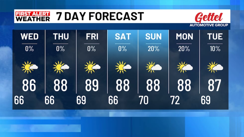 The 7 day forecast shows dry weather until Sunday with low humidity and great nights and mornings.(WWSB)
Copyright 2025 WWSB. All rights reserved.