
The Brief
Scattered showers and thunderstorms return to Central Florida this weekend after several dry days.
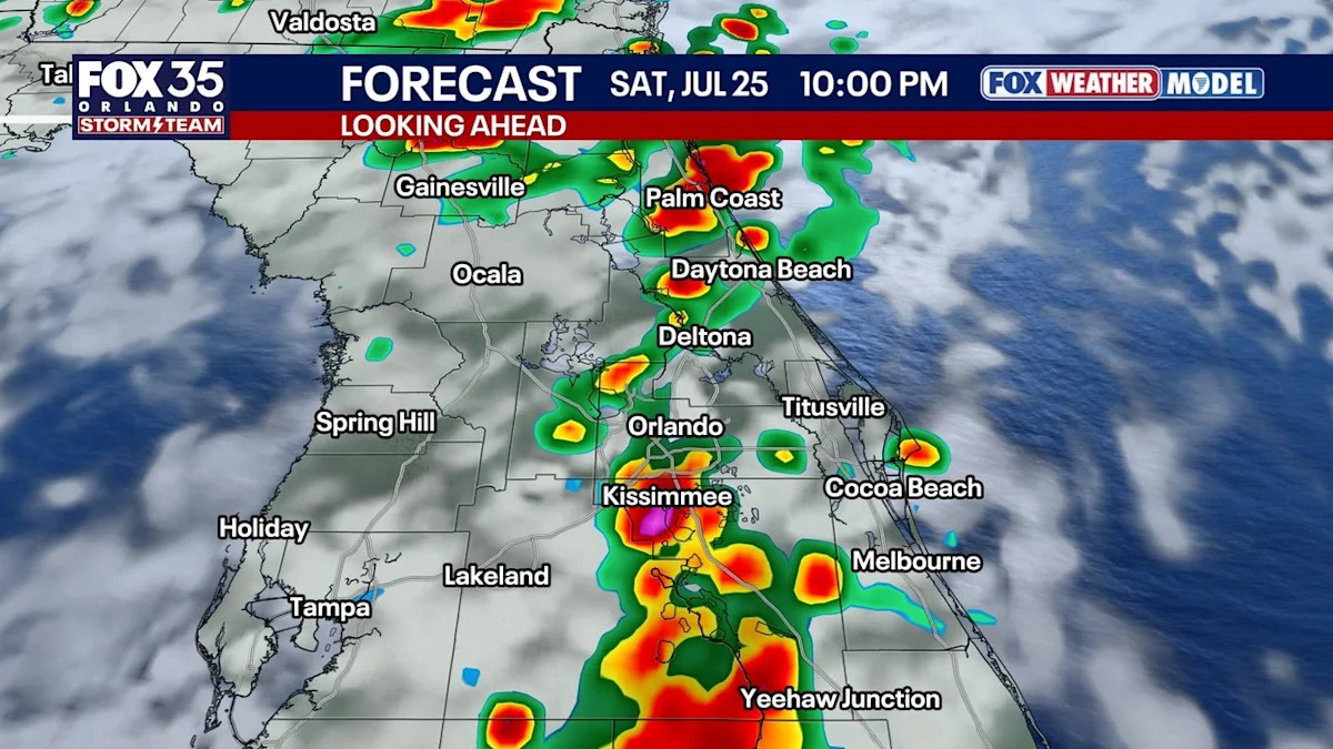
Storms arrive later Saturday but are expected earlier and more widespread on Sunday.
The Atlantic remains quiet, with no tropical development expected through the end of July.
ORLANDO, Fla. – A stretch of dry weather across Central Florida is expected to end this weekend.
Scattered showers and thunderstorms return, bringing higher humidity and a more typical midsummer weather pattern.
Wet weekend ahead
Timeline
The greatest difference between the two days will be the timing and coverage of storms.
On Saturday, scattered showers and thunderstorms are expected mainly between 5 p.m. and 11 p.m.

Saturday is expected to offer better beach conditions than Sunday, particularly along the coast from Daytona Beach to Cocoa Beach.

On Sunday, storms are forecast to develop earlier, with widespread activity possible from noon through 6 p.m.

Forecasters expect the pattern of afternoon and evening showers and thunderstorms to continue into next week.
 Daily storms return next week
Numerous daily afternoon storms return next week, as we return to our more typical rainy season setup.

Moisture will be enhanced with seven-day totals over 6 inches possible, as a weak cold front stalls north of Florida.
Tracking the tropics
In the Atlantic, tropical activity remains quiet following Tropical Storm Bertha. No tropical development is currently forecast through the end of July, according to forecast models.

So far this Atlantic hurricane season, Tropical Storms Arthur and Bertha have made landfall in the United States. The average date for the Atlantic basin’s third named storm is Aug. 3.
The Source
The information in this story was provided by the FOX 35 Storm Team.