
TALLAHASSEE, Fla. (WCTV) – We are flirting with record high territory for early next week as the July heat lingers.
Tonight Through Sunday Night
Spotty downpours are possible for Saturday evening. It will not rain for everyone, and most of the action weakens after sunset. An isolated shower cannot be ruled out for the overnight as lows settle in the mid-70s under a partly cloudy sky.
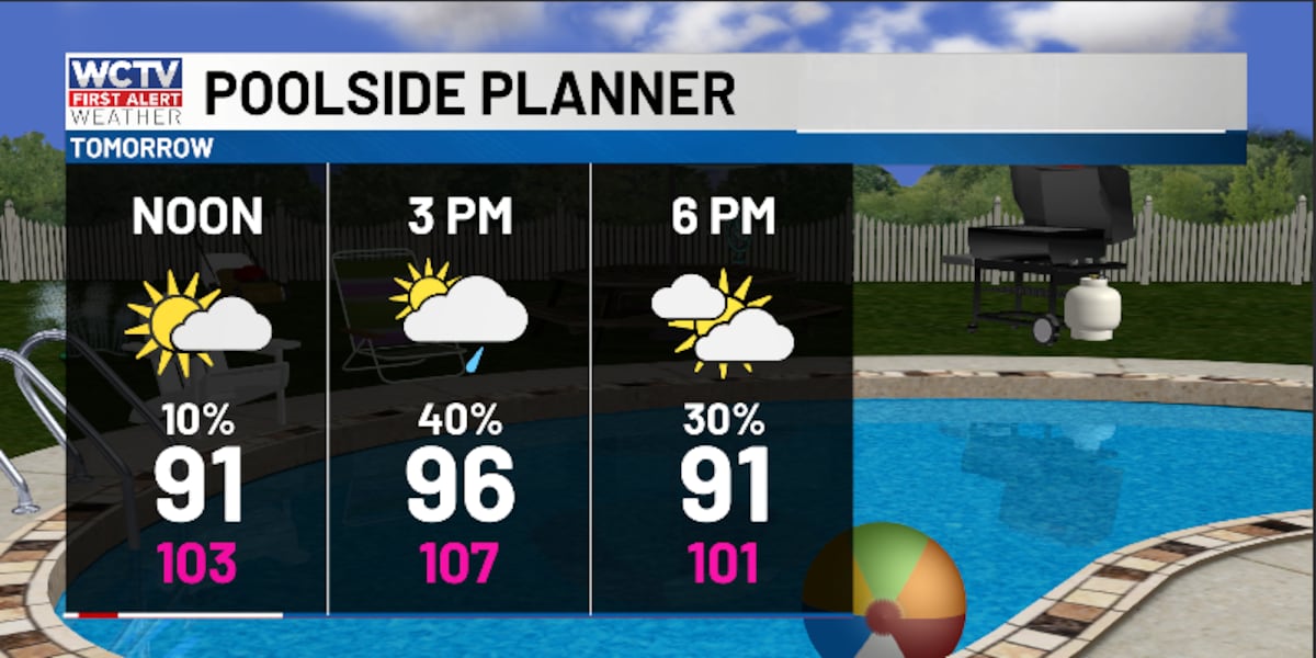
Another toasty day is ahead to end the weekend. Temperatures on Sunday climb into the mid-and-upper-90s under a mix of Sun and clouds. Again, during the afternoon and evening, we are expecting another round of pop-up showers and storms, but it will not rain for every town. The better rain chance may stay further to the south.
Isolated showers stick around for Sunday night under a partly cloudy sky. Temperatures fall into the mid-70s.
Flirting With The Century Mark
Sizzling temperatures stick around for early next week.
An isolated shower is possible for Monday and Tuesday, but most of us are looking drier and hot.
Temperatures soar into the upper-90s under a partly cloudy sky. A few locations may make a run at 100º. We will see heat index values in the low-100s, so be sure to stay cool and hydrated.
Overnight lows fall into the mid-70s.
Extended Forecast
Looking ahead, the weather pattern is looking a little more soggy.
Rain chances are looking to climb for the second half of next week.
Because of a better rain chance, heat levels are slightly dropping. Highs stay in the mid-90s, with lows in the mid-70s.
To stay updated on all the latest forecasts and weather, follow WCTV First Alert Weather on Facebook and X (Twitter).
Click here to see all the latest weather headlines and here to view the First Alert Radar. Receive push alerts and watch the latest forecast anytime on the free WCTV First Alert Weather app. Click here to download it now.
Interested in becoming a WCTV First Alert Weather Watcher? Click here to join the team!
Copyright 2026 WCTV. All rights reserved.