
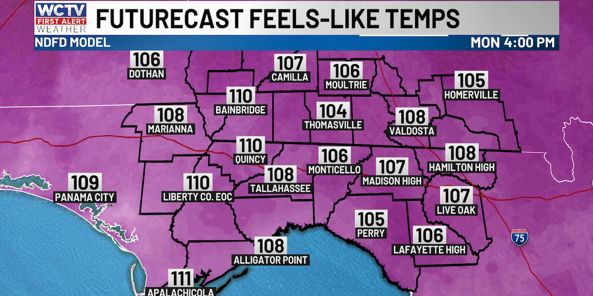
TALLAHASSEE, Fla. (WCTV) – A very warm and humid start to your day with temperatures in the upper 70s and low 80s. Thermometers quickly climb into the 90s by late morning, so it gets HOT quick today.
If you have yardwork to get done or need to take the dog out for a walk, the earlier you can get activities done, the better. Very hot this afternoon with a high around 98, which falls just shy of the record high from 1983 of 99.
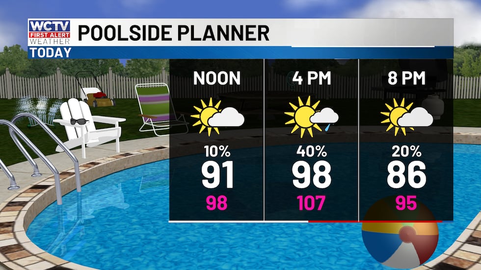 Hot with a few afternoon showers or storms.(WCTV)
Scattered showers and storms between 2 and 8 p.m. will help to cool down some folks across the Big Bend and South Georgia.
Beach and Boating
Waters will be a little choppier this afternoon due to a decent westerly wind between 10 and 15 knots. Waves up to 3 feet.
Rip current risk is moderate, so dangerous swimming conditions are not expected today. However, still be careful in the water as you try to cool off this weekend!
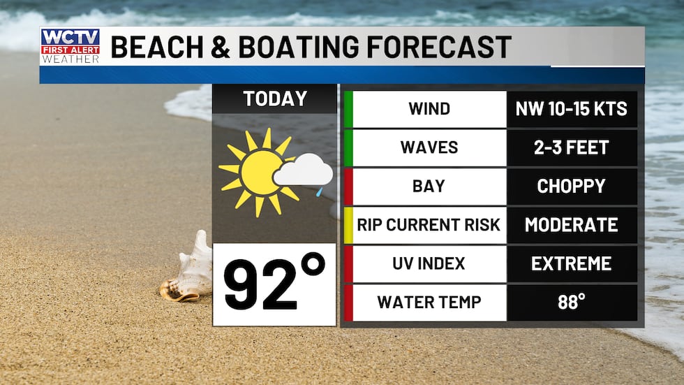 Waters a little choppy this afternoon. Waves up to 3 feet.(WCTV)Reaching the century mark?
High pressure and dry air move in on Monday. This means lower rain chances and even HOTTER high temperatures.
I expect highs to get CLOSE to the century mark on Monday, Tuesday and Wednesday, which is flirting with record highs each afternoon. Very warm mornings in the upper 70s. Monday may end up the warmest day of the summer so far, with a high of 100.
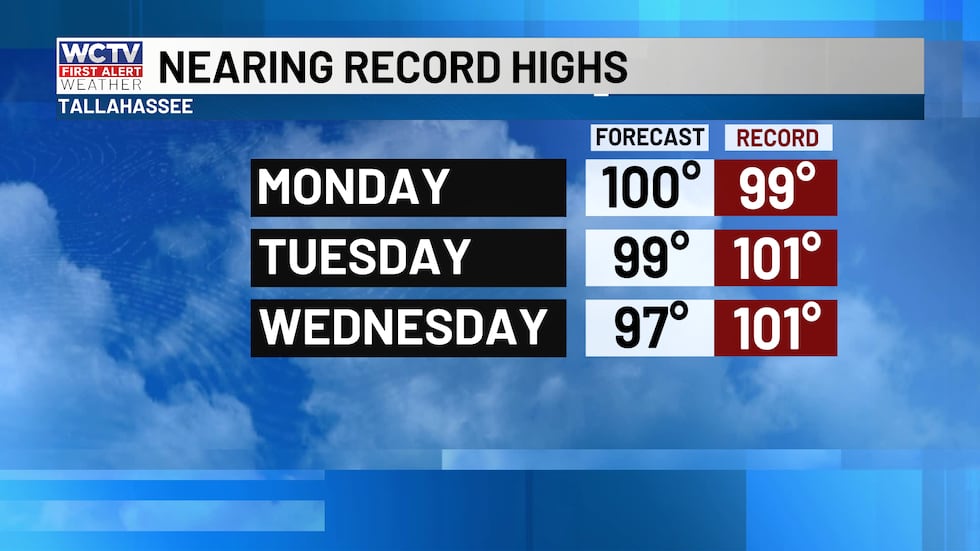 Record highs for early this week.(WCTV)
To stay updated on all the latest forecasts and weather, follow WCTV First Alert Weather on Facebook and X (Twitter).
Click here to see all the latest weather headlines and here to view the First Alert Radar. Receive push alerts and watch the latest forecast anytime on the free WCTV First Alert Weather app. Click here to download it now.
Interested in becoming a WCTV First Alert Weather Watcher? Click here to join the team!
Copyright 2026 WCTV. All rights reserved.