
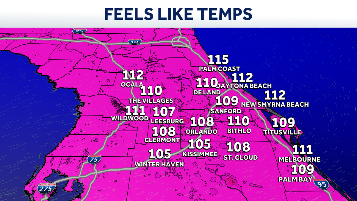
Impact Weather: Triple-digit heat index grips Central Florida

 ORLANDO, Fla. —
Central Florida will face one more day of excessive heat before storm coverage increases throughout the week.
Heat and humidity will lead to feels-like temperatures between 108 and 111 degrees in part of Central Florida on Wednesday.
That’s why WESH 2’s First Warning Weather team has issued an Impact Weather alert from 11 a.m. to 8 p.m.
This content is imported from x. You may be able to find the same content in another format, or you may be able to find more information, at their web site.
Heat Advisory runs through 8PM for Volusia, Lake, Orange, Seminole, and Brevard Counties. Heat index values up to 110 today, with the worst of it from 11AM through this evening. Heads up if you have anything going on outside today. pic.twitter.com/c8Ta8jIJ2r
— Eric Burris (@EricBurrisWX) July 29, 2026
Overall storm coverage today remains fairly low, and that helps build the heat up to around 95 degrees.
Starting Thursday and continuing through the weekend, storm coverage will build as a weak, fading front dips south, bringing rain coverage up to 70% or so.
>> What is Impact Weather?
Impact Weather suggests weather conditions could be disruptive or a nuisance for travel and day-to-day activities.
First Warning Weather
Stay with WESH 2 online and on-air for the most accurate Central Florida weather forecast.
Download the WESH 2 News app to get the most up-to-date weather alerts.
The First Warning Weather team includes First Warning Chief Meteorologist Tony Mainolfi, Eric Burris, Luke Vickery, Cam Tran and Victoria Wisniewski.