
TALLAHASSEE, Fla. (WCTV) – The first thing you will notice as you step outside this morning is that the air is not as sticky! Temperatures are starting seasonable in the low to mid-70s, but that humidity has relaxed to start our Friday.
Still HOT to end the week
With some drier air in place, a much less active morning is expected across the region. We will start off with mostly sunny skies.
It is going to be another HOT afternoon, but the “feels-like” temperature will not be as rough with lower humidity for most of the day. Thermometers top out in the low to mid-90s by early afternoon with a heat index around 100 to 105.
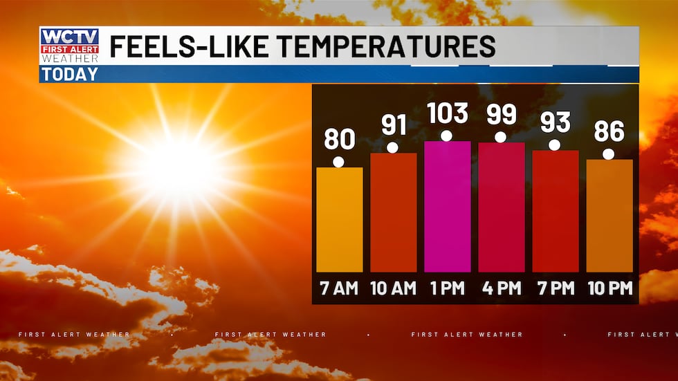 Not as hot as recent days, but still plenty warm this afternoon.(WCTV)
Scattered showers and storms are expected to develop again this afternoon both along a weak front in South Georgia and along the sea breeze. These two clusters will meet near I-10 again, with the highest chance of rain being in the eastern Big Bend and South Georgia this afternoon. Storms once again could contain some gusty winds and heavy rain between 1 p.m. and 10 p.m.
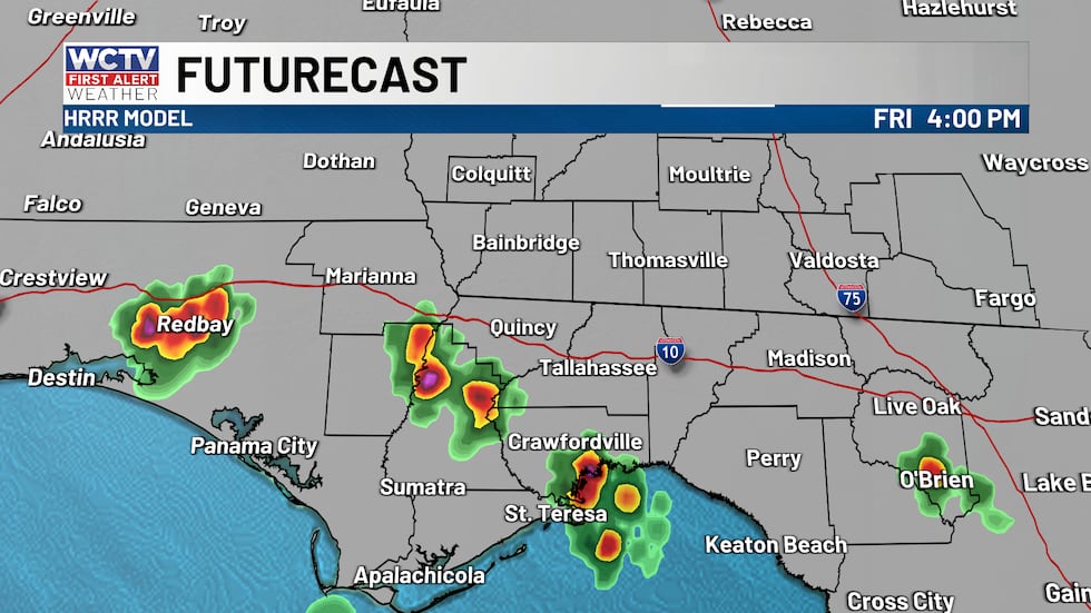 Scattered showers and storms this afternoon.(WCTV)Cooler and wetter for the weekend
Rain and clouds are going to be the name of the game this weekend. An unsettled weather pattern takes shape on Saturday and will stick around through early next week. While it will not be a constat rain, showers and storms will be around at almost any time during the day.
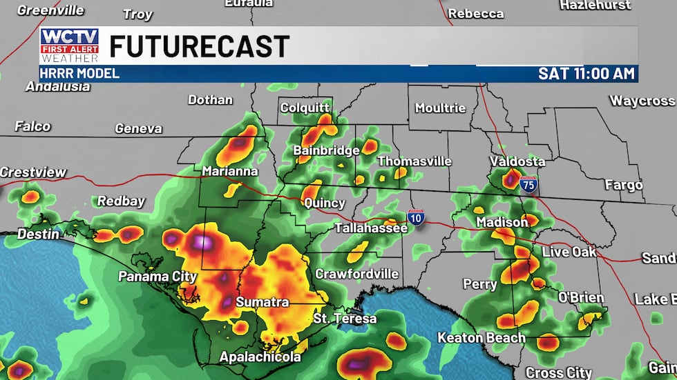 More rain this weekend. Showers will already be ongoing during your Saturday morning plans.(WCTV)
Saturday’s wave of showers develops by mid-morning with some heavier thunderstorms. If you have morning plans, be sure to have the raincoat or wait it out for the afternoon, as showers look a little spottier between lunch and dinner. Additional widespread rain expected after 5 p.m. Highs stuck in the mid-80s from the early rain and clouds.
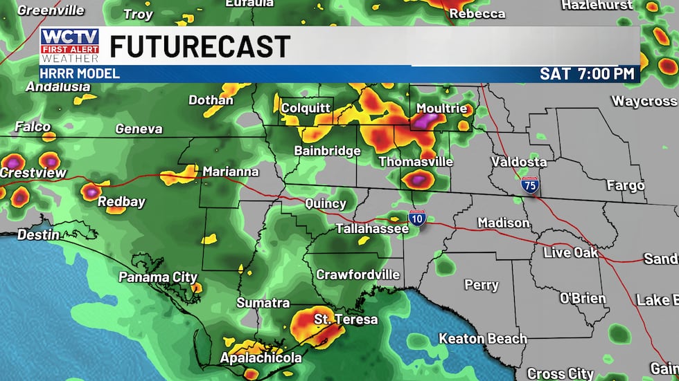 Showers continue for your Saturday evening after a midday lull of rain.(WCTV)
Saturday night I expect additional showers and storms to develop, most likely after midnight. These storms should linger into your Sunday morning. Heading to church is looking a little messy with widespread rain and a few storms. Like Saturday, much of the action will wrap up for the second half of the day, turning from widespread rain to hit or miss storms in the afternoon. Mostly cloudy skies will keep temperatures in the 80s once again.
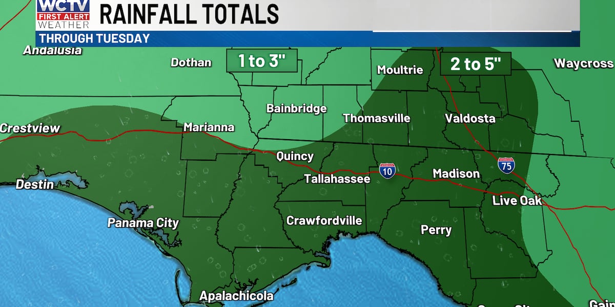
Severe weather is NOT expected, but there could be a few stronger storms with brief gusty winds. The biggest risk would be localized flooding as rainfall totals will range between 2 and 5 inches from today through Tuesday. There will be a few spots that see higher amounts.
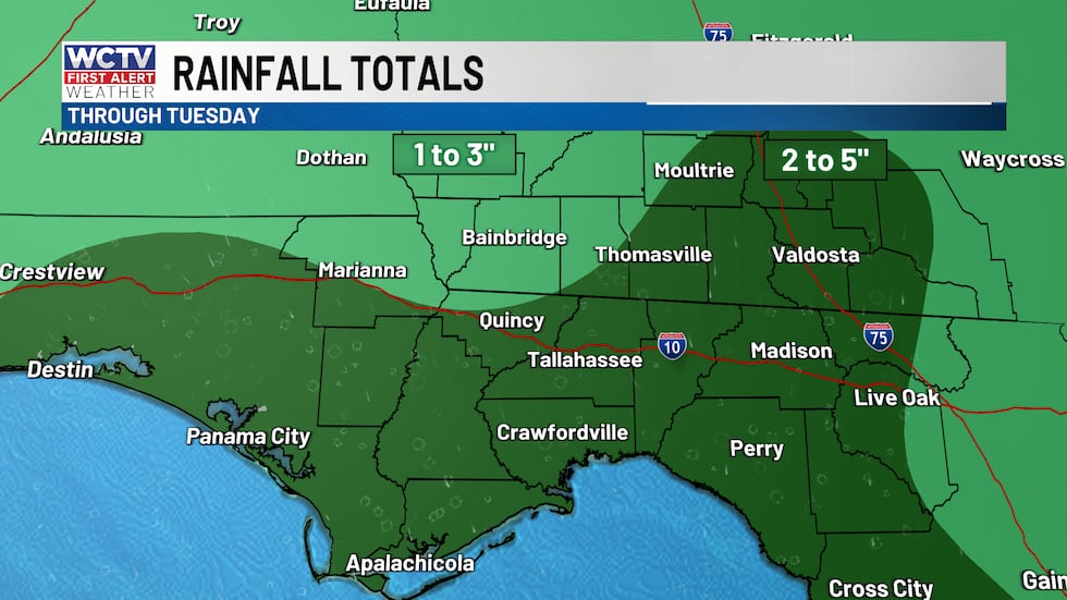 Rain totals between today and Tuesday will be between 2 and 5 inches for most of the area.(WCTV)Some changes next week
Monday looks similar to Saturday and Sunday with periodic rain and storms. Highs in the 80s.
Tuesday through the end of the week, showers and storms become less numerous. Which means warmer temperatures are back by the end of the week.
Tropical update
As we climb closer to the peak of hurricane season, there is nothing to be concerned about at this point. No development is expected in the next 7 days.
To stay updated on all the latest forecasts and weather, follow WCTV First Alert Weather on Facebook and X (Twitter).
Click here to see all the latest weather headlines and here to view the First Alert Radar. Receive push alerts and watch the latest forecast anytime on the free WCTV First Alert Weather app. Click here to download it now.
Interested in becoming a WCTV First Alert Weather Watcher? Click here to join the team!
Copyright 2026 WCTV. All rights reserved.