
TALLAHASSEE, Fla. (WCTV) – Well, that didn’t last! The really nasty humidity is back this morning and will be with us throughout the weekend.
Both Saturday and Sunday are going to be a day where you will not be able to be outside much. The clouds and showers will make for very warm and muggy mornings and cooler (but humid) afternoons.
FLOOD WATCH: Coastal counties are expected to see the highest rain totals through early next week. Rain totals between 3 and 6 inches, with 8 inches or more possible in some spots. While we need the rain in the eastern Big Bend, too much at once is not a good thing.
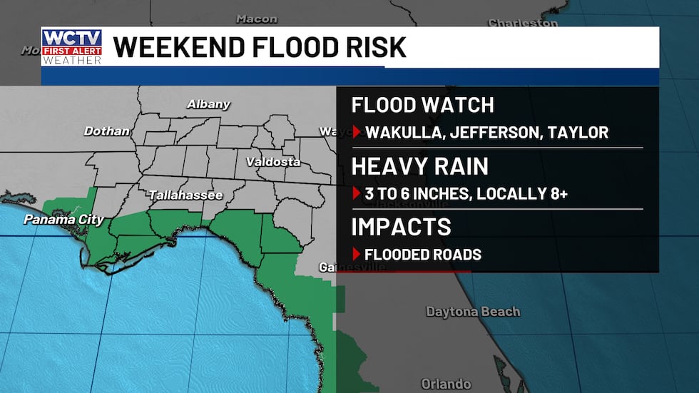 Heavy rain is expected this weekend, could lead to some localized flooding.(WCTV)
The heavy rain could lead to flash flooding this weekend. If it has been raining for hours, it will be best to stay inside and avoid driving. If you are in a vehicle, avoid driving over flooded roads because you never know how deep it is.
Dreary start to the weekend
As you head out the door, you should plan on rain and some thunderstorms throughout the day. While it is not going to rain ALL day, it will feel like it in a lot of spots.
Showers will gradually develop this morning, with some very heavy downpours with frequent thunder and lightning. Showers start to become more widespread by mid-morning in the Big Bend, expanding to South Georgia by lunch.
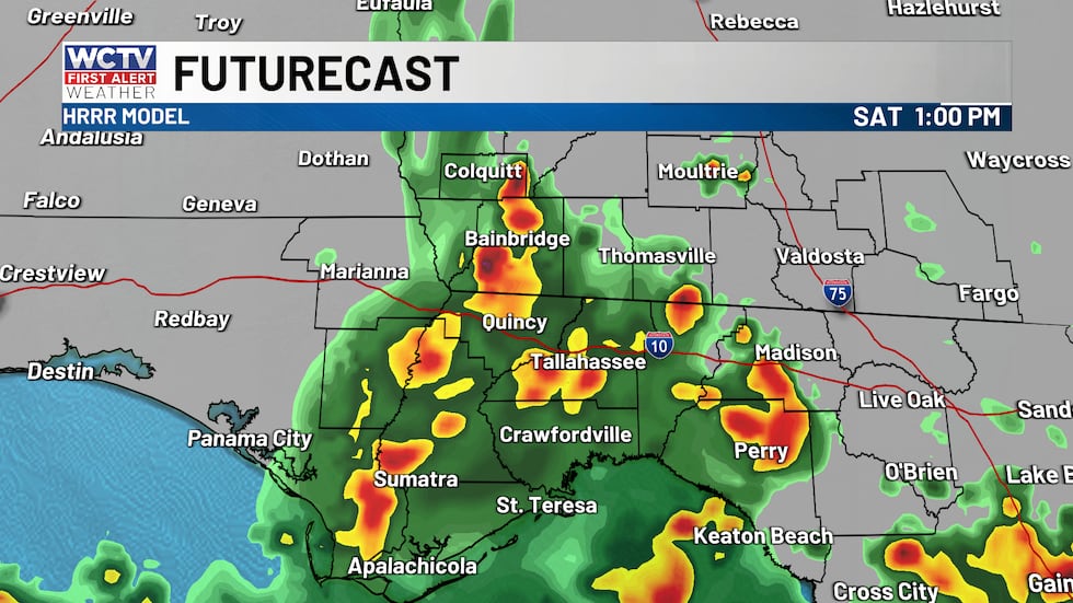 Rain periodically throughout the day.(WCTV)
A light to moderate steady rain with occasional thunder midday through dinner time. This looks like a steady rain with minimal breaks. I would suggest moving any outdoor plans inside today.
Most get a break after dinnertime. However, additional showers and storms are expected to develop overnight in the eastern Big Bend, near I-75.
More showers on Sunday
Sunday is looking wet as well. Several rounds of showers and storms are expected. While I do not expect a constant rain on Sunday, there are going to be several hours of rain.
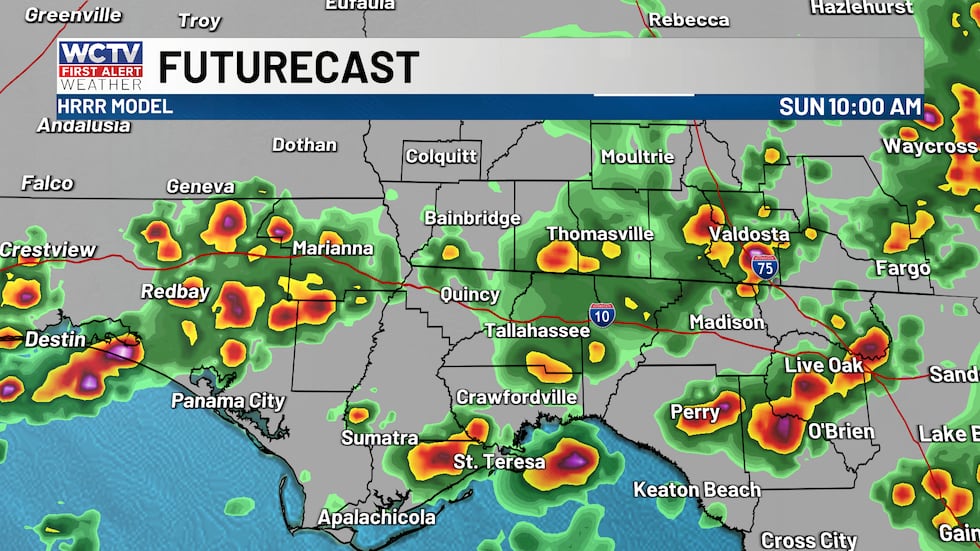 Rain continues periodically throughout Sunday.(WCTV)
If you live in South Georgia, showers and storms will be on and off throughout the day. You may be able to get to church just fine without a drop of rain, while others will be facing a downpour. Be sure to check radar frequently and grab the rain jacket if you are going to be out and about.
If you are in the Big Bend, especially south of I-10, rain is going to be a lot more frequent with several rounds of showers and thunderstorms. The rain is more isolated early between 5 and 8 a.m. However, storms become widespread after 9 a.m. and will continue on and off until 8 or 9 p.m.
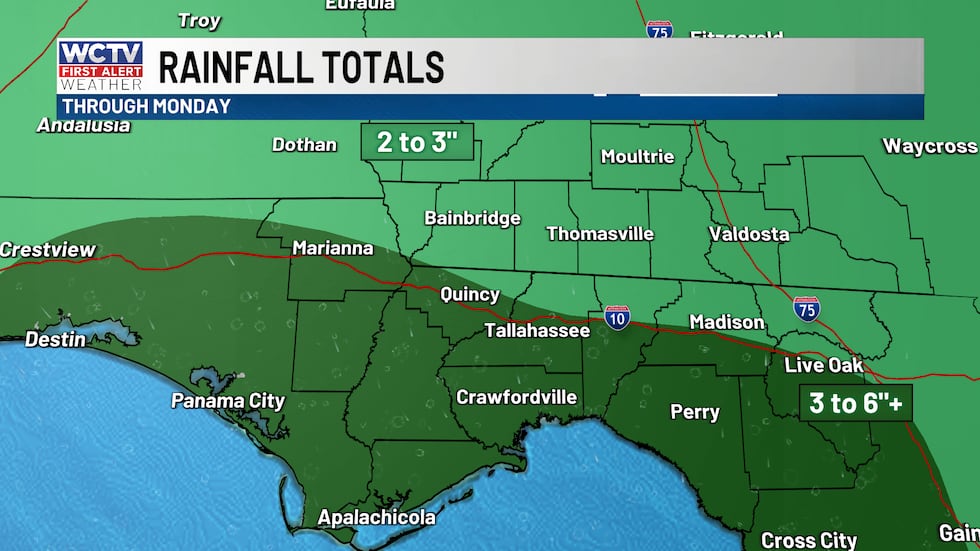 Heavy showers and storms are expected this weekend through Monday. Highest totals south of I-10.(WCTV)
Severe weather is NOT expected, but there could be a few stronger storms with brief gusty winds. The biggest risk would be localized flooding as rainfall totals will range between 2 and 5 inches from today through Tuesday. There will be a few spots that see higher amounts.
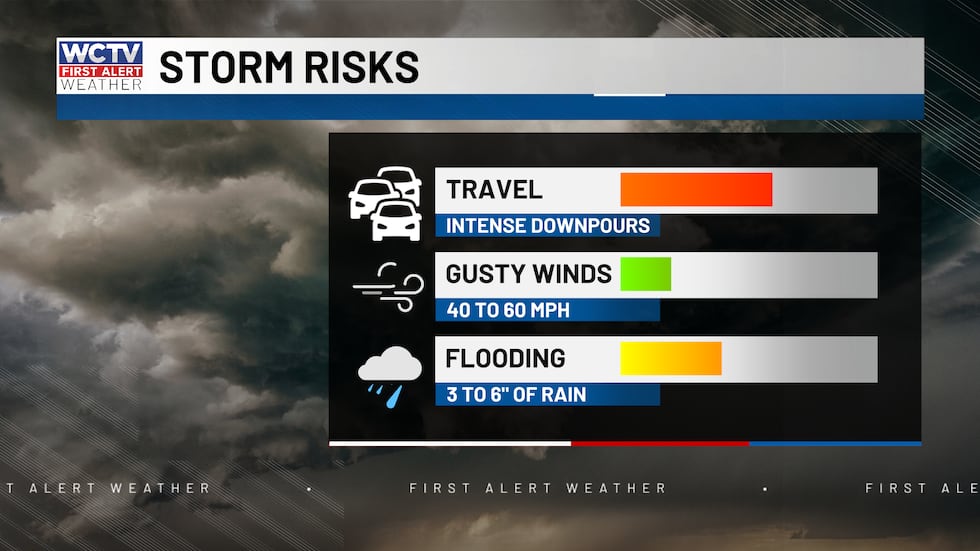 Strong storms could bring some brief gusty winds or localized flooding.(WCTV)Beach and Boating
This weekend is not looking great for beaches or small crafts. Rain and storms are likely, with the heaviest of the rain near or offshore. Winds will get breezy too, especially tomorrow.
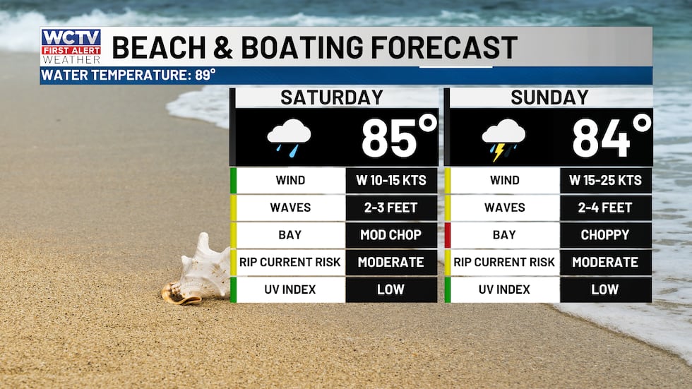 Showers are likely this weekend, so that boating conditions will not be great. Reduced visibility and high waters.(WCTV)Some changes this week
Monday looks similar to Saturday and Sunday with periodic rain and storms. Highs in the 80s.
Tuesday through the end of the week, showers and storms become less numerous. Which means warmer temperatures are back by the end of the week.
Tropical update
As we approach the peak of hurricane season, there is nothing to be concerned about at this point. No development is expected in the next 7 days.
I am watching a plume of tropical moisture that is forecast to cross over the Atlantic, steered by the Bermuda High next week. Depending on its track, some tropical moisture might make its way toward the Mid-Atlantic coast. Nothing to be concerned about, just something to watch.
To stay updated on all the latest forecasts and weather, follow WCTV First Alert Weather on Facebook and X (Twitter).
Click here to see all the latest weather headlines and here to view the First Alert Radar. Receive push alerts and watch the latest forecast anytime on the free WCTV First Alert Weather app. Click here to download it now.
Interested in becoming a WCTV First Alert Weather Watcher? Click here to join the team!
Copyright 2026 WCTV. All rights reserved.