
Heavy rain made a big comeback Monday afternoon. The skies seemed to open up with sudden downpours. Once the heavy rain began, it didn’t want to let up!
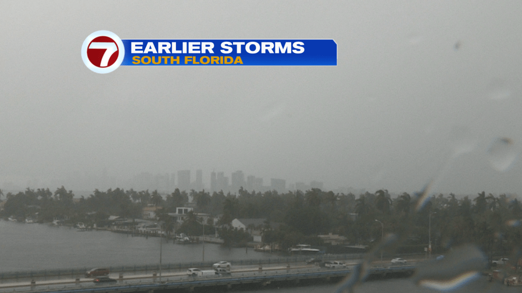
Throughout the afternoon, many areas had torrential type rain and low visibility. The view (shown above) of downtown Miami became “murky” with a deep overcast as heavy rains dropped. It wasn’t the only thing to drop…
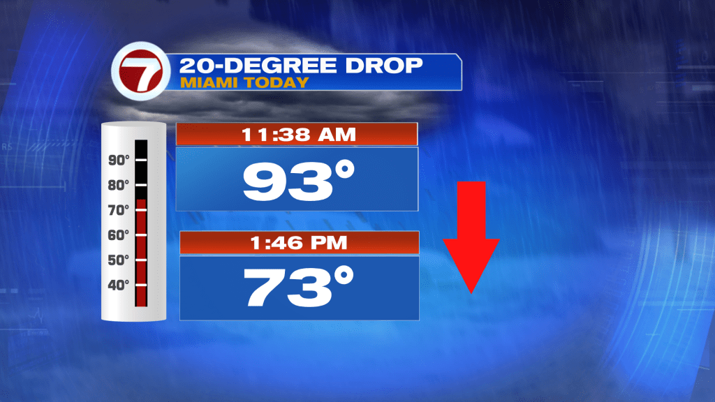
The only way we cool-off this time of year is from occasion batches of heavy rain. During the early afternoon (Monday, in Miami) temperatures plunged 20-degrees with storms, in less than two hours.
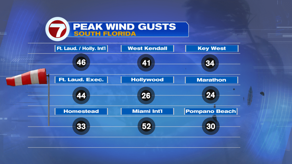
The storms did more than just drop heavy rain and temperatures, we also had briefly strong wind gusts. As shown above, thunderstorms cranked winds to impressively high levels. One particular storm even allowed for a gust up to 52 mph in Miami!
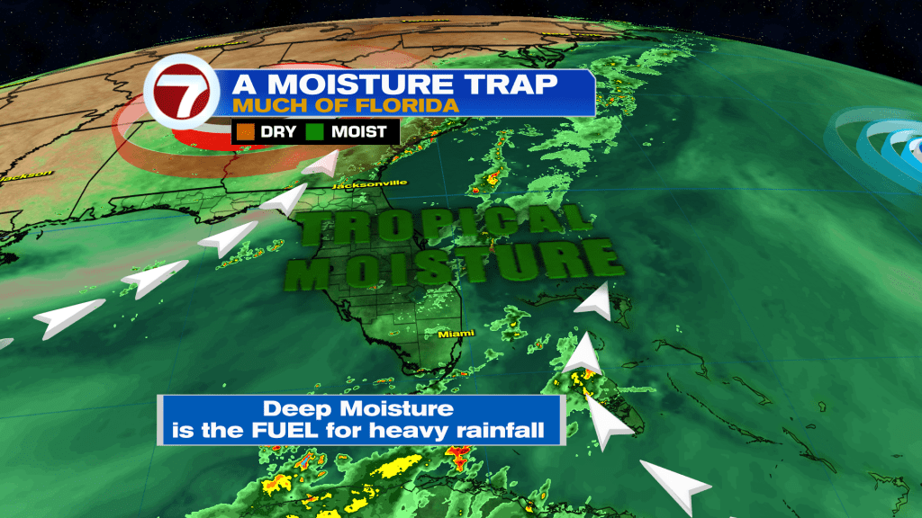
As we continue through the early part of the week, Florida remains very steamy south of a stalled Front. With limited peeks of sun, storms will develop, yet again, especially as the air heats up during the day. Notice on the Futurecast map below, the Atlantic High (High Pressure) becomes more prominent over time. By Wednesday, it will even turn winds out of the east. This stronger onshore flow may have an effect of moving, or pushing, most rain farther inland. After scattered “earlier” showers, storms are forecast to favor interior spots while coastal and metro areas get less impactful conditions.
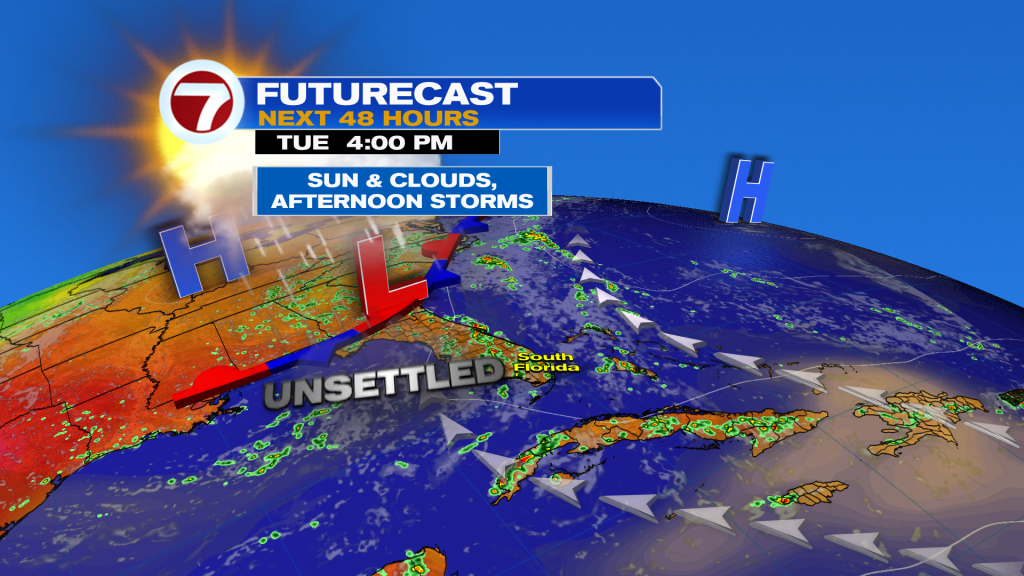
The steering switch could hold for Wednesday and Thursday with slightly lower rain returns. Then, by Friday, another moisture surge could develop along the same flow.
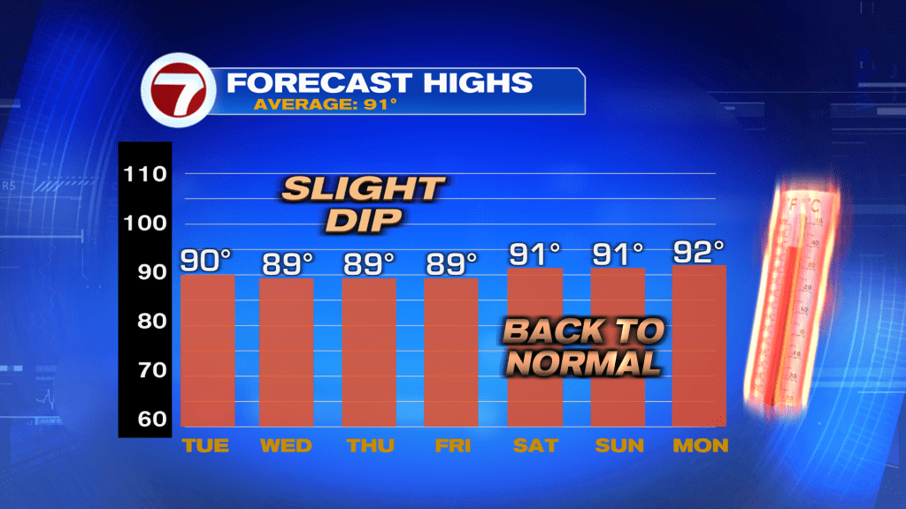
Over the next week it’s a persistent stretch of steadier temperatures. Daily highs will typically peak around 90-degrees. While that’s close to average, it’s a real difference from the extra-hot pattern that has held for a long time. Going back almost 8-weeks, temperature highs have been elevating into the lower to middle 90’s. It’s actually a near-record long stretch of highs in the 90’s!
Join our Newsletter for the latest news right to your inbox