
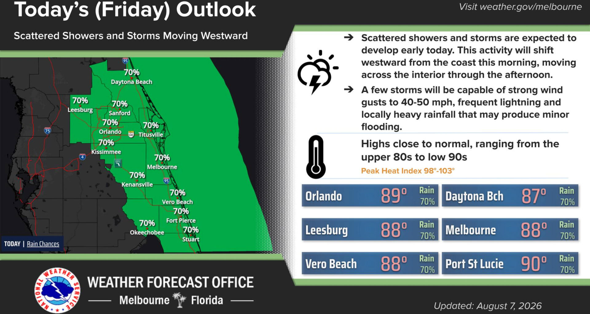
Rain chances jump to 70% as a trough of tropical moisture will make its way from east to west across Central Florida on Friday and into Saturday, according to the National Weather Service.
While highs will be in the upper 80s and low 90s, extreme humidity will bring the heat indices, or feels-like temperatures, into the 100-105 degree range.
Rainfall totals could dump 2-4 inches across much of the region including some localized totals of 5 inches, according the the NWS Melbourne forecaster’s discussion.
“Through early this morning, scattered showers and storms across the waters will push onshore, with coverage of this activity increasing, becoming scattered to numerous with daytime heating,” forecasters said. “Showers and
storms will spread westward from the coast and across the interior through late morning and into the afternoon/early evening.”
Whiles storms may move quicker, there could be more of them, leading to the localized rainfall totals.
“This may lead to mostly minor nuisance flooding of roadways and poor drainage areas,” forecasters said. “However, should totals toward the higher end of this range occur, it could lead to isolated flash flooding, mostly in the form of more significant standing water issues on roadways.”
There is some chance that some of the storms will be stronger with frequent lightning strikes and strong wind gusts to 40-50 mph.
Rain chances drop overnight, but warm and muggy conditions will persist overnight with lows in the 70s.
Beachgoers face a high risk for rip currents on Friday that are forecast to continue into Saturday.
Rain chances are back up to 60-70% on Saturday.
“Greatest coverage of showers and storms looks to focus across the interior as Atlantic ridge axis north of the
area keeps an onshore flow across the region,” forecasters said. “Typical summer-time storm threats persist with isolated stronger storms capable of producing strong wind gusts to 50 mph and frequent lightning.”
Minor flooding with rain totals of 2-4 inches are possible again.
Rain chances drop on Sunday as the deep moisture shifts north-northwest.