
TALLAHASSEE, Fla. (WCTV) – I am already tracking some rain and storms this morning near the coast, as expected. These are carrying heavy downpours and some lightning.
Out the door
As you get prepared for your Sunday whether it is tee-time or church, our day is starting off dry and humid inland.
For those near the coast, showers and storms will remain possible until the sea breeze pushes inland mid-morning. Then rain will drift inland, making way for a great beach day this afternoon.
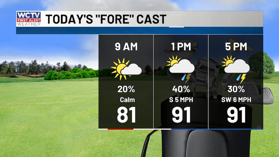 Sunny this morning, scattered storms this afternoon.(WCTV)Afternoon showers
South winds will push the Gulf sea breeze north quickly mid-morning and will bring quick moving showers or storms along it during the mid-morning through mid-afternoon. The heaviest storms will be near and north of I-10.
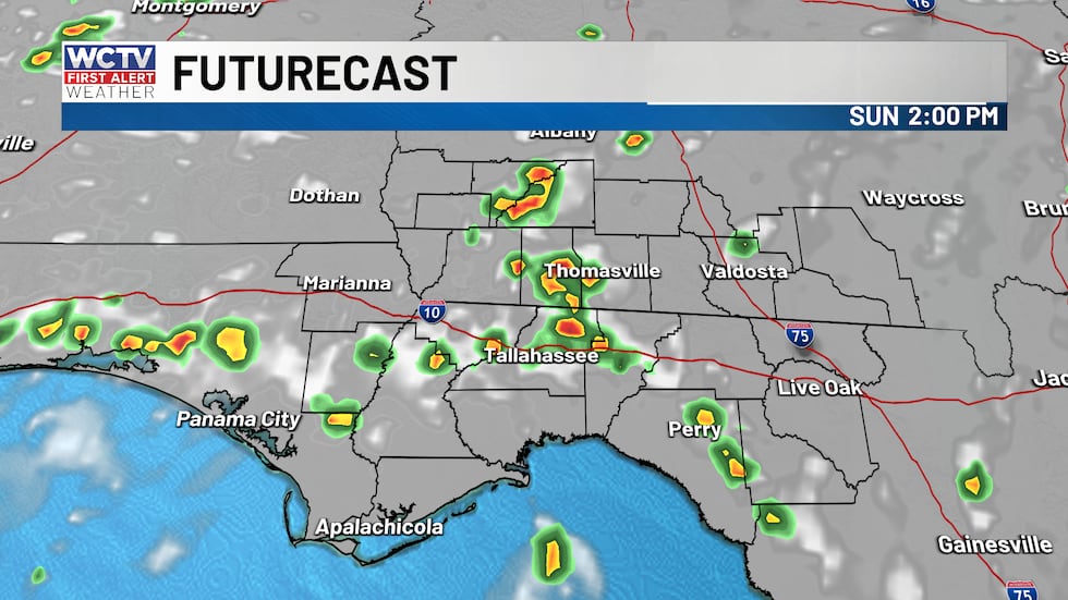 Scattered sea breeze showers this afternoon.(WCTV)
Any storm will be capable of strong gusts 40 to 50 mph, frequent lightning and heavy downpours between 10:30 a.m. and 5 p.m.
Rain and storms should be short-lived for most spots. The majority of the day will be dry. Highs in the low to mid 90s.
Beach and boating
Waters will be a tad rough this morning due to scattered showers and storms in the Apalachee Bay, and rivers and bays near the coast. The biggest threats will be lighting and low visibility.
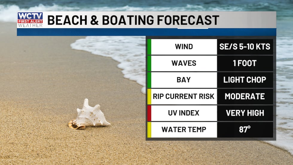 Weather looks great for folks hoping to hit the water today.(WCTV)
Conditions gradually improve by mid-morning turning into a mostly sunny late morning and afternoon along the coast and rain chances dropping to near zero.
Waves will be 1 foot or less with an onshore wind 5 to 10 knots.
Heating up next week
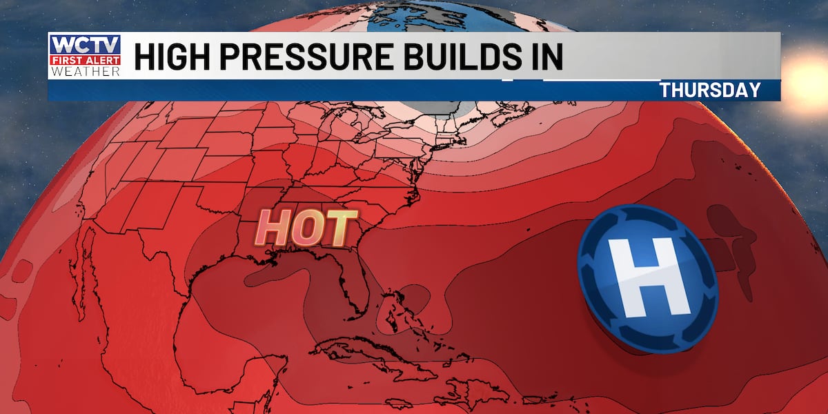
High pressure slowly builds in early next week and will start to lower rain chances each afternoon. I expect partly to mostly sunny and HOT afternoons. Temperatures should reach the low to mid 90s early week.
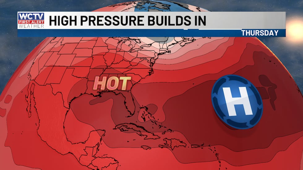 High pressure settles in this week leading to higher temperatures.(WCTV)
With the high continues to build through the end of the week, temperatures should reach the upper 90s by Wednesday or Thursday and stay high into next weekend.
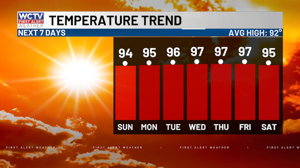 Highs above average this week with numbers reaching the mid-90s.(WCTV)Perseid meteor shower🌠
A meteor shower will be peak between Wednesday night (Aug. 12) and Thursday (Aug. 13 morning). This is as debris from the comet Swift-Tuttle passes by Earth.
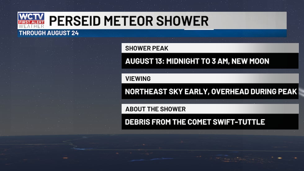 Meteor shower peaks this week.(WCTV)
If you leave the city lights, you will be able to catch 60 to 100 meteors per hour! You can submit photos of the meteor shower here.
Tracking the tropics
Turning to the Atlantic and Gulf, there are a few disturbances that I am keeping an eye on. There is no development expected in the next few days, however the National Hurricane Center does have TWO areas of interest in the eastern Atlantic.
Area number one is the lead wave, which has a lower chance of developing as it interacts with a very hostile environment from strong wind shear and Saharan dust. The agency gives it only a 20% chance of development in the next 7 days.
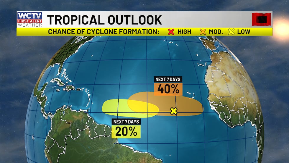 A few tropical waves have a low to moderate chance of developing into a more organized tropical system over the next week.(WCTV)
The NHC is watching another wave that will emerge off the Africa coast early this week. This has a better chance at developing into a more organized system. Long range computer models, ensembles and AI models ALL hint at some gradual development with this.
This is VERY normal for activity to really ramp up in the main development region (MDR) in early August, so this is not shock. No threats or impacts are expected locally with either of these.
To stay updated on all the latest forecasts and weather, follow WCTV First Alert Weather on Facebook and X (Twitter).
Click here to see all the latest weather headlines and here to view the First Alert Radar. Receive push alerts and watch the latest forecast anytime on the free WCTV First Alert Weather app. Click here to download it now.
Interested in becoming a WCTV First Alert Weather Watcher? Click here to join the team!
Copyright 2026 WCTV. All rights reserved.