
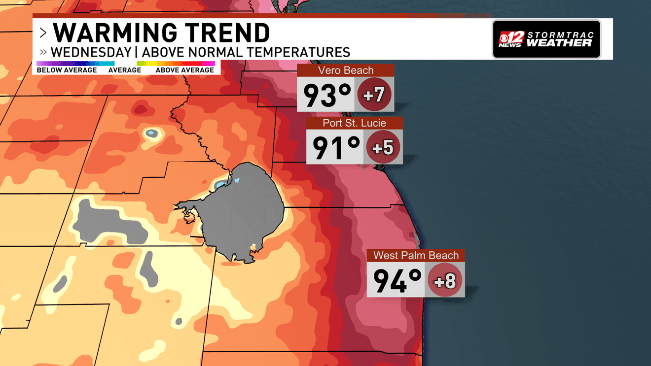
WEST PALM BEACH, Fla. (CBS12) — Dangerous heat will be South Florida’s primary weather concern today and through much of the upcoming week, with only periodic thunderstorms offering brief relief from the oppressive conditions.
A Heat Advisory is in effect today for all of South Florida as temperatures climb well above normal. Highs will reach the middle to upper 90s in many areas, and when combined with high humidity, it will feel even hotter. Heat index values are expected to reach advisory levels, making prolonged outdoor activity potentially dangerous without proper hydration and access to cooling.
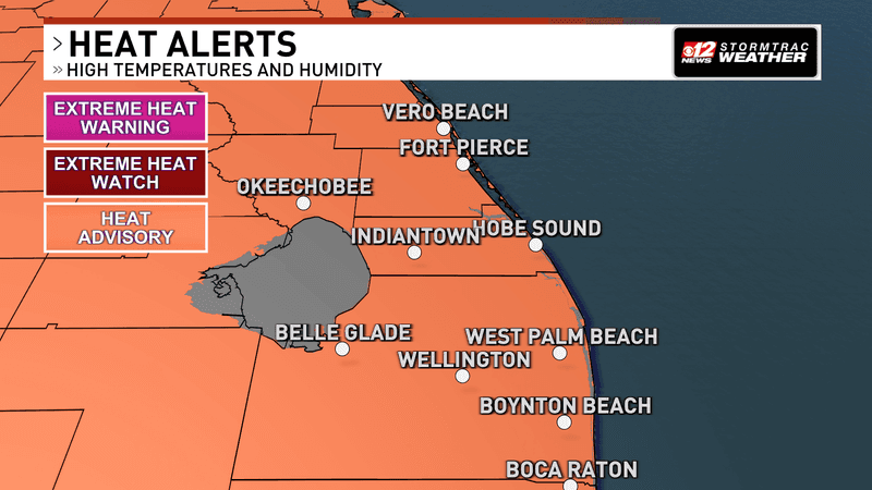
Dangerous heat will be South Florida’s primary weather concern today and through much of the upcoming week, with only periodic thunderstorms offering brief relief from the steamy conditions. (WPEC)
The atmosphere will contain a little more moisture today as the recent influence of Saharan dust begins to weaken. That will allow scattered showers and thunderstorms to develop along sea breezes during the afternoon and evening. Storms will move slowly because winds higher in the atmosphere are weak, with the greatest rain chances expected across southern portions of South Florida where storms and leftover boundaries may come together.
Interactive Radar: Track storms across your area
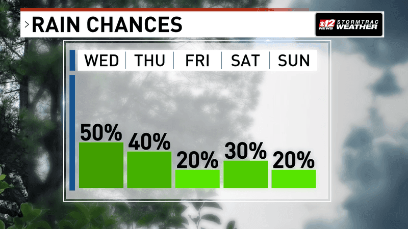
Dangerous heat will be South Florida’s primary weather concern today and through much of the upcoming week, with only periodic thunderstorms offering brief relief from the steamy conditions. (WPEC)
Thursday brings another opportunity for afternoon thunderstorms, and another Heat Advisory may be needed for portions of the region as temperatures remain unusually high.
Read more about the tropics heating up.
A pocket of Saharan dust, a layer of hot, dry and dusty air that travels across the Atlantic from Africa, is expected to reduce storm coverage somewhat on Friday. Tropical moisture then briefly returns Saturday, bringing another increase in showers and thunderstorms before drier air settles over the region Sunday.
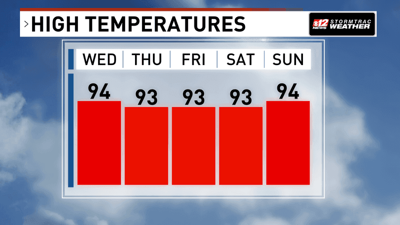
Dangerous heat will be South Florida’s primary weather concern today and through much of the upcoming week, with only periodic thunderstorms offering brief relief from the steamy conditions. (WPEC)
Regardless of the day-to-day changes in rain chances, heat will remain the dominant weather story. A strong area of high pressure is expected to become firmly established over the region, allowing afternoon temperatures to remain in the middle to upper 90s with dangerous heat index values continuing through next week.