
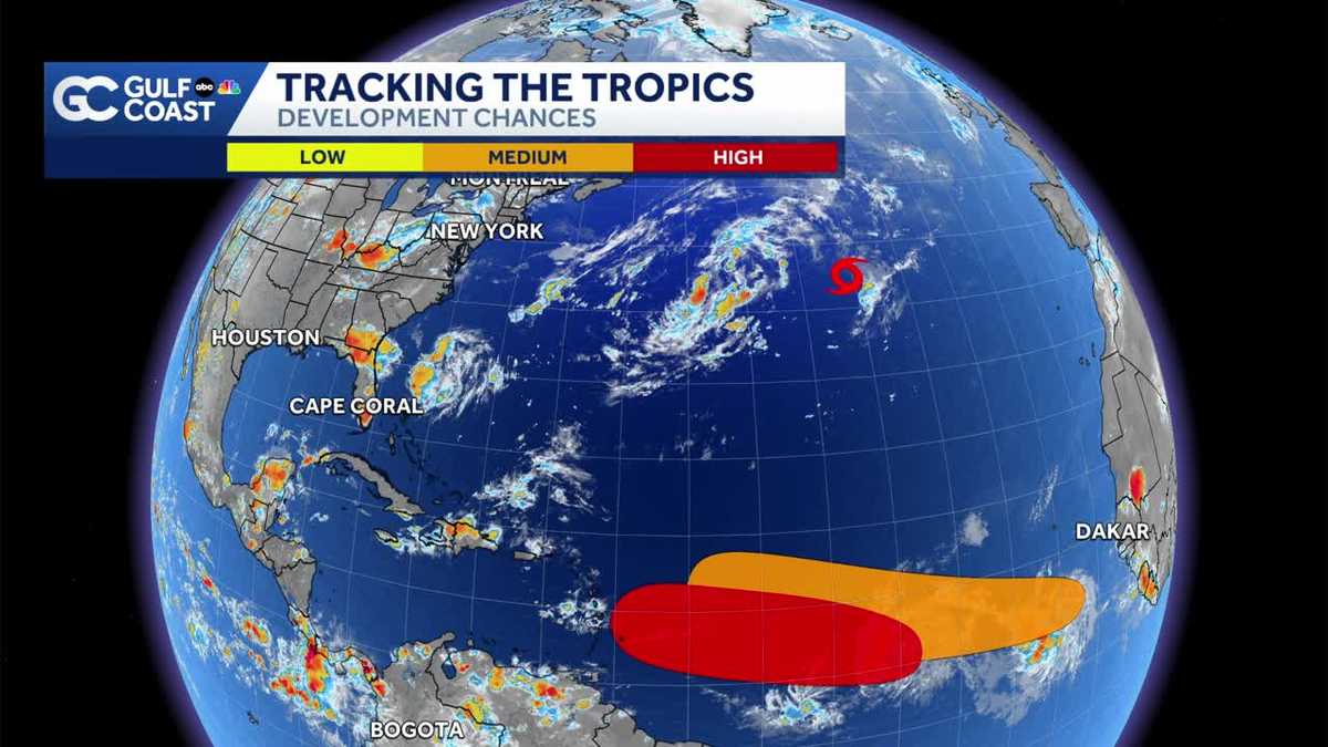
Tracking two Invests in the Atlantic as Cristobal moves east
The Atlantic remains very active with Tropical Storm Cristobal and two other areas of interest.
FORT MYERS, Fla. —
The Gulf Coast Hurricane Tracking Team is monitoring Tropical Storm Cristobal and two areas of interest in the Atlantic for tropical development.
Tropical Storm Cristobal
As of 5 p.m. Wednesday, Tropical Storm Cristobal formed 1050 miles northeast of Bermuda. The storm is producing sustained winds at 45 mph, tracking to the east at 21 mph.
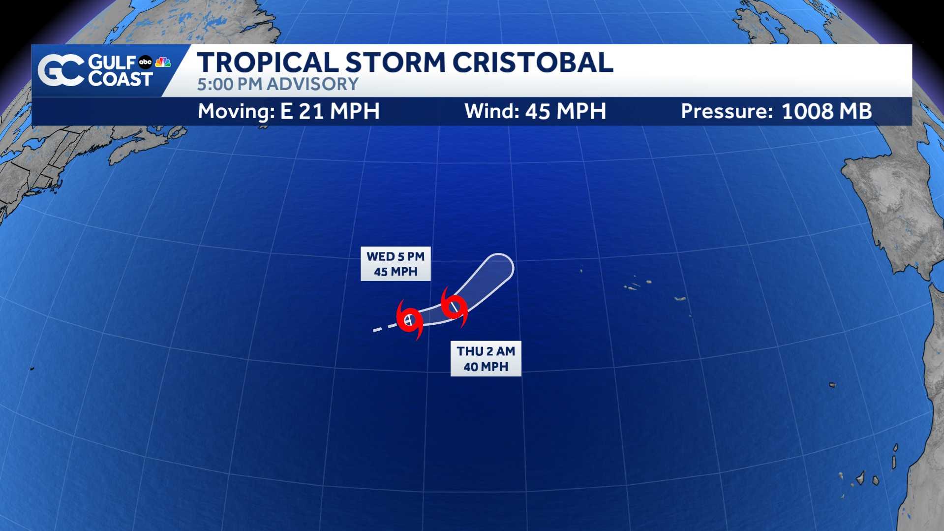
Cristobal will be a short-lived tropical storm as the system heads toward cooler waters Thursday. Regardless of development, Cristobal poses no threat to the United States as it is moving east away from North America.
 Area one: Invest 92L
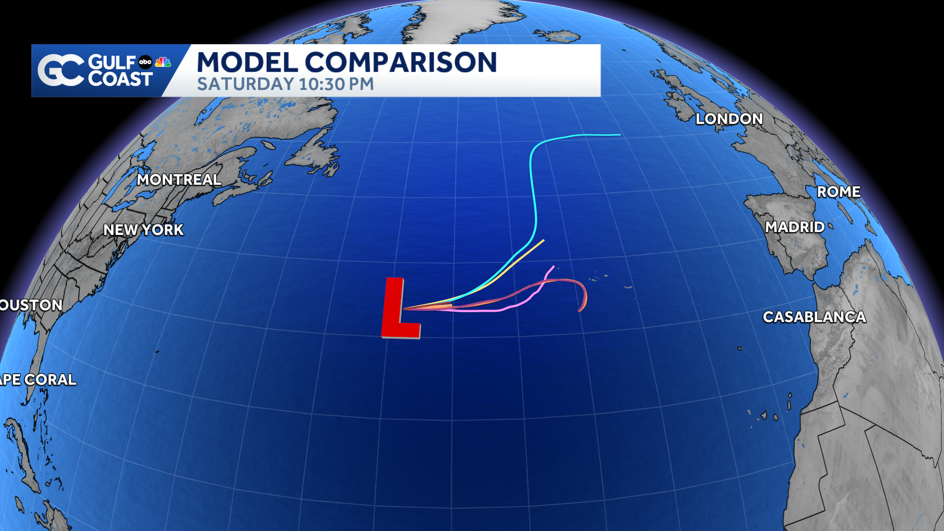
As of 8 p.m. Wednesday, Invest 92L is 900 miles west-southwest of the Cabo Verde Islands. An area designated an “invest” does not guarantee tropical development, but the classification triggers more data collection.
This tropical wave is likely to become a tropical depression by the end of the week. Development odds are at 80% over the next two days and 80% over the next seven.
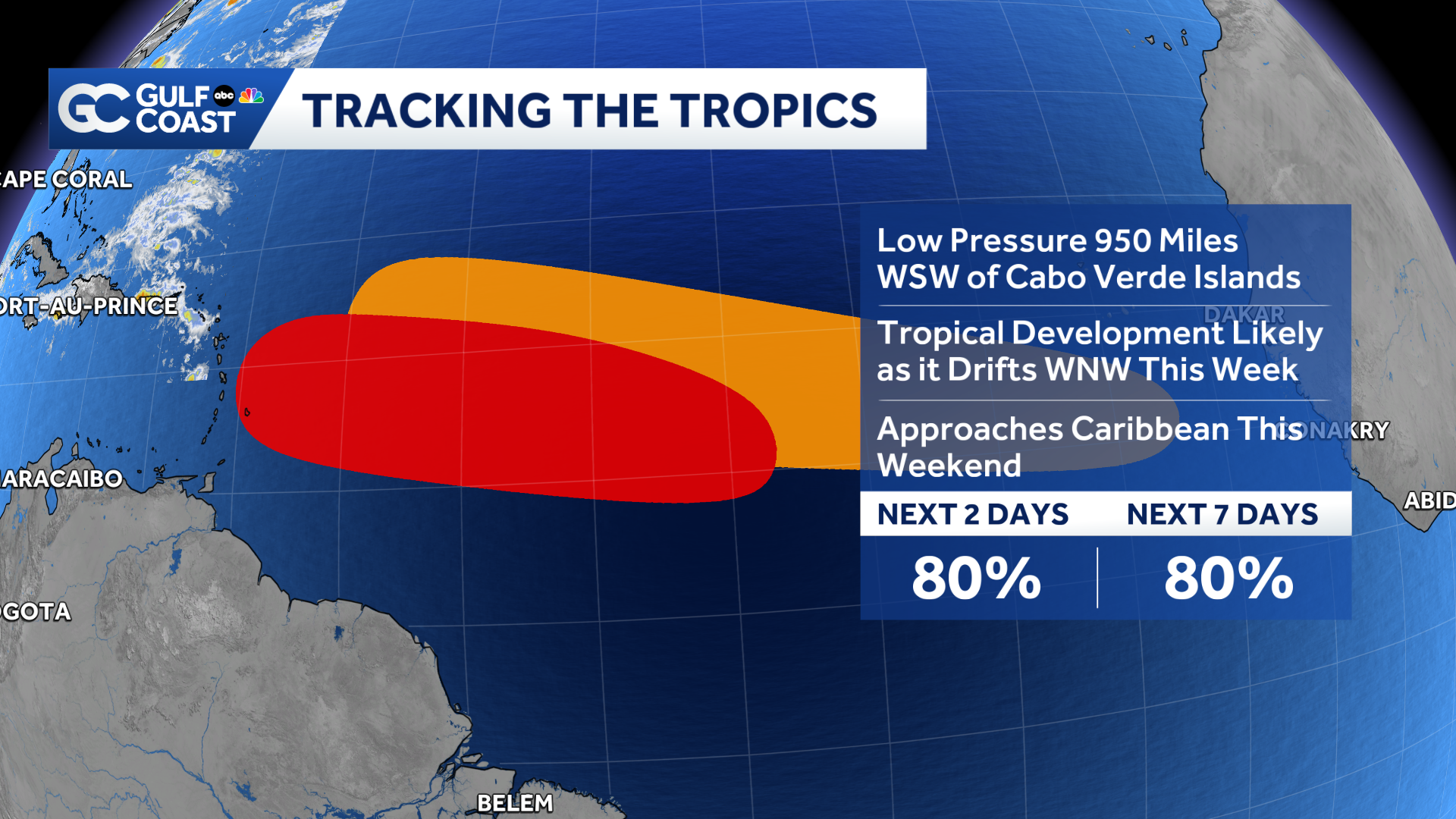
For now, an area of high pressure over the Atlantic Ocean will steer it westward in the direction of the Caribbean Sea. The disturbance is surrounded by dry dusty Saharan air, and will encounter increasingly strong wind shear as it approaches the Caribbean later this week.
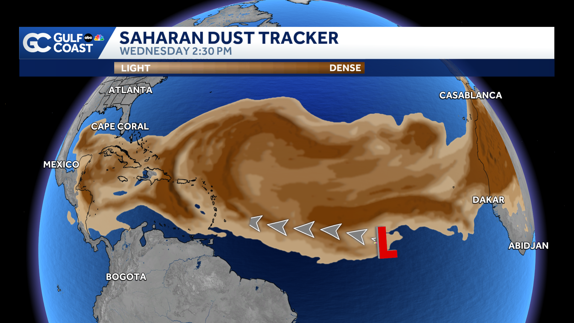
So while some development of the system is expected, significant development does not look likely at this time. If this disturbance becomes a named storm, Dolly is the next name on the list.
Area two: Invest 94L
A tropical wave near the west coast of Africa is also being tagged as Invest 94L.
The area highlighted in orange on the map below is where to watch for any organization in the coming days.
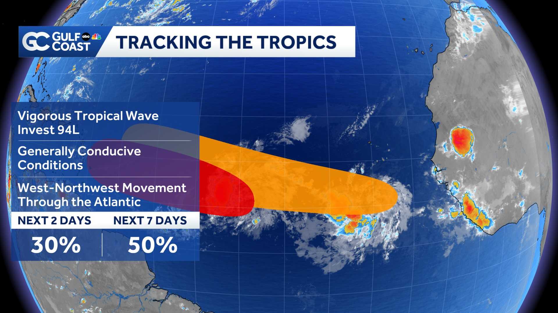
While it will also face dry air and increasing wind shear as it moves westward, some gradual development of this system is possible. The chance of it becoming at least a tropical depression within the next 48 hours is 30%, while the 7-day development odds are at 50%.
What is an Invest:
Invest is a shorthand way of saying “area of tropical weather investigation.”
When the National Hurricane Center pegs an area as an invest, it allows the running of tropical weather-specific forecast models that can help identify the likelihood of development.
It should be stressed that invests are not organized systems, and it does not guarantee a system will form.
We’ll keep you updated on Gulf Coast News.
However you watch or scroll, we’re committed to delivering your Gulf Coast Weather Most Accurate Forecast, one you can rely on every day, wherever you are.
Live Interactive Radar: Track conditions in real time with the Gulf Coast Live Radar.
Watch Gulf Coast Weather: Find the latest weather forecast videos, streaming live or on demand, on TV and online.
Stream on the Go: Download the free Gulf Coast News app to watch on your phone or tablet.
Your Gulf Coast Weather Team
Follow on Social: Follow, like and subscribe to Gulf Coast News on social media to share your tips and be part of the conversation with Southwest Florida’s most experienced, trusted weather team: Facebook | Instagram | YouTube | TikTok | Threads | Bluesky | Nextdoor | X
DOWNLOAD the free Gulf Coast News app for your latest breaking news and weather alerts. And check out the Very Local Gulf Coast app to stream news, entertainment and original programming on your TV.