
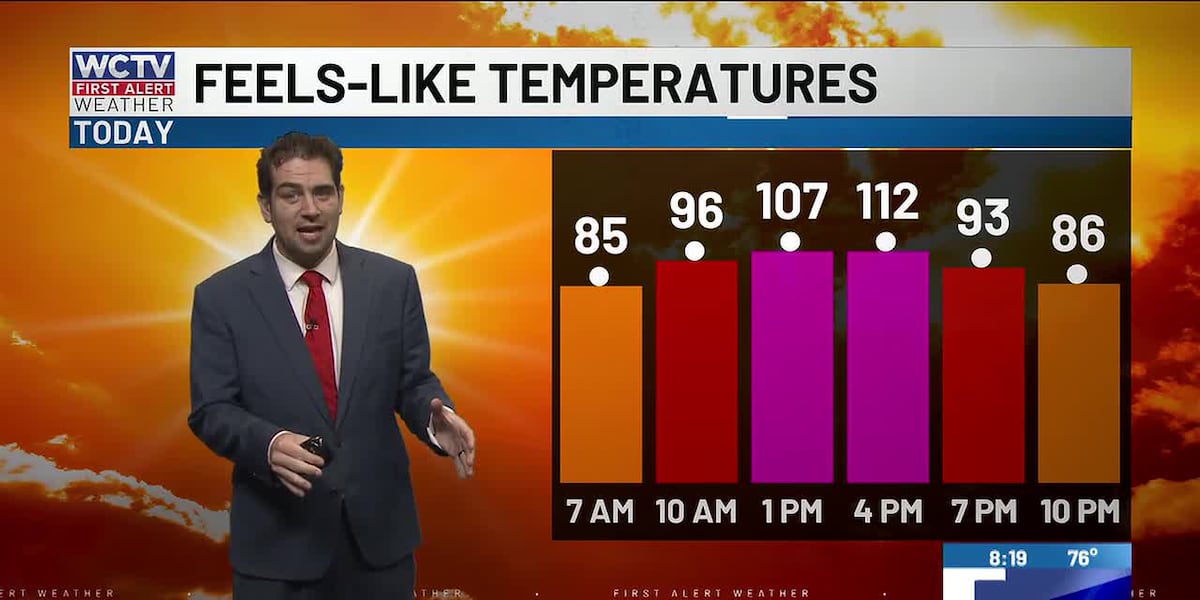
TALLAHASSEE, Fla. (WCTV) – More dangerous heat is expected this afternoon as the combination of the heat and humidity leads to temperatures well into the triple digits again today. This pattern will not break until late next week.
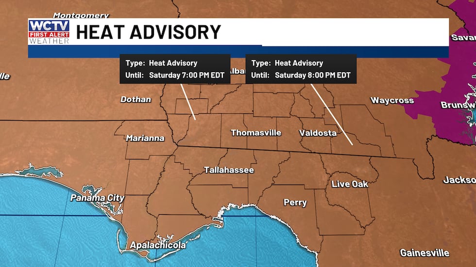 A heat advisory is in effect from 11 am until this evening for dangerous heat.(WCTV)
Heat Advisory: Everyone is under a heat advisory in the Big Bend and South Georgia. The reason for the alert is feels-like temperatures are expected to reach 105 to 112 again this afternoon. It will not be as humid as yesterday, which is why there are no extreme heat warnings today. Nonetheless, a very hot afternoon is expected across the area.
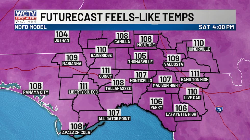 Heat and humidity will make it feel up to 112 degrees this afternoon.(WCTV)Some afternoon storms
Outside of the heat, scattered afternoon and evening storms are expected once again today. Despite high pressure anchored across the southeast, there is so much heat and moisture, plus several local boundaries that will work in tandem to develop the rainmakers later today.
Future radar is once again struggling with this afternoon. My expectation is for showers to get going in South Georgia near the Albany area and slowly drift east and south through the afternoon and evening. These storms will produce outflow boundaries which will trigger new storms, which is something computer models struggle with BIG TIME.
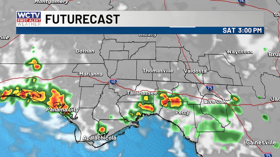 Scattered showers and thunderstorms this afternoon and evening.(WCTV)
Eventually the Gulf and Atlantic Sea Breeze will also help to trigger storms this afternoon running into each other and other storms. Despite model’s struggle, I am going with a 60% chance of rain this afternoon.
Some storms will be strong to severe with torrential downpours, frequent lightning and strong wind gusts between 40 and 60 mph, which could down trees and lead to outages.
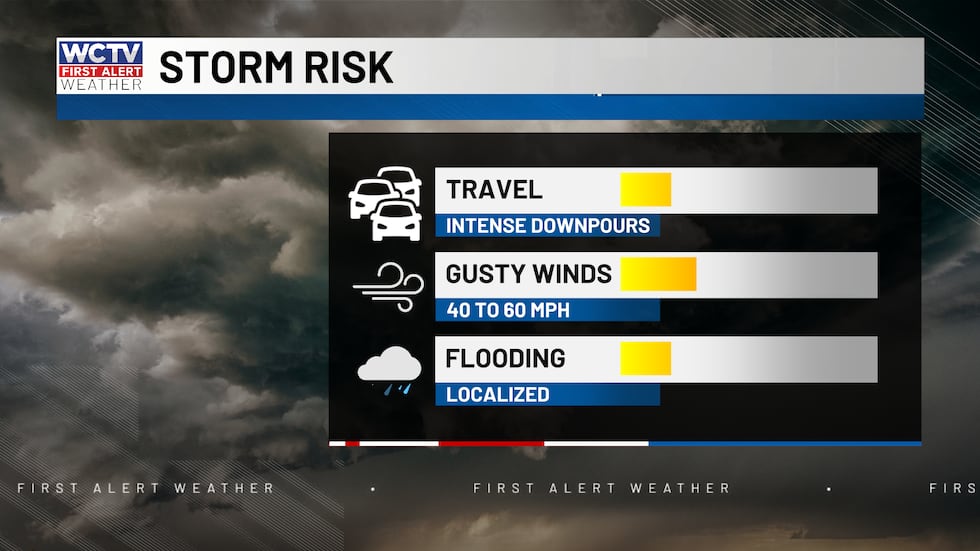 A few strong to severe storms are possible this afternoon.(WCTV)No change for Sunday
Sunday is pretty much a repeat of today. Hot with scattered afternoon showers and thunderstorms. There has been a shift in computer models to be more widespread with the rain coverage tomorrow. It will depend on how storms behave this afternoon and where tomorrow’s local boundaries setup. Either way, a good chance of afternoon storms. Highs in the upper 90s with a heat advisory likely again.
Beach and boating
As far as the waters and waves, conditions are fine. With the chance of thunderstorms both inland and near the coast, be sure to keep an eye on the radar before heading out to the Gulf waters or local rivers.
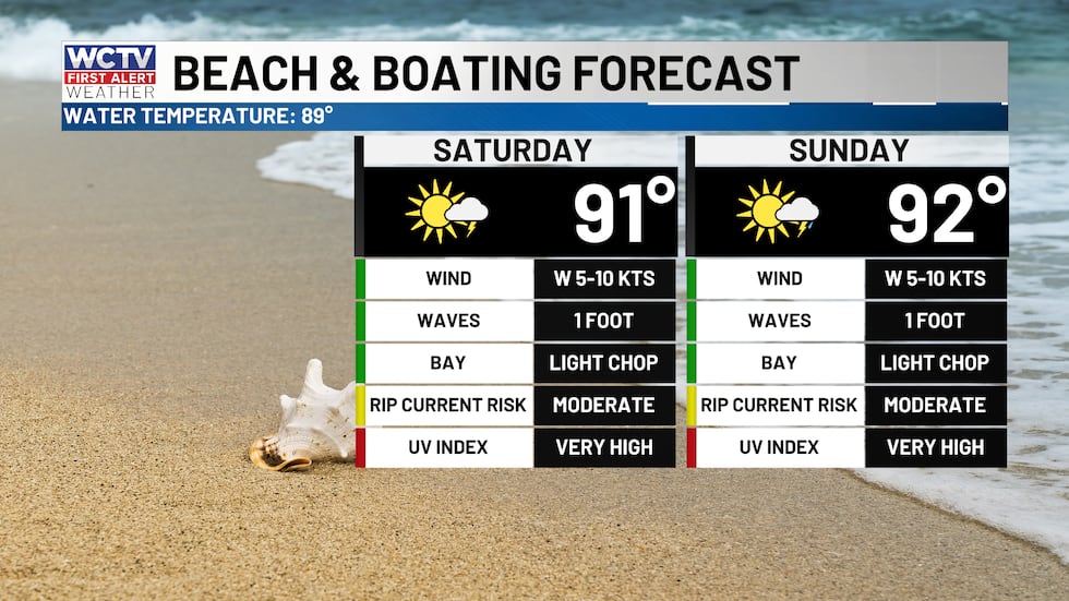 Showers and storms and HOT for beaches this weekend.(WCTV)Nearing record highs early next week
High pressure continues to dominate and parks right over the Big Bend and South Georgia early this week. This will lead to the hottest temperatures of our prolonged heat wave. I am forecasting a high of 99 both days.
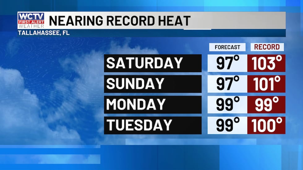 Highs will approach record territory over the next several days.(WCTV)
99 would tie a record on Monday for Tallahassee and would come up just shy on Tuesday. Scattered afternoon storms remain in the picture both days.
The heatwave will hang on through the end of next week, until better rain chances make a return.
Tropical Outlook
The two areas of interest that the National Hurricane Center has been monitoring have both lowered in likelihood of developing. Both tropical waves are fighting Saharan dust and strong wind shear, which is making them struggle to develop further.
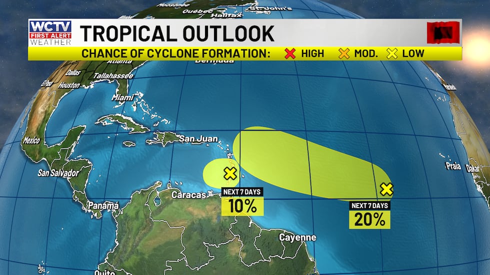 Chances staying low for both waves in the Atlantic for organized development.(WCTV)
I do not expect either of these to develop and make an impact locally. However, this should bring at least some beneficial rain to parts of the Caribbean.
On the flipside, Lala is moving toward Hawaii and is expected to scoot by the islands bringing hurricane force winds (74 mph or greater) and heavy rainfall to the state.
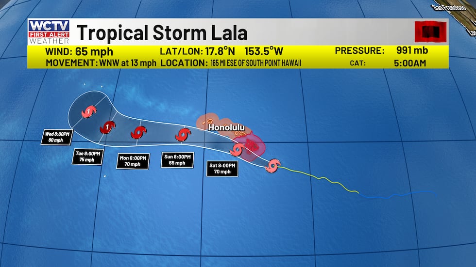 Lala is expected to bring hurricane conditions to the Big Island today.(WCTV)
No other tropical threats over the next 7 days.
To stay updated on all the latest forecasts and weather, follow WCTV First Alert Weather on Facebook and X (Twitter).
Click here to see all the latest weather headlines and here to view the First Alert Radar. Receive push alerts and watch the latest forecast anytime on the free WCTV First Alert Weather app. Click here to download it now.
Interested in becoming a WCTV First Alert Weather Watcher? Click here to join the team!
Copyright 2026 WCTV. All rights reserved.