
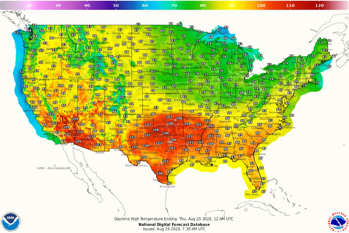
Miami reached 100 degrees Fahrenheit on Tuesday, matching a temperature the city has recorded only once before in more than 130 years of weather observations.
The triple-digit reading tied Miami’s all-time temperature record, first set on July 21, 1942, as a powerful heat dome settled over Florida and much of the southeastern United States.
Weather officials said the feat is particularly unusual because Miami’s coastal location and humid climate normally prevent temperatures from climbing that high.
Why Miami Almost Never Reaches 100 Degrees
Miami is famous for heat and humidity, but paradoxically those same factors often stop the city from hitting triple digits.
The Atlantic Ocean typically acts as a natural air conditioner, with sea breezes helping cap temperatures. Frequent summer thunderstorms also provide cooling relief before thermometers can climb into the 100s.
Meteorologists said Tuesday’s setup was different. Drier air mixed down beneath a strong area of high pressure, while offshore winds limited the cooling ocean breeze that usually develops along South Florida’s coastline. With fewer clouds and less storm activity, temperatures continued rising throughout the afternoon.
The Record That Stood for 84 Years
Miami officially reached 100°F on July 21, 1942.
Until Tuesday, that remained the highest temperature ever recorded in the city, despite decades of hurricanes, heat waves and unusually warm summers. Tuesday’s reading tied that mark, making it just the second time Miami has hit the century mark since records began in 1895.
The average high temperature for mid-August in Miami is about 91°F, putting Tuesday’s reading roughly nine degrees above normal.

NOAA’s National Digital Forecast for Aug 19 2026.
Heat Dome Fuels Dangerous Conditions Across Florida
The record came as a major heat dome settled across Florida and the Southeast.
A heat dome forms when a large area of high pressure traps hot air beneath it. As the air sinks, it compresses and warms, while cloud formation and rainfall become less likely. Forecasters said the pattern helped push temperatures across Florida well above seasonal averages this week.
More than just Miami was affected. On August 19, a National Weather Service (NWS) heat advisory warning remained in place for South Florida, with the NWS indicating maximum heat indices, the temperature felt on the human body, between 105°F and 112°F.
NWS advice suggests residents stay hydrated, limit strenuous time outdoors in the afternoon, wear lightweight and light colored clothing and use AC where possible.

A picture of the warning issued by NWS Miami.
A Summer of Weather Extremes Across America
Miami’s record-tying temperature comes during a summer marked by significant weather extremes across the United States.
While parts of the Southeast have endured prolonged heat and humidity, other regions have faced severe flooding, powerful storms and tropical weather threats, underscoring the stark contrasts that can develop in the nation’s weather patterns at the same time.
Forecasters are monitoring broader climate signals that could influence weather patterns in the months ahead. Researchers recently reported that El Niño has been linked to a 176-year record in historical climate data, underscoring the unusual conditions observed in the Pacific Ocean.
El Niño can influence temperature, rainfall and storm patterns across parts of the United States, including Florida, although it was not identified as the direct cause of Miami’s record-tying temperature this week. The immediate driver was the powerful heat dome and associated atmospheric conditions over the Southeast.
Forecasters expect the Florida pattern to begin changing later this week as rain and thunderstorms return to South Florida, potentially bringing some relief after the historic heat.
Contact Newsweek editors on this story: Rebecca Flood and Cristina Diciu.
Related Articles