
TALLAHASSEE, Fla. (WCTV) – If you missed the upper 90s, they are back! Not much of a change temperature-wise from yesterday… but a few degrees warmer since showers will be fewer and far between today as drier air takes over the area.
Out the door
Although there may be a straggling shower for the eastern Big Bend in the morning, most showers should be limited for most of the day. I am expecting partly to mostly sunny skies and a hot day with the thermometer reaching the mid-90s again.
Afternoon scattered storms
Coverage of rain should be lower than yesterday, however with the boundary still to our north, showers and storms should still develop in the afternoon after 2 p.m. A stray morning shower or storm is possible.
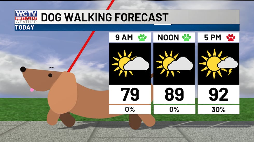 As you walk the dog today, plan on a hot afternoon with scattered storms.(WCTV)
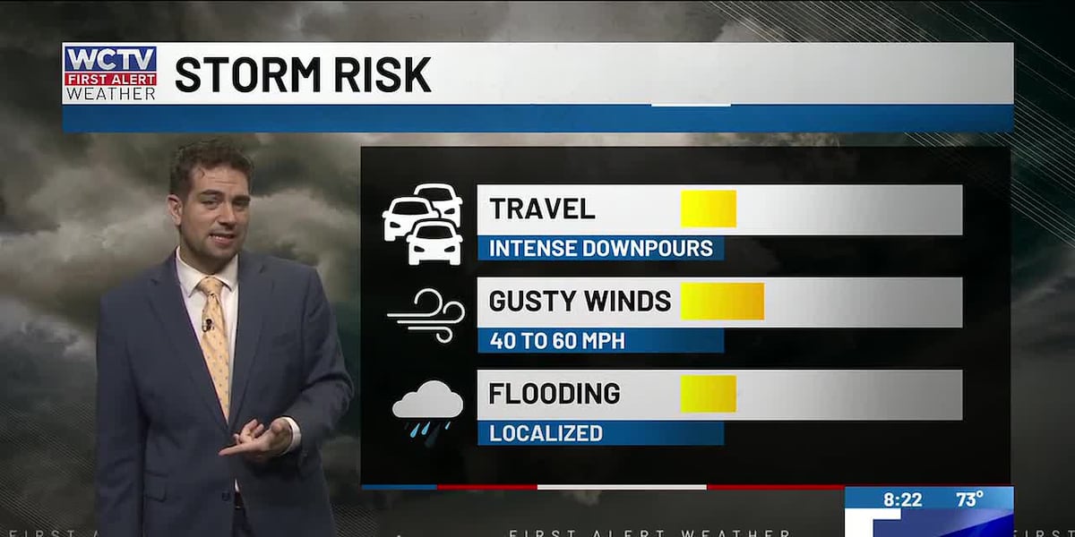
Winds should be more west/northwest which should suppress the sea breeze south of I-10. Pop-ups in South Georgia. Those who do see thunderstorms, there is a risk for strong storms with gusty winds, heavy rainfall and frequent lighting.
Better coverage on Monday
The drier air does not last as long as we had hoped. Scattered rain and storms look likely on Monday afternoon for many spots. Once again, a few morning showers will be worth watching out for as winds are more west/southwest. That should help bring the sea breeze north in the afternoon and focus the showers near I-10, similar to Saturday. As always some of these storms will bring heavy rain and gusty winds.
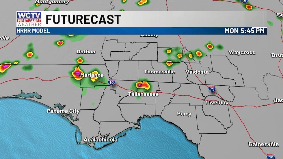 Scattered storms tomorrow afternoon.(WCTV)Less coverage of showers midweek
Wednesday the front finally lifts north from a southerly wind. So, through the end of the week looks like a more typical summer afternoon. Morning sun and hot in the afternoon with pop-up scattered storms. Highs in the low to mid 90s. Morning lows in the low 70s.
Tropical update
There are three areas of interest. Two of which are in the Northern Atlantic and seem to pose little to no threat, other than higher waves for some shipping routes in the Atlantic.
The wave is getting closer to the Atlantic as it emerges off the African coast later today. The wave has pretty good chance of development over the next 7 days. It looks like the Atlantic should have an organized tropical system by midweek.
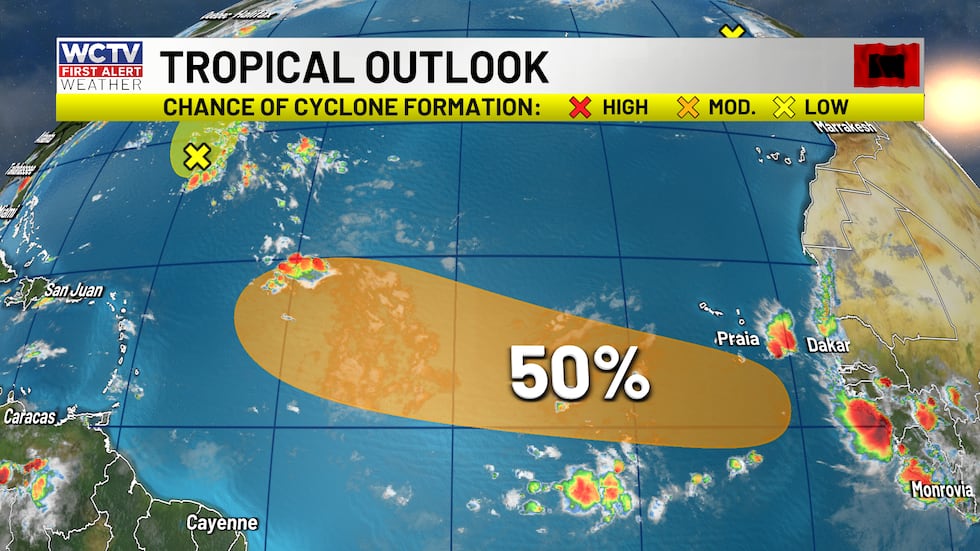 A good chance that a tropical wave organizes next week.(WCTV)
Right now, it is too early to get caught up in a exact track. However, looking at the weather pattern setting up. Bermuda high breaks down and weakens and a trough in the eastern U.S. should pave the way for a curve out to see if the wave organizes.
No threats or concerns to our area for now. As we head into the peak of hurricane season, activity should ramp up in the Atlantic Ocean despite the ongoing El Nino.
To stay updated on all the latest forecasts and weather, follow WCTV First Alert Weather on Facebook and X (Twitter).
Click here to see all the latest weather headlines and here to view the First Alert Radar. Receive push alerts and watch the latest forecast anytime on the free WCTV First Alert Weather app. Click here to download it now.
Interested in becoming a WCTV First Alert Weather Watcher? Click here to join the team!
Copyright 2026 WCTV. All rights reserved.