
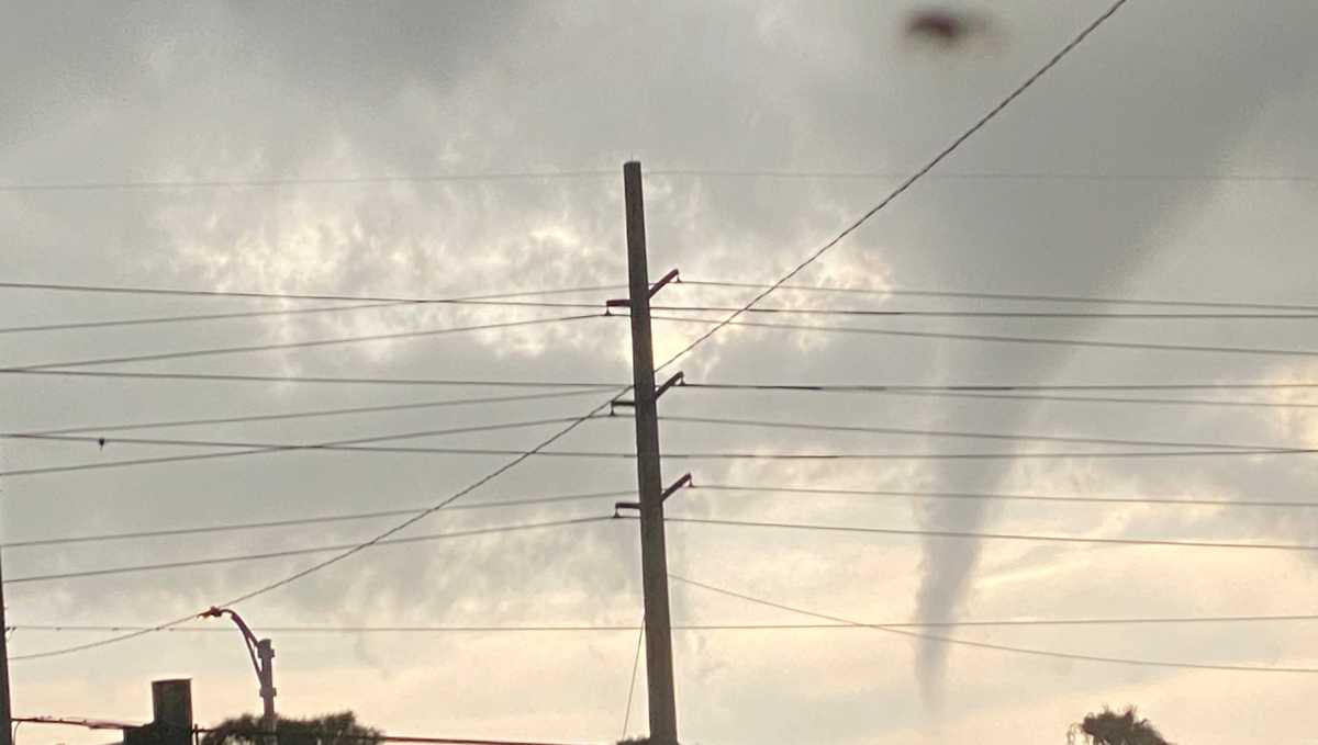
Apparent funnel cloud seen in St. Lucie County

A tornado warning was issued for parts of St. Lucie and Martin counties on Sunday, Aug. 23 until 7 p.m.
Several WPBF 25 News viewers submitted photos and videos of apparent funnel clouds in the sky from Port St. Lucie, Jensen Beach to Palm City.
The latest: Weather coverage from WPBF 25 News
The National Weather Service in Melbourne said on Sunday evening that based on information it received from Martin County and St. Lucie County, it believes brief landspout/tornado likely occurred in the vicinity of the Jessica Clinton Park near Southbend Boulevard & SE Navy Avenue in Port St. Lucie, lofting a small amount of debris and producing minor damage.
Interactive radar: South Florida weather coverage from WPBF 25 News
“Radar data show only a weak circulation signature at the time of the reported damage, suggesting the circulation was likely shallow and near the surface, consistent with a landspout-type event. We are continuing to gather information and coordinate with our public safety partners to better determine the areal extent and nature of the damage.
“After further coordination with our Emergency Management partners, I wanted to provide an update. It appears that the landspout/tornado occurred on the St. Lucie County side – just west of the St. Lucie River. Emergency Management is aware of several homes with minor structural damage near SE Wake Road, Navy Avenue, and West Snow Road in the Southbend area of Port St. Lucie. The tornado may have continued east toward the St. Lucie River. We’re collecting additional information and will have more soon,” the National Weather Service said in a statement.
The National Weather Service announced later Sunday night that it will conduct a storm survey on Monday morning base off information that circulation made it to the St. Lucie River, where it became a waterspout.