
ORLANDO, Fla. – We’re kicking off the workweek with lower rain chances thanks to some drier air overhead.
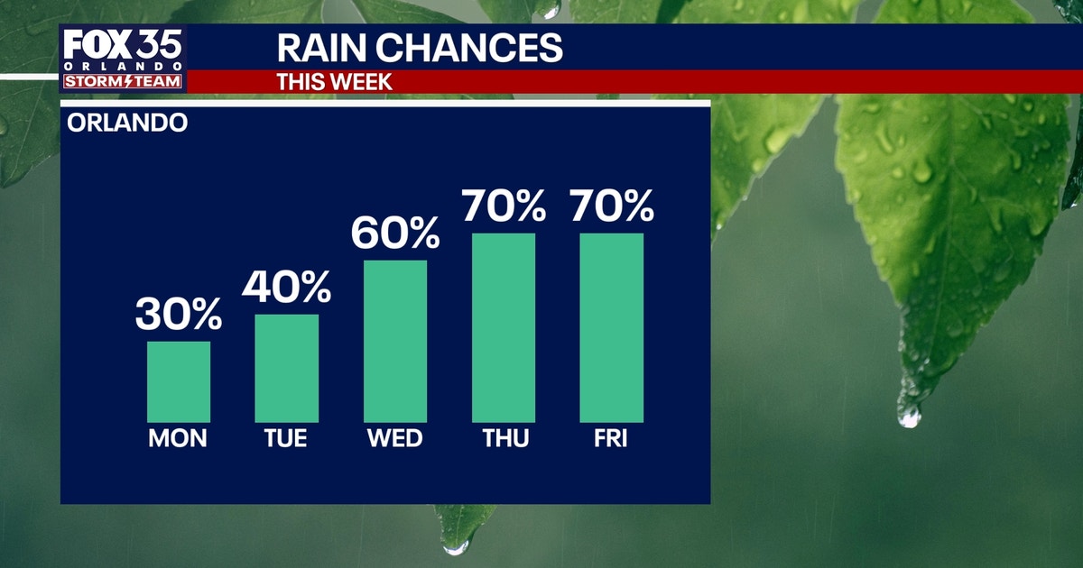
A few showers and storms are on the table through the remainder of the evening, but chances start to increase through the remainder of the week.
Increasing storm chances by the end of the week
Timeline:
Tuesday features a 40% chance of showers and storms as this dominant SW flow holds. This means that we’ll likely see more showers and storms with the sea breeze collision east of Orlando. We’ll see a few west, but chances look a bit higher the closer you get to our East Coast Beaches.
We start to tap into more tropical moisture later in the week with the wind coming in from the south. That will make for higher chances of rain as we progress through midweek onward. Our days won’t be washouts, but we’ll see numerous more storms around during the afternoon and evening. It’ll be more typical of our classic “rainy season” weather pattern.
With the help of the sea breeze collision as well as some upstairs energy moving through the atmosphere, chances come back up to around 60–70%. A few strong to even severe storms are possible, with gusty winds and small hail the main hazards.
 Temperatures will be more seasonal
How hot will it get?:
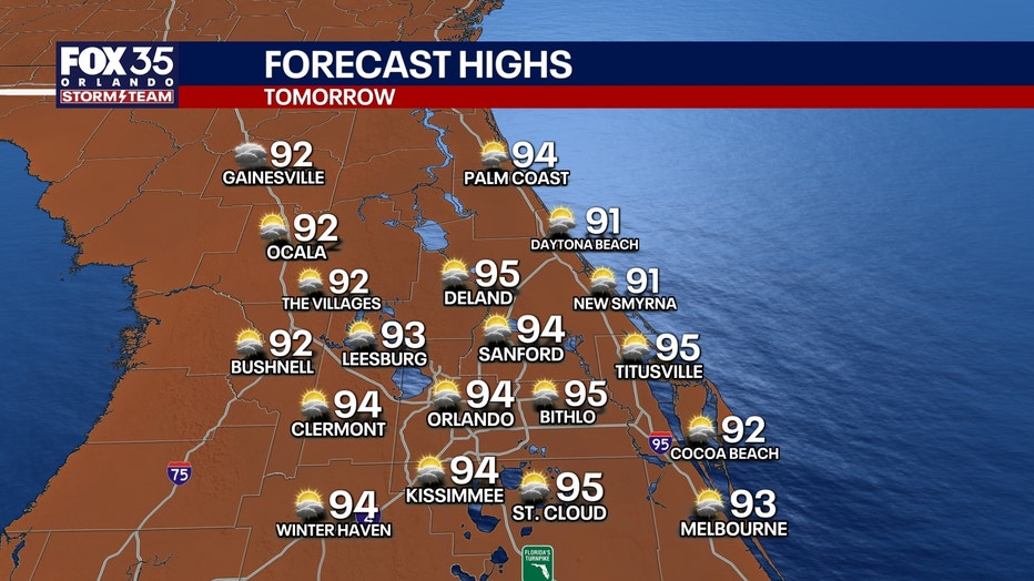
With the chance for showers and storms coming back up and more clouds in the afternoon, our temps look to come down ever so slightly. Our average for this time of the year is 91 degrees, and we’ll likely be closer to that later in the week.
Highs on Tuesday top out in the lower to middle 90s with afternoon readings in the lower 90s for the most part, midweek into this upcoming weekend. It’ll still feel steamy though, with high humidity in the atmosphere. Feels like temps look to top out in the lower to mid-100s.
 Tracking the Tropics
Big picture view:
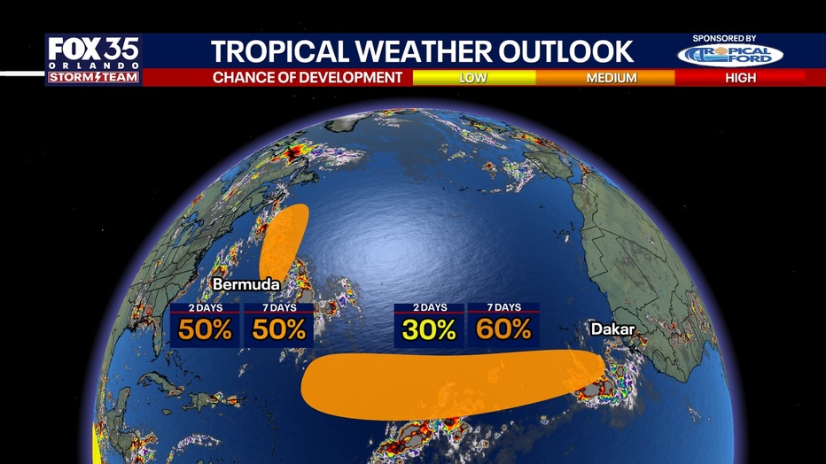
One system is expected to move away from Florida while the other will be moving into an environment that could become more favorable for development, with warmer Atlantic waters, less wind shear and relatively little surrounding Saharan dust.
 Invest 95L could briefly develop
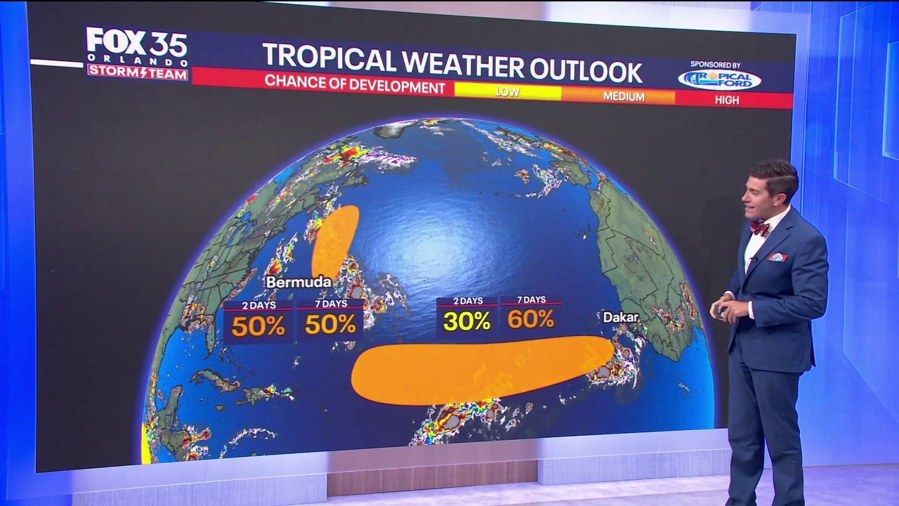
Invest 95L, an area of low pressure several hundred miles east-southeast of Bermuda, continues to produce showers and thunderstorms.
The NHC said conditions are only somewhat favorable for development, but the system could briefly become a tropical depression or tropical storm through Tuesday.
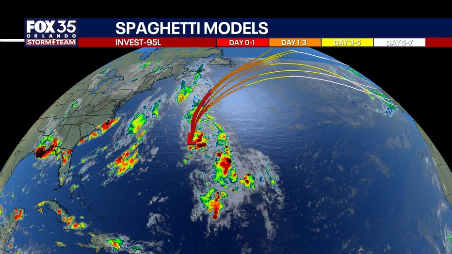
The disturbance is expected to move north and then northeast, remaining well northeast of Bermuda. By Wednesday, it is forecast to move over colder water, ending its chances for further development.
The NHC gives the system a medium chance of developing during the next two days and through the next seven days.
Invest 96L emerges off Africa
Forecasters are also watching a tropical wave that recently moved off the west coast of Africa, several hundred miles southeast of the Cabo Verde Islands.
The system is producing disorganized showers and thunderstorms as it moves west at about 15 to 20 mph.
FOX 35 Storm Team meteorologist T.J. Springer said the eastern Atlantic system has about a 60% chance of development over the next seven days.
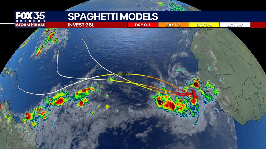
The NHC said conditions are expected to become more favorable for development, and a tropical depression could form by the middle or latter part of the week.
The system is expected to continue generally west across the eastern and central Atlantic.
Other tropical waves
Several other tropical waves are moving across the Atlantic and Caribbean but are showing limited signs of development.
One is moving through the central Atlantic, while another is approaching the eastern Caribbean. A separate tropical wave is moving through the central Caribbean and producing showers and thunderstorms near the Dominican Republic.
None of those systems is currently highlighted by the NHC for tropical development.
The Source: The information in this story was provided by the FOX 35 Storm Team.