
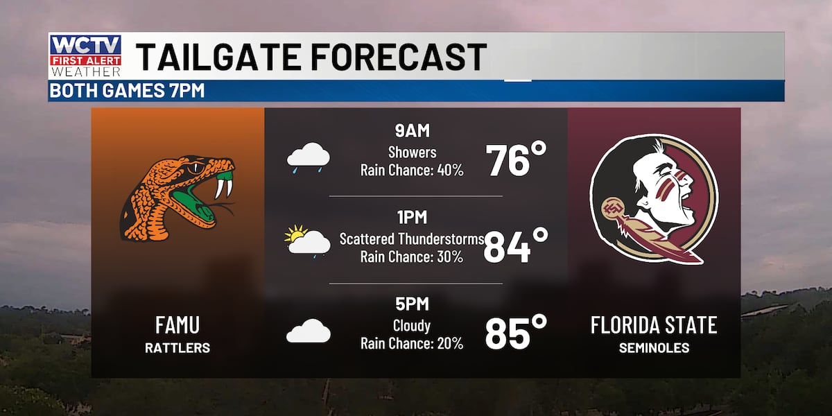
TALLAHASSEE, Fla. (WCTV) – Tailgaters, a heads-up that isolated to scattered showers and a few storms are possible this morning.
College football is back!
Rain is most likely this morning along the coast. Showers will slowly spread north throughout the morning into the early afternoon. I expect coverage of rain to be lower in the afternoon, but mostly cloudy skies should keep temperatures in the mid to upper 80s.
Rain will be spotty at best for your afternoon and evening, which should be the case for kickoff for both FSU and FAMU. Really not bad weather for the games, clouds keep temperatures in the low to mid 80s. Not bad for late summer.
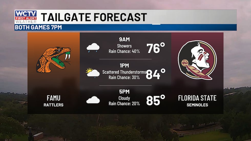 Cloudy with scattered showers this morning.(WCTV)
If you are heading to the coast today, showers and storms likely this morning, with a chance of rain and storms this afternoon. Otherwise, mostly cloudy with highs in the mid 80s. Waves 1 foot or less with a southeast wind 5 to 10 knots.
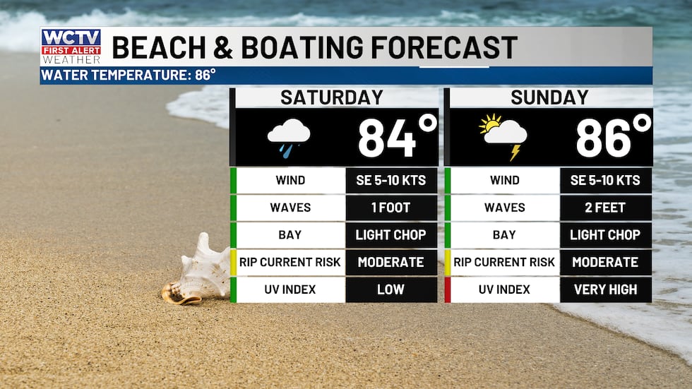 Scattered rain with a light chop in between storms.(WCTV)
Scattered rain on Sunday. However, it will not be an all-day rain. The morning hours look fine as you get ready to head to church. The best chance of rain will be in the afternoon and evening. Highs in the low 90s.
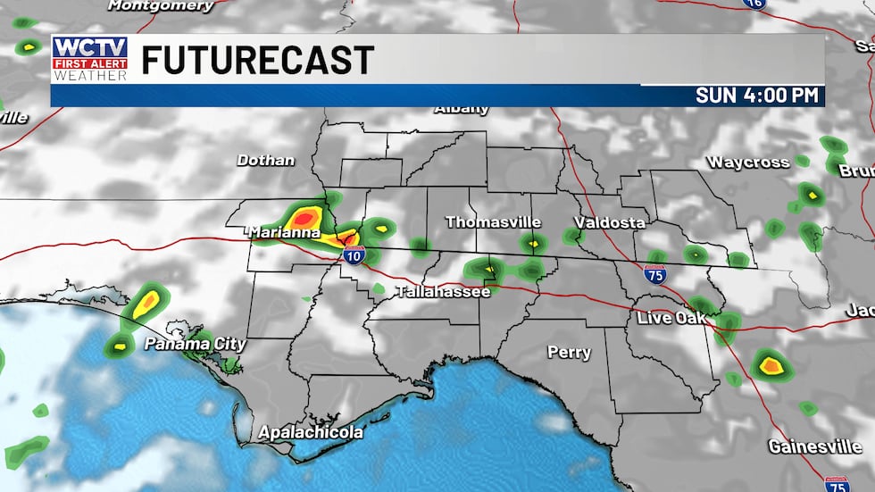 Scattered showers and storms tomorrow.(WCTV)Hotter next week
Next week, showers and storms become a little less widespread as high pressure settles in. Lower shower coverage means hotter temperatures. Highs back in the mid-90s. Any rain or storms should be late afternoon and evening from the Atlantic Sea breeze.
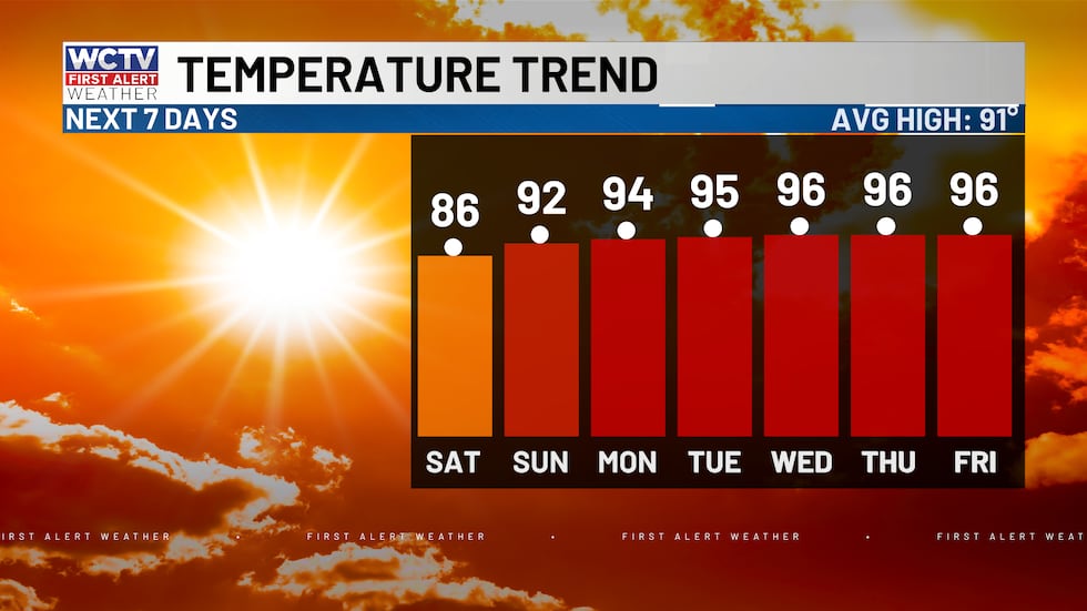 Highs gradually rise back into the mid-90s this week.(WCTV)Tracking the tropics
Dolly is no longer a tropical storm as it fights high wind shear as it approaches the Leeward Islands. The remnants of Dolly has a small chance of redevelopment over the next 7 days as it approaches the Bahamas. The moisture may move toward the Florida Straits by the middle of next week, helping to increase rain chances late next week. Worth watching, but nothing to be concerned about right now.
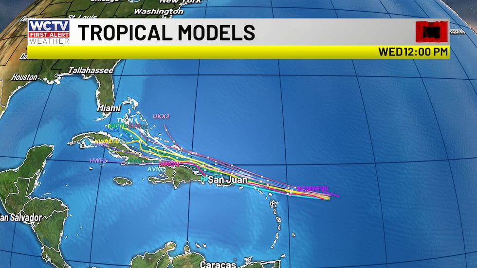 Remnants of Dolly have a small chance of redevelopment.(WCTV)
Additionally, the National Hurricane Center is monitoring an area in the northern Gulf. An area of low pressure is spinning just off the Florida coast, helping to keep rain chances a little higher this weekend. A small chance that this becomes organized over the next week. With wind shear low and warm water temperatures it is worth keeping our eyes on. Nonetheless, in the off chance this becomes organized, it will be moving away from the area thanks to high pressure next week.
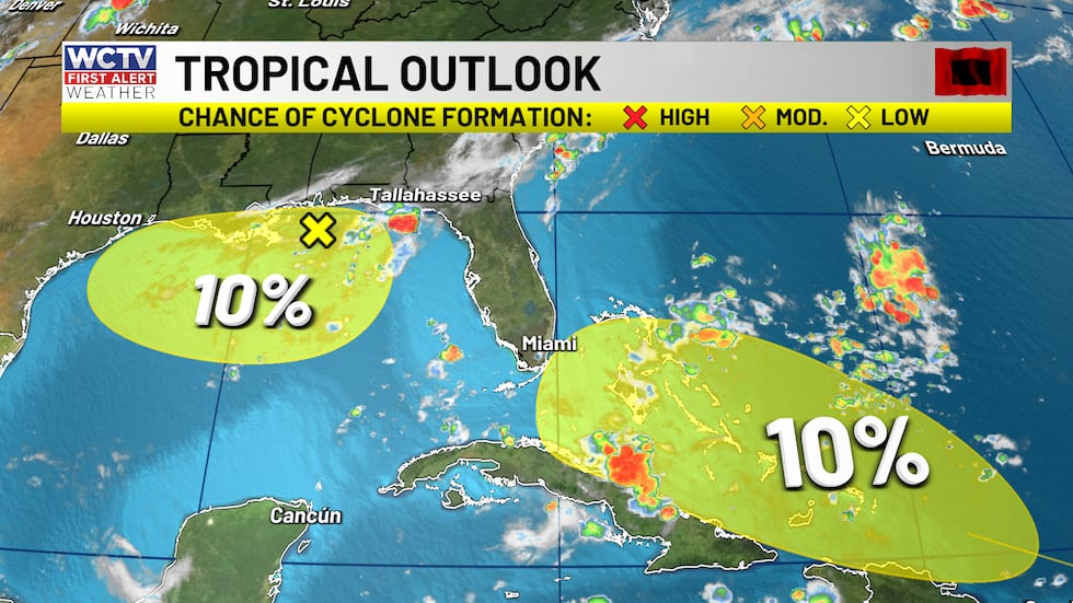 A 10% chance of both areas of interest developing.(WCTV)
No concerns right now. I will keep watching.
To stay updated on all the latest forecasts and weather, follow WCTV First Alert Weather on Facebook and X (Twitter).
Click here to see all the latest weather headlines and here to view the First Alert Radar. Receive push alerts and watch the latest forecast anytime on the free WCTV First Alert Weather app. Click here to download it now.
Interested in becoming a WCTV First Alert Weather Watcher? Click here to join the team!
Copyright 2026 WCTV. All rights reserved.