
A strong tropical wave, the remnants of Tropical Storm Dolly, continues to produce an area of showers and thunderstorms just east of the northern Leeward Islands. – Remnants of Tropical Storm Dolly could have indirect impacts on our region regardless of development. The upper-level dynamics associated with this passing wave could enhance lift and increase tropical moisture across northeast FL, favoring higher rain chances and stronger storms, as well as elevated rip current risk due to a slightly tighter pressure gradient and/or more long-period swells reaching the coast.
East of the Leeward Islands (Remnants of Dolly): a strong tropical wave, the remnants of Tropical Storm Dolly, continues to produce an area of showers and thunderstorms just east of the northern Leeward Islands.
Satellite data and surface observations indicate that there are no signs of a closed surface circulation, and redevelopment is unlikely while the wave moves westward to west-northwestward at about 25 mph.
The system could bring locally heavy rains and gusty winds to portions of the Leeward Islands, the Virgin Islands, and Puerto Rico over the next couple of days.
Formation chance through 48 hours…low…near 0 percent. Formation chance through 7 days…low…10 percent.
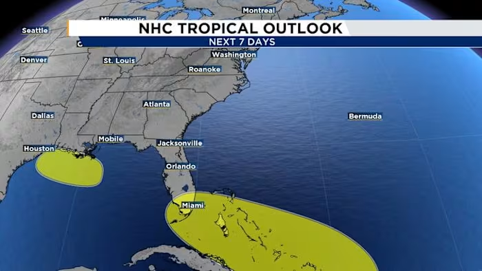
Northern Gulf (AL97): a weak area of low pressure located about 100 miles south of the coast of southeastern Louisiana continues to produce disorganized showers and thunderstorms.
Some slow development of this system is possible during the next few days as it drifts westward across the northern Gulf. Interests along the Louisiana and Upper Texas coasts should monitor the progress of this system.
Formation chance through 48 hours…low…10 percent. Formation chance through 7 days…low…20 percent.
The next named storm will be Edouard.
Copyright 2026 by WJXT News4JAX – All rights reserved.