
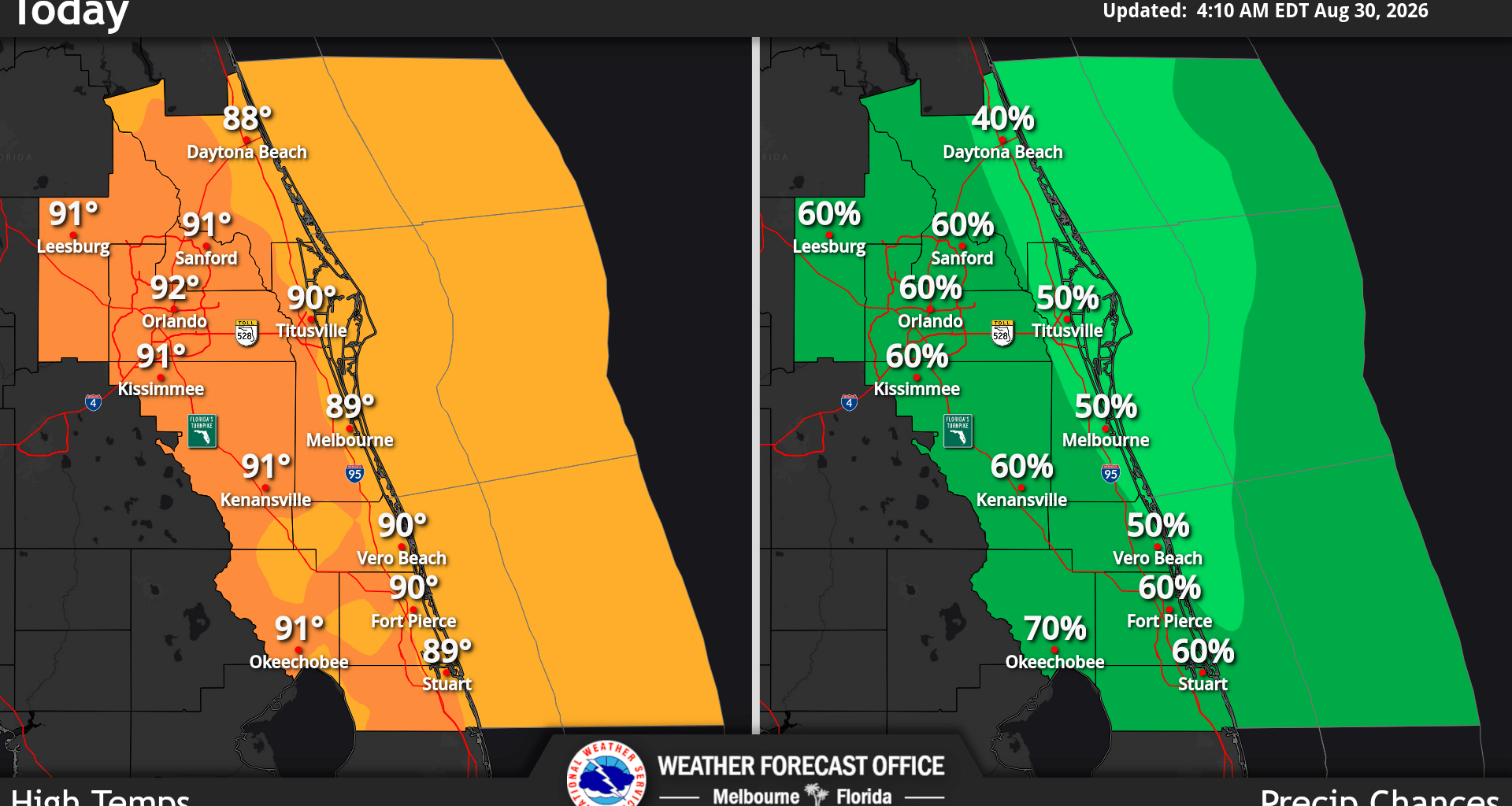
Central Florida temperatures on Sunday include muggy conditions and will be seasonably hot in the upper 80s to low 90s. Chances of rain also increase to 50-70% near the typical afternoon-evening period, according to the National Weather Service in Melbourne.
The primary storm hazards today will be gusty winds to 45-55 mph with a very low chance for isolated damaging winds to around 60 mph.
“Frequent lightning, and locally heavy rainfall may lead to flooding of urban, low-lying, and poor drainage areas,” forecasters said.
While heat risk impacts remain generally moderate, a few pockets of major warmth are expected around the Orlando Metro Area and along the southern coast. Temperatures with highs in the upper 80s and middle 90s, combined with high humidity, were said to result in peak afternoon heat indices in the upper 90s to middle 100s.
Forecast called for lingering 20-40% chances in the overnight, mainly from convection developing over the Atlantic waters moving onshore, while heat indices continue to produce in the triple digits through the week.
NWS also reported that strong storms will be possible each day as an active weather pattern will persist across east Central Florida this week as onshore flow and high moisture supports above normal rain and storm chances, including during the overnights and early mornings.