
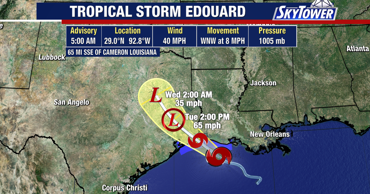
TAMPA, Fla. – Tropical Storm Edouard remained a minimal tropical storm early Tuesday as it moved toward the Texas coast, with hurricane watches in effect for parts of Texas and Louisiana.
Tropical Storm Edouard Texas path
What we know:
The storm is expected to make landfall in southeastern Texas later Tuesday, but FOX 13 Meteorologist Dave Osterberg says its intensity could fluctuate significantly before reaching the coast.
The storm’s track is becoming increasingly clear, with Edouard expected to move into southeastern Texas later Tuesday.
Hurricane watches have been issued for portions of the Texas and Louisiana coasts as the storm approaches.
The latest forecast calls for Edouard to have maximum sustained winds of about 65 mph at landfall.
Compact storm intensity shifts
Dig deeper:
While Edouard is expected to remain relatively small, its compact size could make its intensity more difficult to predict.
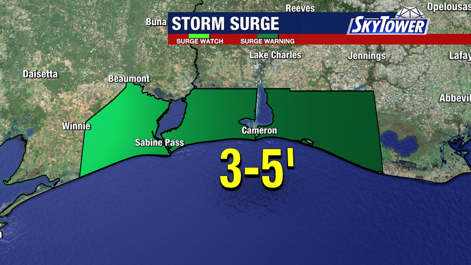
Small tropical systems with tight centers can experience rapid changes in strength, meaning Edouard could strengthen quickly before weakening just as quickly.
Forecasters will continue monitoring the storm as it approaches the coast.
Heavy rain and flooding impact
Why you should care:
Despite the possibility of changes in intensity, rainfall is expected to be Edouard’s biggest impact.
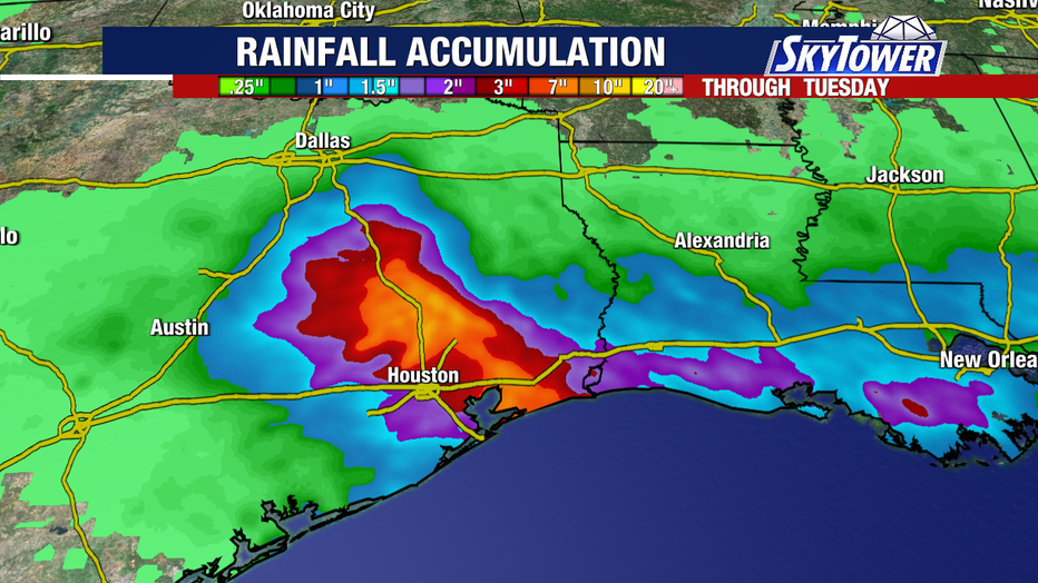
The storm could produce 3 to 6 inches of rain, with isolated totals approaching 9 inches.
While Edouard could briefly pack a punch, the system is expected to be relatively short-lived after moving inland.
The Source: The information in this story was gathered from tropical updates provided by FOX 13 Meteorologist Dave Osterberg and national forecast models tracking Tropical Storm Edouard.