
TALLAHASSEE, Fla. (WCTV) – Rain is likely this afternoon as deep tropical moisture moves through the region to wrap up the work week. A decent chance of showers throughout the holiday weekend, especially on Sunday.
Tracking rain this afternoon
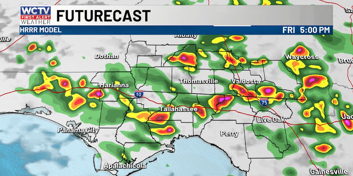
Most spots can expect rain and a few thunderstorms this afternoon. If you have outdoor plans for your Friday, be sure you are checking radar and have the raincoat handy. While it will not be raining the whole afternoon, there will be spots that see showers for an extended period of time after 1 p.m. Here is a snapshot of this afternoon’s future radar.
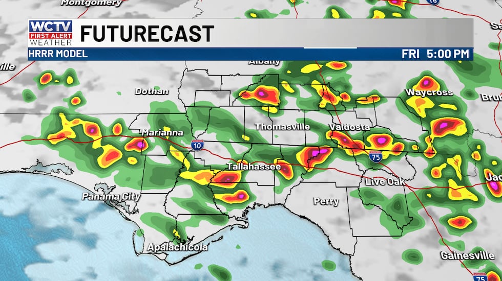 Rain and storms are likely this afternoon with heavy downpours.(WCTV)
While this does not point out EXACTLY where showers will be, it gives you a good idea that coverage of showers will be widespread. Heavy rain, lightning and brief gusty winds are all possible with the strongest storms. I think extreme downpours will be the biggest impact, leading to travel troubles, especially between FL-20 and U.S. 84, including I-10 travel this evening.
The best chance of rain is between 2 p.m. and 7 p.m. This will impact kickoff for some of the Friday night football games, especially for those in South Georgia. Rain will be moving from north to south or stationary today rather than east to west like the last few days.
Highs in the upper 80s to low 90s, peaking midday before showers cool us into the low to mid 80s by the afternoon and evening.
Holiday weekend showers
Coverage of rain looks a little lower for Saturday. The highest chance of rain will be for the Big Bend of Florida, mainly south of I-10 and near I-75. Showers will be moving southwest to northeast. Highs in the low 90s.
Rain coverage will be greater on Sunday as a cold front approaches the Northern Gulf Coast. Showers and storms will develop north along Highway 82 and move south throughout the afternoon and evening. Additionally, the sea breeze will get going along Highway 98 in Florida and the two will clash and lead to some stronger storms in the afternoon and evening. Gusty winds will be the primary threat. So a few severe thunderstorm warnings are possible. Be sure you have ways to get weather alerts if you plan to be outdoors on Sunday celebrating the holiday. Hot and humid with highs in the low to mid 90s.
Labor Day front
Sunday’s front will stall just south of the area on Monday, keeping the weather rather unsettled. Partly to mostly cloudy with occasional showers and storms. The best chance of rain looks like the Florida Big Bend right now, with lower chances for South Georgia. Keep an eye on Monday’s weather IF you are going to be grilling outside with the family, as storms will develop quickly for those that do see them. Where the rain develops, coverage will be high. It will be warm and humid before the rain in the upper 80s and low 90s.
Once the front stalls in the Northern Gulf, there is a chance that more weak low pressures develop along the front and will heighten rain chances. Still looks like a decent chance for rain Tuesday and possibly Wednesday. Slightly drier air may return by late week.
Beach and boating
There will be some showers and storms this afternoon and each day for your Labor Day Weekend. Rain should be mainly inland this afternoon. Waves 1 foot or less and a light chop in between storms.
For Saturday, showers and storms will be mainly in the morning, turning mostly sunny in the afternoon. Waves 1 foot or less and a light chop after showers pass.
On Sunday, some morning showers and storms. A break midday into the afternoon. But showers and storms are possible again in the evening as a cold front pushes showers south. Waves 1 foot or less and a light chop in between storms.
For your Labor Day, cloudy with scattered showers and storms. This may be the worst weather day. But it is highly dependent on where the front stalls late Sunday and early Monday. Waves 1 foot or less and a light chop in between storms.
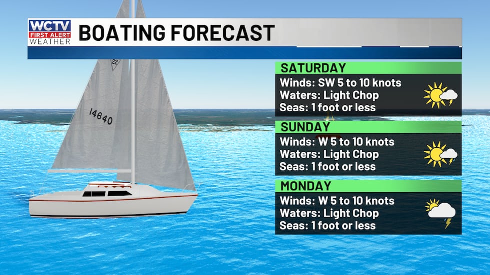 Beach and boating will be okay this weekend. Will need to dodge a few showers and storms.(WCTV)Tracking the tropics
The peak of hurricane season is less than a week away. There has not been a hurricane so far in the Atlantic Basin. This is nearing record territory for the longest wait for a hurricane to develop in the modern record era. The latest first hurricane to develop was Gustav in 2002 and Humberto in 2013, both on September 11. If there is no hurricane by September 12, this year would go into the record books as the latest date for a hurricane to develop.
As far as what I am tracking. Plenty of action in the Pacific with three hurricanes.
In the Atlantic, there is currently no area of interest. However, I mentioned next week’s front diving south and stalling in the Northern Gulf above. With high water temperatures and low wind shear, it is worth keeping an eye on the Northern Gulf for any quick development like we have seen with Arthur, Bertha and Edouard this season. I am NOT concerned, nor is there a threat, but something to watch into early next week.
For the remainder of September, the Climate Prediction Center is watching the main development region off the African coast for some brief tropical development mid to late September. There is no storm forecast to develop in the Atlantic, but the conditions look a little more favorable, which is no surprise as we are nearly at the peak of hurricane season.
To stay updated on all the latest forecasts and weather, follow WCTV First Alert Weather on Facebook and X (Twitter).
Click here to see all the latest weather headlines and here to view the First Alert Radar. Receive push alerts and watch the latest forecast anytime on the free WCTV First Alert Weather app. Click here to download it now.
Interested in becoming a WCTV First Alert Weather Watcher? Click here to join the team!
Copyright 2026 WCTV. All rights reserved.