
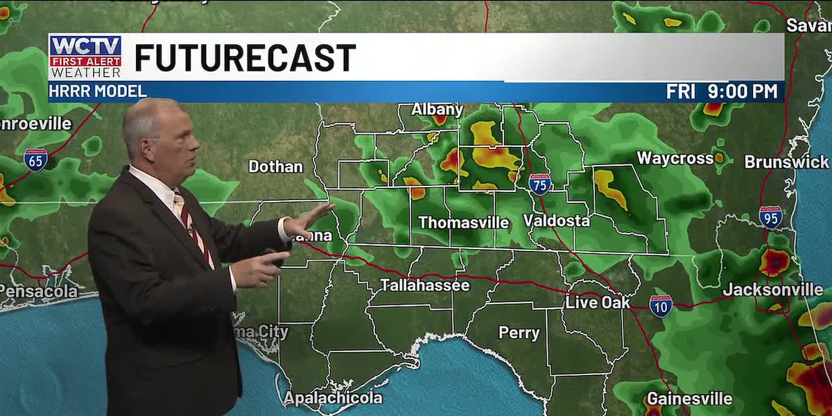
TALLAHASSEE, Fla. (WCTV) – Tracking some lingering thundershowers in North Florida and South Georgia this evening. Some rain will impact kickoff for some of the Friday night football games, especially for those in South Georgia. Rain will be moving from north to south or stationary today rather than east to west like the last few days.
Highs in the upper 80s to low 90s, peaking midday before showers cool us into the low to mid 80s by the afternoon and evening.
Holiday weekend showers
Coverage of rain looks a little lower for Saturday. The highest chance of rain will be for the Big Bend of Florida, mainly south of I-10 and near I-75. Showers will be moving southwest to northeast. Highs in the low 90s.
Better coverage of rain Saturday
Rain coverage will be greater on Sunday as a cold front approaches the Northern Gulf Coast. Showers and storms will develop north along Highway 82 and move south throughout the afternoon and evening. Additionally, the sea breeze will get going along Highway 98 in Florida and the two will clash and lead to some stronger storms in the afternoon and evening. Gusty winds will be the primary threat. So a few severe thunderstorm warnings are possible. Be sure you have ways to get weather alerts if you plan to be outdoors on Sunday celebrating the holiday. Hot and humid with highs in the low to mid 90s.
Labor Day rain
Sunday’s front will stall just south of the area on Monday, keeping the weather rather unsettled. Partly to mostly cloudy with occasional showers and storms. The best chance of rain looks like the Florida Big Bend right now, with lower chances for South Georgia. Keep an eye on Monday’s weather IF you are going to be grilling outside with the family, as storms will develop quickly for those that do see them. Where the rain develops, coverage will be high. It will be warm and humid before the rain in the upper 80s and low 90s.
Once the front stalls in the Northern Gulf, there is a chance that more weak low pressures develop along the front and will heighten rain chances. Still looks like a decent chance for rain Tuesday and possibly Wednesday. Slightly drier air may return by late week.
To stay updated on all the latest forecasts and weather, follow WCTV First Alert Weather on Facebook and X (Twitter).
Click here to see all the latest weather headlines and here to view the First Alert Radar. Receive push alerts and watch the latest forecast anytime on the free WCTV First Alert Weather app. Click here to download it now.
Interested in becoming a WCTV First Alert Weather Watcher? Click here to join the team!
Copyright 2026 WCTV. All rights reserved.