

Overview
On the evening of August 23rd, 2026, a strong thunderstorm interacting with the sea breeze produced a weak tornado in Port St Lucie, Florida.
Tornadoes:
Select a tornado from the table to zoom into the track and view more information. The default table view is limited to 8 tracks, but can be scrolled by a mouse wheel or dynamically expanded. Additionally, the table can fill the entire window by clicking the small circular expanding arrow icon at the very top right of the table and returned to its original size by clicking the button again. The side information panel that opens over the map can be closed using the “X” on the upper right corner of the pop-up. Zoom into the map and click damage points to see detailed information and pictures from the surveys.
The Enhanced Fujita (EF) Scale classifies tornadoes into the following categories:
EF0
Weak
65-85 mph
EF1
Moderate
86-110 mph
EF2
Significant
111-135 mph
EF3
Severe
136-165 mph
EF4
Extreme
166-200 mph
EF5
Catastrophic
200+ mph

Radar
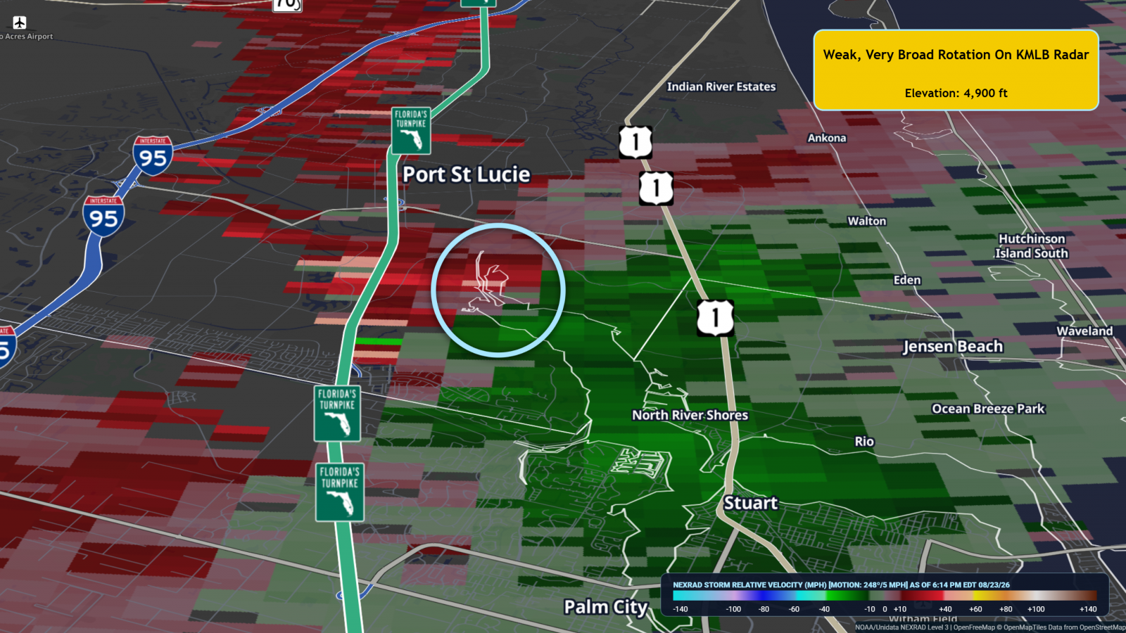
KMLB radar imagery at the time of the tornado are below, with an circle placed where the tornado occurred. Radar data showed weak and broad rotation at the lowest scan, which is at around 5,000 ft above the ground in this area, with average rotational velocity values of around 20 knots or less.
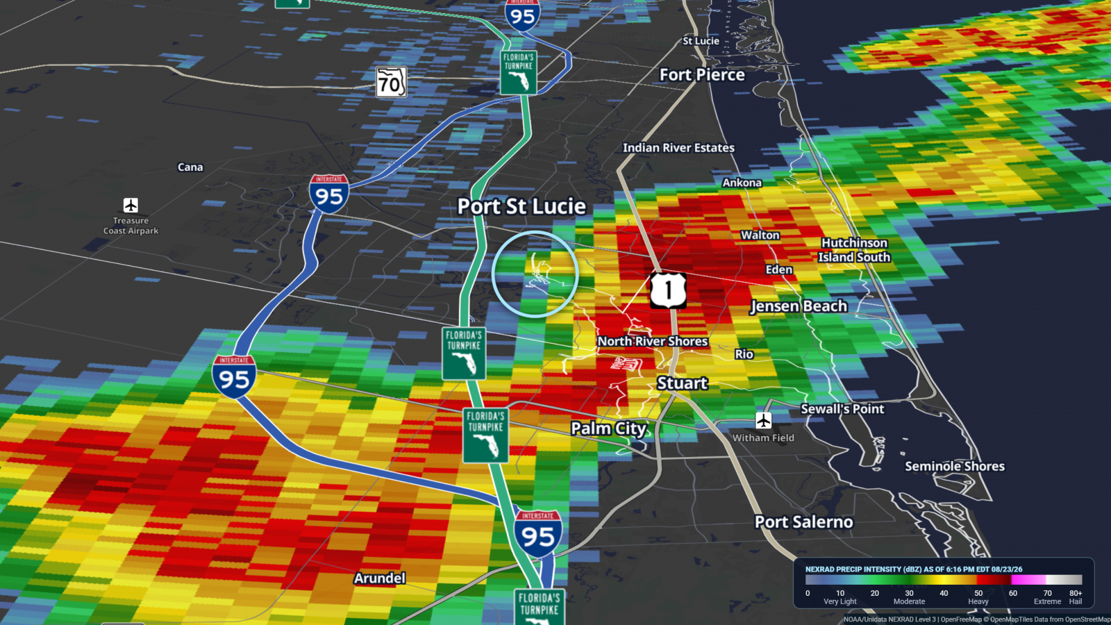
KMLB Reflectivity
KMLB Storm Relative Velocity