
Is Mother Nature a sports fan? Numerous showers and thunderstorms will develop along the Gulf and Atlantic sea breezes. Locally heavy rainfall possible.
We got lucky last night as showers and thunderstorms skirted downtown Jacksonville. Although the storms got close at times, it did not affect the Jumbo Shrimp game or, unfortunately, the outcome.
Showers and thunderstorms will begin to develop near and along I-75 around 2 p.m., as the Gulf breeze moves inland. The chance of showers and thunderstorms will build starting around 5 p.m., with thunderstorms possible over downtown and along I-95 around 6 – 7 p.m. These will drift north through the night ending around 10 – 11 p.m. Locally heavy rainfall could lead to flooding and some storms could create strong wind gusts.
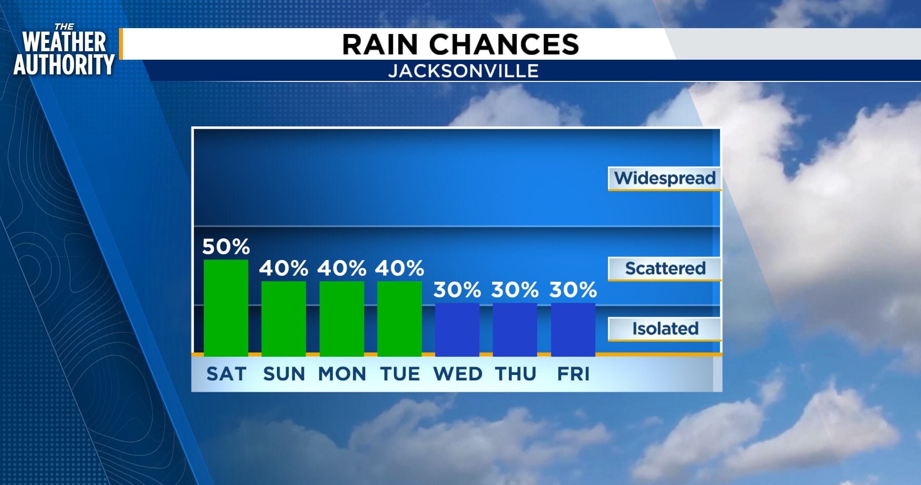
This pattern will continue this weekend, although with less overall coverage. The main hazards will be locally heavy rain and gusty storm winds. Saturday will have slightly better rain chances than Sunday.
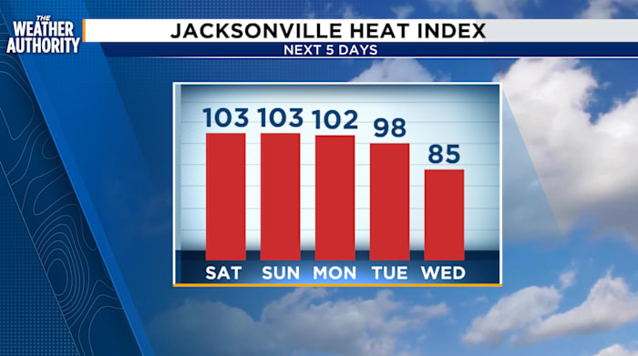
The temperatures trend remain above average with Feels Like temperatures around 100 – 106 degrees.
The northeast wind returns next week bringing windy conditions along the beaches as well as rough surf and increasing rip current risks.
Tonight: Showers and thunderstorms, near and along I-95, then drifting inland through 11 p.m. Partly cloudy with patchy fog overnight.
 . (.)
. (.)
Saturday: Patchy fog early then becoming partly cloudy. Afternoon showers and thunderstorms, 40-60 percent for northeast Florida, 30-50 percent for southeast Georgia. Morning lows in the 70s to low 80s. Highs in the 80s to low 90s. Wind: SW/SE 10-15 mph.
 . (.)
. (.)
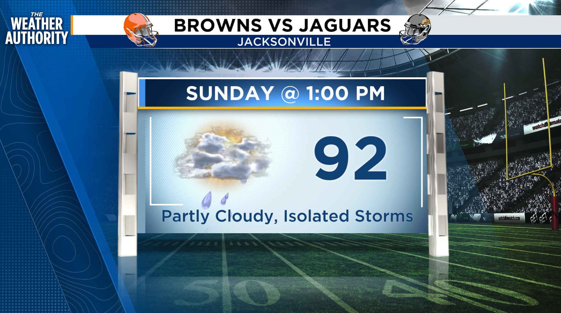
Sunday: Sea breeze showers and thunderstorms, 30-50 percent for NE FL, 10-20 percent for SE GA. Locally heavy rain possible. Lows in the 70s with highs in the 80s and 90s. Wind: SW/SE 5-10 mph.
Tropics: The GFS continues to show possible development late next week in the Caribbean as the National Hurricane Center keeps the Atlantic basin quiet for the next 7 days.
Looking ahead: Near-seasonal temperatures and windy northeast winds next week.
Sunrise: 7:10 a.m.
Sunset: 7:36 p.m.
Copyright 2026 by WJXT News4JAX – All rights reserved.