
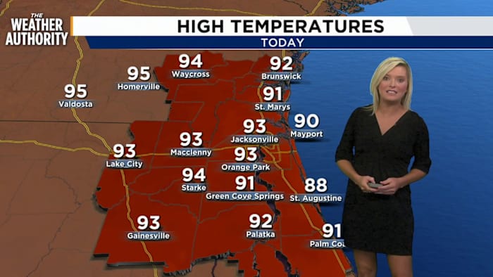
JACKSONVILLE, Fla. – Today will stay mostly sunny and hot, with highs near 93 and heat index values up around 103.
Rain chances are lower today, around 30%, with the best window for a few showers or storms mainly between about 3 and 5 p.m.
Winds start west around 6–10 mph, then turn easterly this afternoon.
Tonight looks mostly clear and warm with lows near 77.
Rain chances increase Tuesday as onshore flow picks up. Scattered showers are possible late morning into early afternoon, then showers and thunderstorms become likely after 2 p.m.
Tuesday will be breezy to windy with northeast winds increasing to 15–20 mph and gusts near 29 mph. Rain chances run about 70% Tuesday and 60% Tuesday night, mainly before 8 p.m.
Wednesday turns mostly sunny, windy, and a little cooler with highs near 87.
The rest of the week keeps an unsettled pattern in place with highs in the upper 80s, breezy to windy conditions at times, and daily rain/storm chances around 50% Thursday, Friday, and Saturday, then likely showers and storms Sunday.
In the tropics, there are no active tropical cyclones in the Atlantic right now, but the National Hurricane Center is watching one central Atlantic disturbance with a 30% chance of development over the next seven days.
Copyright 2026 by WJXT News4JAX – All rights reserved.